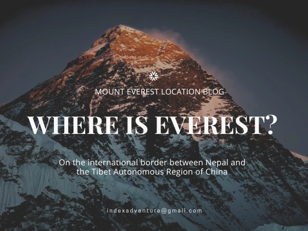
Mount Annapurna is in Nepal. Not Nepal and China. Not Nepal and India. Entirely, unambiguously Nepal. That distinction matters more than it sounds because a surprising number of travelers, even experienced trekkers, assume the Himalayas blur political borders at the top. For Annapurna, they don't. Every metre of this mountain sits within Nepali territory, specifically inside Gandaki Province in the north-central Himalayan zone.
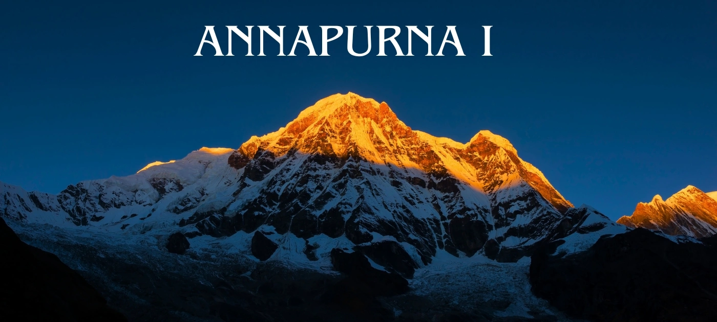
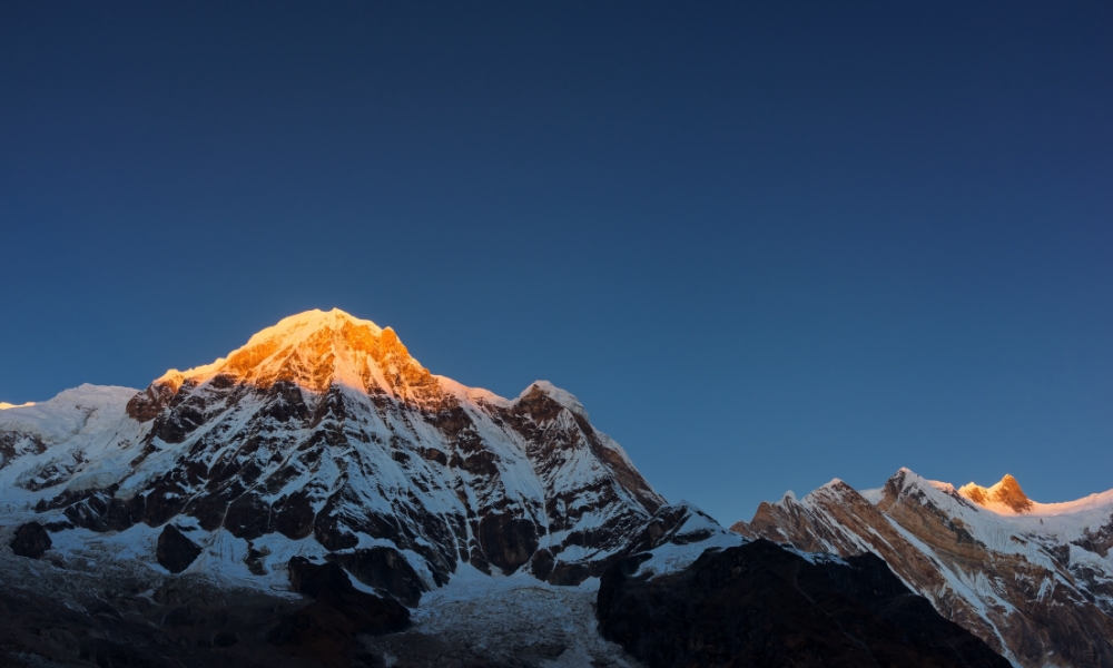
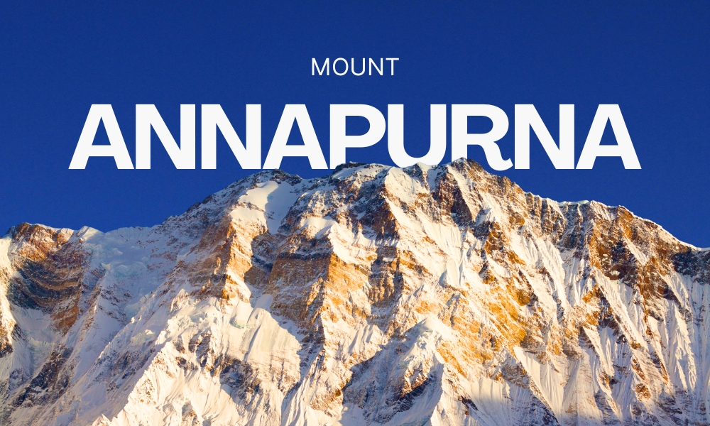
Annapurna I, the main summit, stands at 8,091 metres (26,545 feet) above sea level, ranking it the 10th highest mountain on earth. It lies approximately 160 kilometres northwest of Kathmandu and 50 kilometres north of Pokhara. On a clear morning in Pokhara, you can look directly north across Phewa Lake and see the full massif stretched across the horizon. It's one of the only places on earth where you can drink coffee and stare at a mountain with a 20-plus percent fatality rate.
Mount Annapurna is entirely located in Nepal. Specifically, the massif lies within the Gandaki Province in the north-central part of the country.Key Location DetailsMountain Range: Himalayas (Annapurna Massif)Height: 8,091 meters (26,545 feet)—the 10th highest mountain in the world
- Nearest Major City: Pokhara (located about 50 km south)
- Distance from Kathmandu: Roughly 160 km northwest of the capital
- Unlike Mount Everest, which straddles the border between Nepal and China, the Annapurna range lies fully within Nepal's national borders.
This guide covers everything you need: exact location, elevation history, climbing records, death rate data, seasonal conditions, permits, and trekking routes. Whether you're a researcher, a first-time trekker, or a mountaineer building a target list, it's all here.
Mount Annapurna Location: Province, District, and GPS Coordinates
Annapurna I sits at coordinates 28°35'46"N and 83°49'13"E, within Gandaki Province, Nepal. The summit specifically straddles the boundary between Myagdi district to the west and Kaski district to the south. The broader massif reaches into Manang district to the north and Lamjung district to the east.
| Location Category |
Detail |
| Country |
Nepal |
| Continent |
Asia |
| Province |
Gandaki Province |
| Summit Districts |
Myagdi and Kaski (shared border) |
| Adjacent Districts |
Manang (north), Lamjung (east) |
| GPS Coordinates |
28°35'46"N, 83°49'13"E |
| Nearest Major City |
Pokhara, approximately 50 km south |
| Distance from Kathmandu |
Approximately 160 km northwest |
| Mountain Range |
Annapurna Himalayan Range |
| Protected Zone |
Annapurna Conservation Area |
| Massif Length |
55 km east to west |
| World Rank by Height |
10th |
| Official Elevation |
8,091 m / 26,545 ft |
The massif stretches 55 kilometres from east to west, bounded by the Kali Gandaki River gorge on the west and the Marsyangdi River on the north and east. The Pokhara Valley closes the massif from the south, which is why Pokhara residents wake up every morning to what is arguably the most dramatic unobstructed Himalayan view available from any populated city anywhere.
Four districts share direct boundaries with the Annapurna massif, each with a distinct role for trekkers and climbers:
| District |
Province |
Primary Role for Visitors |
| Kaski |
Gandaki |
Southern gateway; Pokhara is the main access hub |
| Myagdi |
Gandaki |
Western approach; routes to south face expeditions |
| Manang |
Gandaki |
Northern access; Annapurna Circuit crosses here |
| Lamjung |
Gandaki |
Eastern entry; lower Marsyangdi valley trekking |
Annapurna in the Context of Asian and Global Geography
Asia holds all 14 of the world's eight-thousanders. Nepal contains eight of them. Annapurna I sits in the central Himalayan zone, flanked by neighbors that are themselves among the most formidable mountains on earth.
| Neighboring Peak |
Distance from Annapurna I |
Height |
Separation Feature |
| Dhaulagiri |
~34 km west |
8,167 m |
Kali Gandaki Gorge |
| Manaslu |
~95 km east |
8,163 m |
Marsyangdi watershed |
| Tibetan Plateau |
North |
4,500 m avg |
Trans-Himalayan passes |
| Pokhara Valley |
~50 km south |
820 m |
Modi Khola river system |
The vertical shift between Pokhara at 820 metres and the Annapurna summit at 8,091 metres, compressed into roughly 50 kilometres of horizontal distance, produces one of the most extreme elevation gradients visible from any city on the planet. That same gradient, combined with the monsoon moisture funneling up from the Bay of Bengal, generates the snowfall and avalanche cycles that define Annapurna's character as a climbing objective.
How Far Is Annapurna from Major Cities? Travel Distance and Times
Pokhara is the practical gateway for everyone entering the Annapurna region. It has an international airport (Pokhara International Airport, opened 2023), established trekking infrastructure, and direct road access to major trailheads. Teams from Index Adventure typically land clients in Kathmandu, connect to Pokhara by air the following morning, and reach the first trail overnight stop the same evening.
| Origin City |
Distance to Annapurna Region |
Best Travel Method |
Approximate Travel Time |
| Kathmandu, Nepal |
~160 km northwest |
Domestic flight to Pokhara |
25-30 minutes |
| Kathmandu, Nepal |
~160 km northwest |
Road via Prithvi Highway |
6-7 hours |
| Pokhara, Nepal |
~50 km north |
Drive to trailhead |
1.5-2 hours |
| New Delhi, India |
~1,100 km |
Flight to Kathmandu, then connect |
2+ hours flying |
| Mumbai, India |
~2,000 km |
International flight to Kathmandu |
2.5 hours flying |
| London, UK |
~7,600 km |
International flight to Kathmandu |
9-10 hours flying |
| New York, USA |
~12,000 km |
International flight with connection |
14-16 hours flying |
Annapurna I Official Height: Why 8,091 Metres May Not Be the Final Answer
The official height of Annapurna I is 8,091 metres (26,545 feet). Most sources treat this as settled. The actual history of how we arrived at that number is considerably more complicated, and geodetic researchers in Nepal are actively making the case that it needs to be updated.
| Survey / Source |
Year |
Recorded Height |
Method Used |
| Great Trigonometrical Survey, British India |
1850s-1860s |
8,075 m (26,492 ft) |
Triangulation from Nepal-India border |
| Survey of India Topographic Map |
1929 |
8,078 m (26,504 ft) |
Field survey 1925-1926 |
| Survey of India Aerial Survey |
1963 |
8,091 m (26,545 ft) |
Aerial photography 1957-58, ground check 1959-60 |
| Nepal Government Verification |
2001 |
8,091 m |
Based on Survey of India data |
| DLR Aerial Photogrammetry (Germany) |
2014 |
8,097.47 m (unofficial) |
MACS 3D aerial camera system |
The 1850s British surveyors didn't even know the mountain's local name. They logged it as Peak XXXIX using the same Roman numeral cataloguing system they applied to Everest (Peak XV) and dozens of other Himalayan summits. That it was actually Annapurna only became clear much later.
Nepal's Survey Department published research in 2025 arguing that a formal remeasurement campaign is both scientifically necessary and nationally important. Their case rests on three factors: the limitations of 1950s aerial photography methods, tectonic position shifts following the 2015 Gorkha earthquake, and ongoing glacial changes reshaping the summit zone due to climate stress. The tools now available, specifically GNSS receivers, satellite gravimetry, and high-resolution photogrammetry, can produce results that are simply not achievable with mid-century survey technology.
There's also a medieval geological angle worth knowing. A 2023 paper in the journal Nature proposed that a massive earthquake around 1190 AD triggered a rockslide of roughly 23 square kilometres from near the summit zone, potentially reducing Annapurna's height by several hundred metres from its pre-medieval form. If that analysis holds, Annapurna may once have stood taller than Everest. Nobody can confirm it. But it reframes the mountain in an entirely different way.
All Named Peaks in the Annapurna Massif: Elevations, Ranks, and Climbing Notes
The massif contains one summit above 8,000 metres, thirteen above 7,000 metres, and sixteen above 6,000 metres. That concentration in a single 55-kilometre ridge makes the Annapurna Himalaya one of the densest clusters of high-altitude summits on earth.
| Peak |
Elevation |
Notable Facts |
| Annapurna I (Main) |
8,091 m |
10th highest on earth; sits on Myagdi-Kaski border |
| Annapurna I Central |
8,013 m |
Closely grouped with main summit |
| Annapurna I East |
7,980 m |
Requires technical approach routes |
| Annapurna II |
7,937 m |
Eastern section; first climbed 1960 |
| Annapurna Fang (Roc Noir) |
7,647 m |
First solo ascent by Tomaž Humar, 2007 |
| Annapurna III |
7,555 m |
Respected for sustained technical difficulty |
| Annapurna IV |
7,525 m |
Primarily north face access |
| Gangapurna |
7,455 m |
First climbed by German expedition, 1965 |
| Annapurna South |
7,219 m |
Directly visible from the Base Camp trek floor |
| Machapuchare (Fishtail) |
6,993 m |
Sacred peak; no climbing permitted since 1964 |
| Hiunchuli |
6,441 m |
Southern gate to the Annapurna Sanctuary |
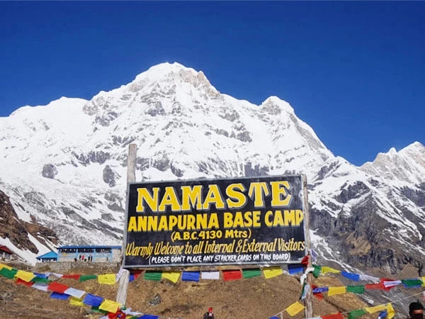
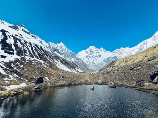
At the western end of the massif, the Annapurna Sanctuary sits as a glacial basin at approximately 4,130 metres, enclosed on nearly all sides by summits above 7,000 metres. The only land access passes through a narrow corridor between Hiunchuli and Machapuchare, where the Modi Khola River carves its way south. This basin serves both as the south base camp for Annapurna I expeditions and as the final destination of Nepal's most popular trekking route.
The Name Annapurna: What It Means and Where It Comes From
Annapurna derives from Sanskrit. "Anna" means food or grain. "Purna" means complete, full, or abundant. The combined meaning translates as "The Deity Abundant in Nourishment" or more simply, "The One Who Provides." The name comes from the Hindu goddess of food and sustenance, reflecting the geographic reality that rivers originating from this massif irrigate agricultural lowlands continuously throughout the year. The mountain is named for what it gives, not for what it demands.
Kali Gandaki Gorge and Marsyangdi River: The Two Boundaries That Shape Everything
Two river systems define the natural edges of the Annapurna massif. They also explain the access routes, the weather behavior, and the avalanche patterns that make this region simultaneously magnificent and dangerous.
| River System |
Location Relative to Massif |
Key Geographic Facts |
Trekking Relevance |
| Kali Gandaki |
Western boundary |
One of the world's deepest gorges; river at ~2,520 m with peaks exceeding 8,000 m on both sides |
Forms outbound leg of the Annapurna Circuit; historic trans-Himalayan salt trade route |
| Marsyangdi |
Northern and eastern boundary |
Flows through Manang and Lamjung before joining the Trishuli River |
Forms inbound leg of the Annapurna Circuit; primary north face expedition corridor |
The Kali Gandaki separates Annapurna from Dhaulagiri 34 kilometres to the west. The elevation difference between the river bed and the adjacent summits exceeds 5,500 metres across just a few kilometres of horizontal distance. The gorge channels strong afternoon winds upvalley, a practical factor that both trekkers and summit teams account for when planning movement days.
Together, these two rivers create a natural topographic bowl that funnels monsoon moisture from the south, feeds the glaciers above, and produces the heavy snowpack and avalanche cycles that make certain seasons on Annapurna functionally uncrossable.
Annapurna Conservation Area: Permits, Wildlife, and What Visitors Need to Know
Every trekker and climber entering the Annapurna region moves through the Annapurna Conservation Area (ACA). Established in 1986 and managed by Nepal's National Trust for Nature Conservation, it covers 7,629 square kilometres across five districts, making it the largest conservation area in Nepal.
| Conservation Area Detail |
Data |
| Year Established |
1986 |
| Total Area |
7,629 sq km |
| Managing Body |
National Trust for Nature Conservation (NTNC) |
| Districts Covered |
Kaski, Myagdi, Manang, Mustang, Lamjung |
| Elevation Range |
~800 m to 8,091 m |
| Mammal Species |
Over 100 |
| Bird Species |
478 |
| Reptile Species |
39 |
| Annual Trekkers (pre-2020) |
Over 100,000 |
The area spans a genuinely extraordinary ecological range. Subtropical forest covers elevations below 1,000 metres. Temperate mixed forest fills the zone from 1,000 to 3,000 metres. Alpine meadows extend upward from 3,000 metres, transitioning to permanent glacial terrain above 5,000 metres. Snow leopards, Himalayan black bears, musk deer, red pandas, and hundreds of migratory and resident bird species occupy different elevation bands throughout.
Climate change is an active threat here. Glacial retreat across the Annapurna range is increasing downstream flood risk and destabilizing slopes previously held firm by permafrost. In January 2025, the Annapurna Conservation Area Project launched a formal waste management program in Mustang district to address the growing environmental pressure from trekking volumes.
Permits Required for Annapurna Region (2025-2026):
| Permit Type |
Cost |
Issuing Authority |
Where to Get It |
| ACAP Permit |
NPR 3,000 (~USD 22) |
Nepal Tourism Board |
Kathmandu (Bhrikutimandap) or Pokhara (Lakeside) |
| TIMS Card |
NPR 2,000 (~USD 15) |
Nepal Tourism Board |
Same offices |
| Annapurna I Climbing Permit |
USD 700 per person (spring) |
Department of Tourism |
Kathmandu, DoT office |
Annapurna I vs Other Eight-Thousanders: Height, Risk, and Global Ranking
| Mountain |
Height |
Country |
World Rank |
Approx. Fatality Rate |
| Mount Everest |
8,849 m |
Nepal/China |
1st |
~1% |
| K2 |
8,611 m |
Pakistan/China |
2nd |
~24% |
| Kangchenjunga |
8,586 m |
Nepal/India |
3rd |
~13% |
| Lhotse |
8,516 m |
Nepal/China |
4th |
Low |
| Makalu |
8,485 m |
Nepal/China |
5th |
Low |
| Dhaulagiri |
8,167 m |
Nepal |
7th |
~14% |
| Manaslu |
8,163 m |
Nepal |
8th |
~9% |
| Nanga Parbat |
8,126 m |
Pakistan |
9th |
~22% |
| Annapurna I |
8,091 m |
Nepal |
10th |
20-38% |
| Gasherbrum I |
8,080 m |
Pakistan/China |
11th |
Low |
Additional Summit Data for Annapurna I:
| Measurement |
Value |
| Official Summit Elevation |
8,091 m / 26,545 ft |
| Topographic Prominence |
2,984 m / 9,790 ft |
| Parent Peak |
Cho Oyu |
| South Base Camp Elevation |
~4,130 m |
| North Base Camp Elevation |
~4,200 m |
| Thorong La Pass (Circuit) |
5,416 m |
| Vertical Rise from Pokhara |
~7,271 m |
Annapurna I Climbing History: First Ascent to Modern Speed Records
On June 3, 1950, Maurice Herzog and Louis Lachenal stood on the summit of Annapurna I. They were the first humans to stand on top of any mountain above 8,000 metres, anywhere on earth. Everest wasn't climbed for another four years. The team approached from the north through the Marsyangdi valley because the south face was simply not a realistic option with mid-20th century equipment. Sherpa climber Ang Tharke guided the expedition but couldn't complete the final push due to severe frostbite at the last high camp, a detail that most headline accounts leave out.
Both Herzog and Lachenal descended with severe frostbite injuries. Herzog lost multiple fingers and toes. Their survival required a major rescue effort by the rest of the expedition. Herzog later documented the entire story in a book that sold millions of copies and opened a generation of readers to what extreme Himalayan climbing actually looks like.
Key Milestones in Annapurna I Climbing History:
| Year |
Milestone |
Climbers |
Nationality |
| 1950 |
First ascent, north face |
Maurice Herzog, Louis Lachenal |
France |
| 1970 |
First ascent of 3,000 m south face |
Don Whillans, Dougal Haston |
UK |
| 1977 |
First Nepali citizen to summit |
Sonam Wolang Sherpa |
Nepal |
| 1978 |
First American women to summit |
Vera Komarkova, Irene Miller |
USA |
| 1981 |
New route on Annapurna I Central |
Maciej Berbeka, Boguslaw Probulski |
Poland |
| 1987 |
First winter ascent |
Jerzy Kukuczka, Artur Hajzer |
Poland |
| 2007 |
First solo ascent of south face |
Tomaž Humar |
Slovenia |
| 2013 |
Solo via Lafaille route in 28 hours |
Ueli Steck |
Switzerland |
| 2022 |
407 total summit completions recorded |
Multiple nationalities |
Nepal Dept. of Tourism |
The 37-year gap between the first summer summit in 1950 and the first winter ascent in 1987 says more about Annapurna's winter severity than any temperature table can.
Annapurna Death Rate 2024: Statistics, Causes, and Risk Breakdown
Annapurna I holds the highest fatality-to-summit ratio of any eight-thousander across the full recorded history of attempts. As of 2022, 72 climbers have died against 365 successful summits. That's a fatality rate of approximately 19.7% by direct calculation. Broader methodologies that include all fatal incidents rather than only summit-attempt deaths push the 2024 figure to 38% in some analyses.
| Mountain |
Country |
Approximate Fatality Rate (2024) |
| Annapurna I |
Nepal |
20-38% |
| K2 |
Pakistan/China |
~24% |
| Nanga Parbat |
Pakistan |
~22% |
| Kangchenjunga |
Nepal/India |
~13% |
| Dhaulagiri |
Nepal |
~14% |
| Manaslu |
Nepal |
~9% |
| Mount Everest |
Nepal/China |
~1% |
Primary Causes of Death on Annapurna I:
| Cause |
Notes |
| Avalanche |
Most frequent cause; approach routes cross high avalanche exposure zones |
| Falls |
South face technical sections and steep descent routes |
| Serac collapse |
Particularly on descent from high camps |
| Altitude illness |
HACE and HAPE above 7,000 m |
| Extreme weather |
Exposure during rapid deterioration events above summit zone |
In the 2021 climbing season, over 50 climbers successfully summited with no fatalities recorded among the successful ascents, suggesting that improved forecasting and modern equipment are making a measurable difference. But the mountain's underlying terrain and avalanche character hasn't changed. The 2014 trekking disaster near Thorong La, which killed at least 43 people in a single snowstorm event, most of them trekkers on trails thousands of metres below the climbing routes, is a reminder that Annapurna's risk extends well beyond the summit zone.
Notable Climbers Who Lost Their Lives on Annapurna:
| Climber |
Country |
Year |
Cause |
| Ian Clough |
UK |
1970 |
Falling serac on descent |
| Alex MacIntyre |
UK |
1982 |
Rockfall, south face |
| Pierre Béghin |
France |
1992 |
Fall on descent |
| Anatoli Boukreev |
Kazakhstan |
1997 |
Avalanche |
| Iñaki Ochoa |
Spain |
2008 |
Altitude illness near summit |
| Park Young-seok |
South Korea |
2011 |
Disappeared near summit |
| Samuli Mansikka |
Finland |
2015 |
Fall on descent |
Annapurna vs Everest: Is Annapurna Actually Harder to Climb?
This question divides experienced mountaineers, and the honest answer is that it depends on which route and which type of expedition you're comparing. Here's the direct comparison across the factors that actually matter:
| Factor |
Annapurna I |
Mount Everest |
| Official Height |
8,091 m |
8,849 m |
| Fatality Rate |
20-38% |
~1% |
| Standard Route |
North face |
South Col (Nepal) / NE Ridge (China) |
| Technical Difficulty |
High |
Moderate on standard route |
| South Face Difficulty |
Extreme |
Not applicable |
| Fixed Rope Coverage |
Partial |
Extensive throughout |
| Commercial Guiding Support |
Limited |
Highly developed |
| Annual Summits (approx.) |
30-60 |
300-600 |
| First Winter Ascent |
1987 |
1980 |
| Spring Climbing Permit |
USD 700 per person |
USD 11,000 per person |
| Helicopter Rescue Access |
Difficult above base camp |
Possible to higher elevations |
Everest is taller. Annapurna is deadlier. Those two facts don't contradict each other. Everest's commercial infrastructure, extensive fixed ropes, and dozens of high-altitude support teams have transformed its standard route into a managed high-altitude experience for prepared clients. Annapurna has none of that. The routes involve more consistent technical terrain, less fixed protection, a narrower summit weather window, and significantly greater avalanche exposure throughout the approach and ascent.
Most experienced alpinists rate Annapurna as the more genuinely dangerous objective for any team without verified eight-thousander experience and full expedition logistics.
Annapurna Weather by Season: Temperature Tables and Climbing Windows
The mountain's climate follows Nepal's monsoon pattern with important local variations driven by its position between the Tibetan plateau and the Bay of Bengal moisture track.
| Season |
Months |
Summit Conditions |
Suitability |
| Spring |
March to May |
Stable windows, warming temperatures |
Best season for climbing and trekking |
| Monsoon |
June to August |
Heavy snowfall, maximum avalanche risk |
Generally avoid |
| Autumn |
September to November |
Clear skies, excellent visibility, cold |
Second best; ideal for trekking |
| Winter |
December to February |
Extreme cold, sustained high winds |
Only for expert winter climbing attempts |
Temperature Reference by Altitude:
| Location |
Elevation |
Spring Daytime |
Winter |
| Pokhara |
820 m |
25-30°C |
10-15°C |
| Annapurna Base Camp (south) |
4,130 m |
-5 to +5°C |
-15 to -5°C |
| High Camp |
~6,800 m |
-15 to -5°C |
-25 to -15°C |
| Summit |
8,091 m |
Below -20°C |
Below -30°C |
Wind chill at summit altitude during spring pushes effective temperatures significantly below the ambient air figure. This is why summit windows are counted in hours rather than days, and why precise meteorological forecasting has become the single most valuable tactical tool for Annapurna expeditions.
Trekking Routes in the Annapurna Region: Options, Durations, and Difficulty
| Trek Name |
Duration |
Max Elevation |
Difficulty |
Best For |
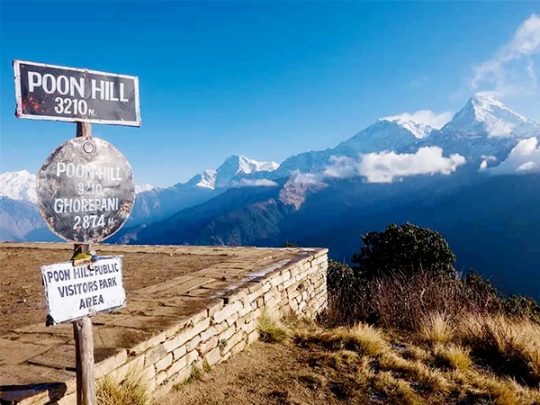
| Poon Hill Trek |
4-5 days |
3,210 m |
Easy-Moderate |
First-timers; limited time |
| Annapurna Base Camp Trek |
7-12 days |
4,130 m |
Moderate |
Fit beginners with guide |
| Mardi Himal Trek |
7 days |
4,500 m |
Moderate |
Less crowded alternative |
| Annapurna Circuit Trek |
14-21 days |
5,416 m (Thorong La) |
Moderate-Hard |
Full circuit experience |
| Nar Phu Valley Trek |
14-18 days |
5,320 m |
Hard |
Off-the-beaten-path |
| Annapurna I Expedition |
30-45 days |
8,091 m |
Extreme |
Professional mountaineers only |
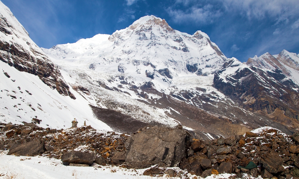
The Annapurna Base Camp Trek is Nepal's most visited trekking route. It follows the Modi Khola valley north from Nayapul or Phedi, passing through Gurung and Magar villages, rhododendron forest, and progressively more exposed alpine terrain before arriving at the Sanctuary floor at 4,130 metres. From there, trekkers look directly up at the full south face of Annapurna I, a 3,000-metre near-vertical wall that represents the mountain's most technically demanding climbing challenge.
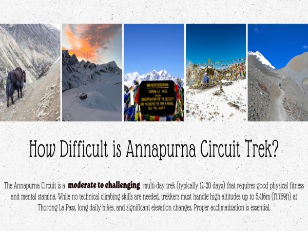
The Annapurna Circuit circumnavigates the entire massif, crossing the Thorong La Pass at 5,416 metres and descending through the Kali Gandaki gorge past Muktinath, Jomsom, and Marpha. It covers extraordinary ecological and cultural diversity across its 14 to 21 days and remains one of the most complete mountain treks anywhere on earth.
Annapurna Region Permit Costs 2025-2026
| Permit |
Cost (NPR) |
Cost (USD approx.) |
Required For |
Where to Get It |
| ACAP Permit |
NPR 3,000 |
~USD 22 |
All trekkers |
Nepal Tourism Board, Kathmandu or Pokhara |
| TIMS Card |
NPR 2,000 |
~USD 15 |
All trekkers |
Same offices |
| Restricted Area Permit (Nar Phu) |
NPR 10,000+ |
~USD 75+ |
Nar Phu Valley |
Department of Immigration |
| Annapurna I Climbing Permit |
NA |
USD 700 per person (spring) |
Summit climbers |
Department of Tourism, Kathmandu |
Frequently Asked Questions About Mount Annapurna
Which country is Mount Annapurna in?
Nepal. Annapurna sits entirely within Nepal's territory in Gandaki Province. It shares no international border with China or India, distinguishing it from Everest, which straddles the Nepal-China boundary.
Where exactly is Mount Annapurna located?
Annapurna I sits at coordinates 28°35'46"N, 83°49'13"E in north-central Nepal, approximately 160 km northwest of Kathmandu and 50 km north of Pokhara. The summit straddles the border between Myagdi and Kaski districts within Gandaki Province.
What is the official height of Mount Annapurna?
8,091 metres (26,545 feet), ranking it 10th on the global list of highest mountains. This figure comes from a 1963 Survey of India map based on aerial surveys from 1957-1958. Nepal's Survey Department proposed a modern GNSS-based remeasurement in 2025, and unofficial 2014 photogrammetry data from Germany's DLR agency suggests the actual height may be approximately 8,097 metres, pending formal verification.
Who first climbed Annapurna?
Maurice Herzog and Louis Lachenal of France reached the summit on June 3, 1950, making Annapurna the first eight-thousander ever climbed, four years before Everest. Sherpa climber Ang Tharke guided the expedition but could not complete the final summit push due to frostbite.
How dangerous is Annapurna I compared to other mountains?
As of 2022, 72 climbers have died against 365 summits, a fatality rate of approximately 20% by direct calculation. Broader 2024 methodologies place the figure at 38%. By both measures, Annapurna I records the highest fatality ratio of any eight-thousander, significantly exceeding K2 at 24% and Everest at approximately 1%.
What is the best time to trek or climb in the Annapurna region?
Spring (March to May) is the primary season for both trekking and climbing. Autumn (September to November) is the second recommended window, offering excellent post-monsoon visibility and manageable temperatures. Winter and monsoon seasons carry significantly elevated risk.
What permits do trekkers need for the Annapurna region in 2025-2026?
All trekkers need an ACAP permit (NPR 3,000 / ~USD 22) and a TIMS card (NPR 2,000 / ~USD 15), both available from Nepal Tourism Board offices in Kathmandu and Pokhara. Climbers attempting Annapurna I require a separate climbing permit from Nepal's Department of Tourism at USD 700 per person for the spring season.
Can beginners trek to Annapurna Base Camp?
Yes, with appropriate fitness preparation and a qualified guide. The Annapurna Base Camp Trek is accessible to fit beginners, reaches 4,130 metres, and takes 7 to 12 days depending on pace and acclimatization schedule. Climbing Annapurna I itself is strictly for professional mountaineers with verified high-altitude expedition experience.
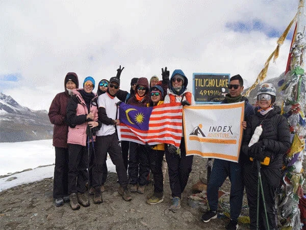
Trek the Annapurna Region with Index Adventure
Index Adventure operates guided trekking and climbing services across the full Annapurna Himalaya from its base in Nepal. The team works directly in Gandaki Province with experienced local guides who carry detailed knowledge of these specific trails, seasonal weather patterns, and approach routes at every elevation.
Available Annapurna programs with Index Adventure:
| Program |
Duration |
Peak Elevation |
| Annapurna Base Camp Trek |
7-12 days |
4,130 m |
| Annapurna Circuit Trek |
14-21 days |
5,416 m (Thorong La) |
| Poon Hill Trek |
4-5 days |
3,210 m |
| Mardi Himal Trek |
7 days |
4,500 m |
| Custom Expedition Support |
Variable |
Up to 8,091 m |
Every itinerary Index Adventure builds accounts for proper acclimatization, realistic daily distances, and verified safety protocols. Whether the goal is the Annapurna Sanctuary at 4,130 metres or a full expedition to Annapurna I, the planning starts from what the terrain and conditions actually demand.
Contact Index Adventure to plan your 2026 or 2027 Annapurna trip.