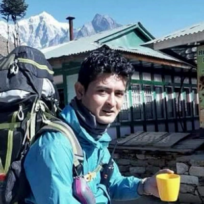
Manang Village is a stunning, high-altitude settlement (approx. 3,540m/11,614ft) in Nepal's Annapurna Conservation Area, renowned as a key acclimatization stop on the Annapurna Circuit Trek. Surrounded by Himalayan peaks, it offers a "cold desert" landscape with rich Tibetan Buddhist culture, traditional stone houses, and panoramic views of Annapurna II, III, IV, and Gangapurna.
There's a moment, usually the morning after you arrive, when you step out of your teahouse in Manang and just stop. Gangapurna glacier is sitting right there above the rooftops, glinting blue-white in the early sun. Yaks are moving through the stone lanes. Prayer flags are snapping in a wind that's cold enough to wake you up properly. And the whole scene feels like something you'd expect from a film set, not a real village at 3,540 metres in the Himalayas.
But Manang is very real. And for anyone trekking the Annapurna Circuit, it's one of the most important stops you'll make, not just scenically, but practically. This is where your body needs to slow down before you push any higher. It's where altitude sickness gets real if you skip the rest day. And it's where a lot of trekkers fall in love with Nepal in a way that the lower valleys don't quite manage.
This guide covers everything, where Manang is, what to do there, how to get there, what the weather does, and all the permit and safety stuff you need to know before you go. Whether you're in the early planning stages or already on the trail, I'd argue this is the one page you'll want to bookmark.
Where is Manang Nepal Located?
Manang sits in the Manang District of Gandaki Province in northern Nepal. Geographically, it's in the upper Marsyangdi River valley, deep inside the Annapurna Conservation Area, which is the largest protected region in the country.
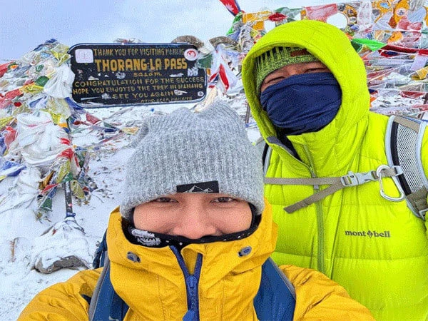
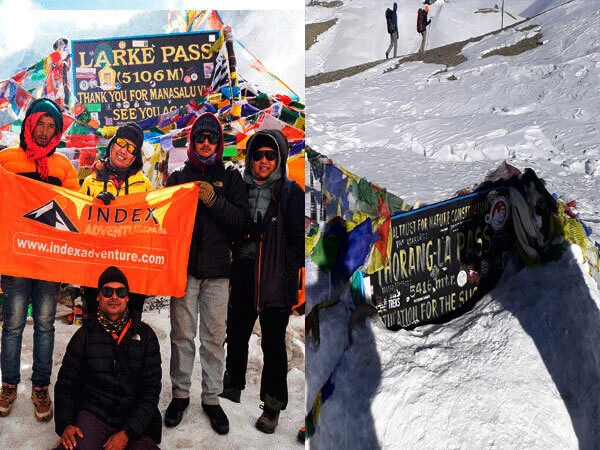
On the Annapurna Circuit, Manang falls roughly at the halfway point. Trekkers typically arrive on Day 5 or 6 from Besisahar and spend a day acclimatizing here before continuing toward Yak Kharka, Thorong Phedi, and eventually Thorong La Pass at 5,416 metres.
In terms of distance during Annapurna Circuit, Manang is approximately 238-254 km from Kathmandu by road (the Besisahar to Chame to Manang jeep route), and around 8-10 hours of drive time depending on road conditions. From Pokhara, you're looking at roughly 6-7 hours.
The trek route flows like this: Besisahar (760m) to Jagat to Dharapani to Chame (2,670m) to Upper Pisang (3,300m) to Manang (3,540m) to Yak Kharka to Thorong Phedi to Thorong La Pass (5,416m) to Muktinath to Jomsom.
Think of Manang as the last significant village before the terrain turns genuinely alpine and unforgiving. Everything south of it feels warmer, greener, more forgiving. Everything north of it demands preparation.
Manang Nepal: Altitude, Geography and Climate
Altitude and Terrain
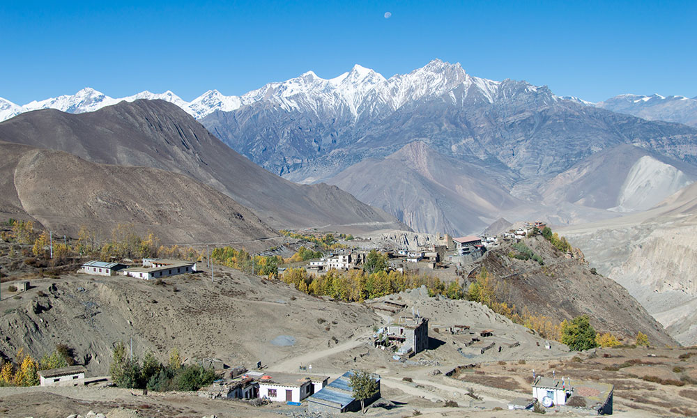
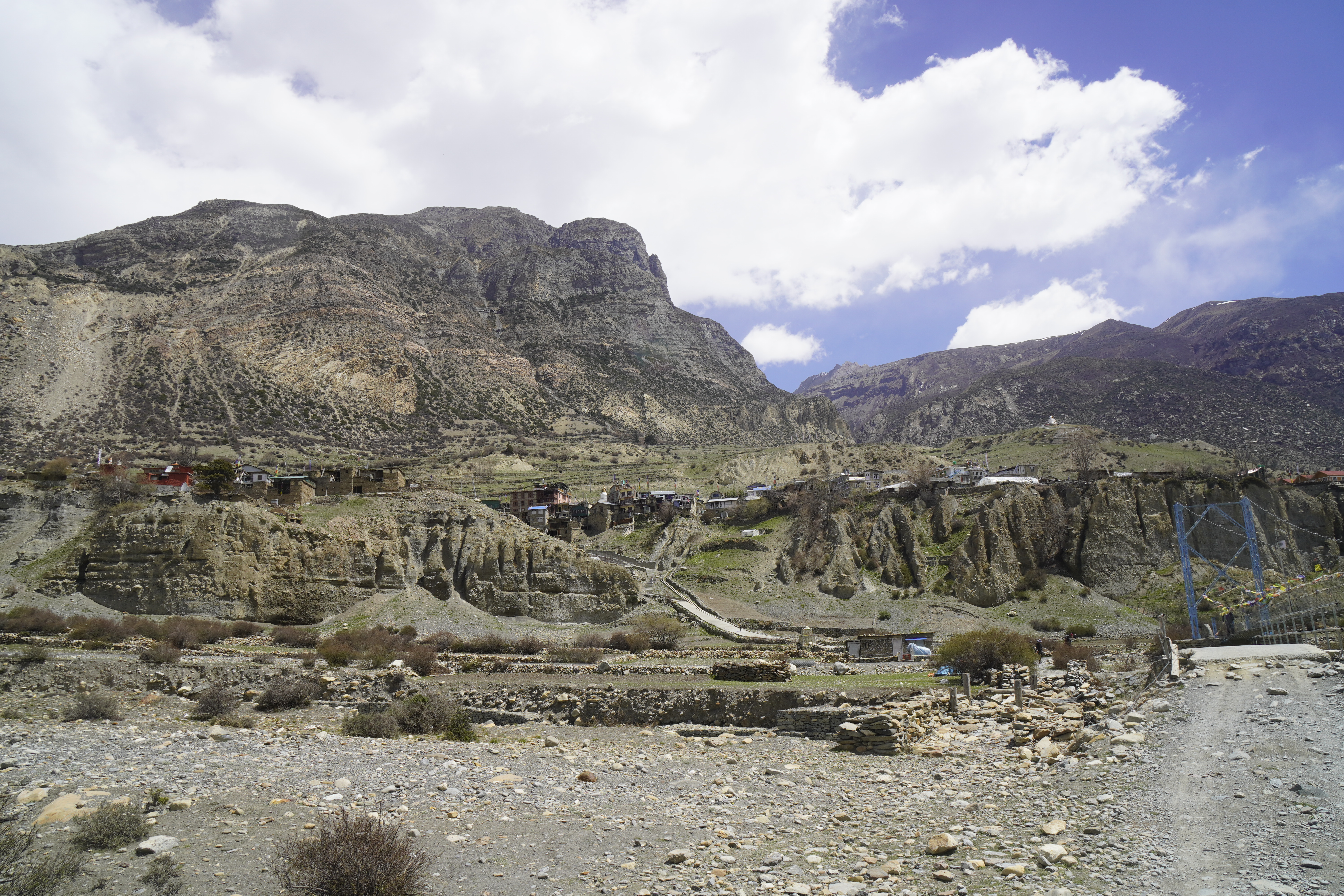
Manang sits at 3,540 metres (11,614 feet). The village is positioned at latitude 29.5784° N and longitude 84.0835° E, north of the Annapurna range, within the Annapurna Conservation Area, bordered by the Marsyangdi River to the south, with striking views of Annapurna II, Gangapurna, and Machapuchare.
Locally referred to as "Himal Pari ko Jilla" or "The district beyond the Himalayas,"Manang, along withMustang Nepal, lies in the rain shadow of the Annapurna and Dhaulagiri ranges, creating a unique, arid landscape known as Nepal's cold desert. Despite the snow-capped peaks all around it, very little rain actually reaches the valley floor. The result is a landscape that feels more like Ladakh or the Tibetan Plateau than the lush, jungle-fringed valleys you walked through just days before on the circuit.
Weather and Temperature
Season
Months
Daytime Temp
Night Temp
Conditions
Spring
March - May
10°C - 15°C
-2°C - 5°C
Clear skies, dry, wildflowers
Monsoon
June - August
8°C - 12°C
0°C - 4°C
Mostly dry (rain shadow), some cloud cover
Autumn
September - November
8°C - 14°C
-5°C - 2°C
Best visibility, peak season
Winter
December - February
-2°C - 5°C
-15°C - -8°C
Heavy snow, most teahouses closed
When you factor in weather and temperature during Annapurna Circuit, you can factor in Manang as well. The day-to-night temperature swing is no joke. You can be hiking in a t-shirt at noon and genuinely shivering by 4 PM. Always pack layers you can add and remove quickly, this is not optional advice.
Why Manang Feels So Different
Most trekkers arrive in Manang after 5-6 days of walking through dense rhododendron forests, terraced rice fields, and deep river gorges. Then suddenly, the valley opens up. The vegetation thins out. The sky gets bigger. The landscape turns dry, rocky, almost moon-like. The architecture is distinctly Tibetan, stone houses with flat roofs line narrow lanes. Manang sits in a rain shadow, and the dry, high-altitude landscape feels more like Ladakh or Mustang than the green valleys to the south.
It's a dramatic shift, and honestly, one of the most memorable moments of the entire circuit.
Manang Village
Why Manang is the Most Important Stop on the Annapurna Circuit
Acclimatization Hub Before Thorong La Pass:
At 3,540m, you're at the altitude where acute mountain sickness (AMS) starts becoming a real concern. Your body needs time to produce more red blood cells and adjust to the thinner air.
Build at least 1-2 rest days into your itinerary in Manang, the unofficial capital of acclimatization. Spend that time doing "active rest" hikes to places like Ice Lake (4,600m) or Gangapurna Lake. Your lungs will thank you later when you're crossing Thorong La Pass without crawling.
The principle to follow here is simple: climb high, sleep low. Hike to a higher elevation during the day, return to Manang to sleep. This pushes your body to adapt without overwhelming it.
Why you should never skip the Manang rest day:
Jumping past Manang too quickly is one of the most common mistakes trekkers make on this circuit
Trekkers who suffer from mountain sickness with severe headaches have needed to turn around from Yak Kharka (4,050m) and return to Manang for proper acclimatization
Your summit attempt at Thorong La at 5,416m, done in pre-dawn darkness, demands that your body is genuinely ready
Medical and Safety Importance
The Himalayan Rescue Association (HRA) operates a seasonal medical clinic in Manang and gives daily altitude talks during the spring and autumn trekking seasons. These talks are free, informative, and potentially lifesaving. Confirm times locally as they may vary.
The HRA talk arguably is worth going to even if you feel perfectly fine. The clinic staff have seen it all, and they'll tell you exactly what signs to watch for in yourself and your trekking partners. It's that kind of practical, on-the-ground knowledge you won't find in any blog.
A normal sea-level SpO2 (blood oxygen saturation) is 95-100%. At 3,540m, guides expect 85-92%. Below 80% with symptoms means you don't go higher until levels improve. Many reputable trekking guides now carry pulse oximeters specifically for this reason, it's worth asking yours if they have one.
Top Places to Visit in Manang Village
Gangapurna Lake and Glacier
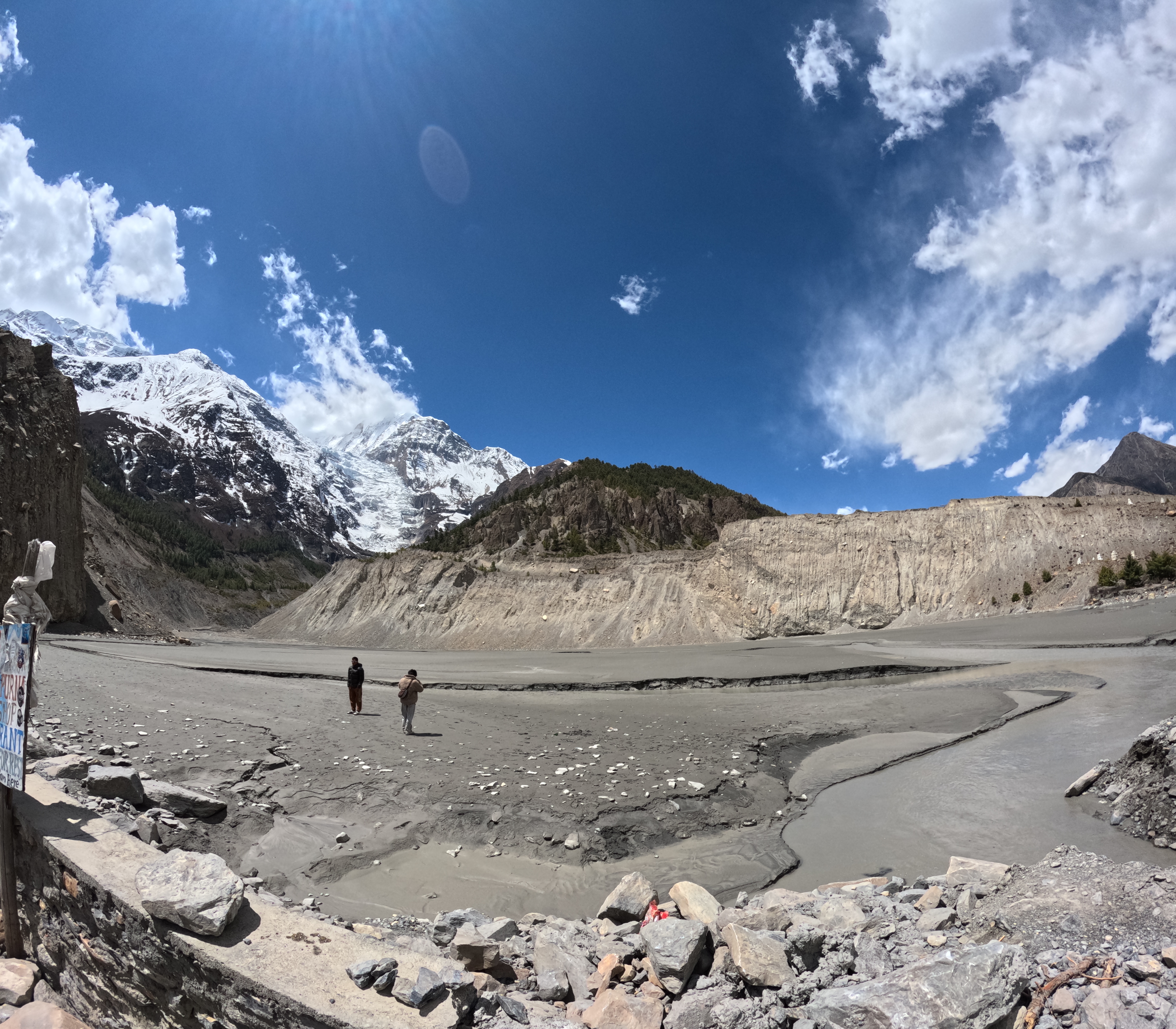
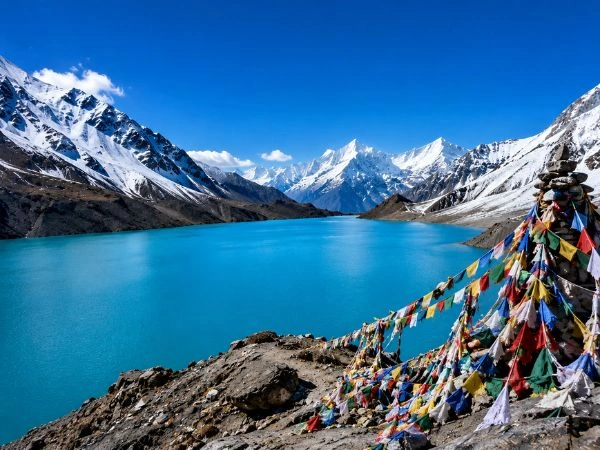
This is usually the first thing trekkers do after arriving in Manang, and rightly so. Gangapurna Lake sits about 30 minutes above Manang at the foot of the Gangapurna glacier. The colour of the water changes depending on the light, sometimes milky turquoise, sometimes deep grey-blue.
The lake was formed by glacial meltwater, and on a clear morning, the reflection of Gangapurna Peak (7,455m) in the still water is one of those views that makes conversation stop. You'll hear the glacier cracking and groaning as chunks of ice shift and occasionally calve off into the lake. Don't get too close to the water's edge near the glacier side, rockfall and ice collapse happen without warning.
Distance from Manang: approx. 30 minutes on foot
Altitude: approx. 3,540m
Difficulty: Easy
Best time to go: Morning, between 8-11 AM
Ice Lake (Kicho Tal)
This one's a step up, literally. Ice Lake sits at 4,620 metres, a full 1,080 metres above Manang. The trail climbs steeply through scrub and scree before opening onto a high alpine plateau with views across the entire Annapurna range.
From the shores of Ice Lake, you'll see a 360° panorama including Annapurna II, III, IV, Gangapurna, and Tilicho Peak. On clear days, the lake's surface reflects the snowy giants like a mirror.
Altitude: 4,620m
Round trip time: 5-7 hours
Difficulty: Strenuous
Start time: Leave by 6:30-7:00 AM to beat afternoon clouds
What to bring: Warm layers, 2L water, snacks, sunscreen, trekking poles
Many trekkers put the Ice Lake hike in their top five trail experiences in Nepal. The climb is hard, you'll feel every step at that altitude, but the reward at the top is worth every gasping breath.
Milarepa Cave
Milarepa Cave is located on a cliffside, about 5 kilometres from Braga village, at an elevation of around 4,100 metres. The natural rock cave holds deep spiritual significance for local Buddhists. The Tibetan yogiGuru Milarepa is believed to have meditated in this cave for years in the 11th century. His teachings remain widely respected across Nepal and Tibet.
A statue of Milarepa was transported to the site by helicopter, which tells you something about how seriously the local communities take this place. It's a quieter, less-visited stop, and worth the walk for anyone interested in the Buddhist traditions of the region.
Braga Monastery (Brahmochhe Gompa)
Braga's 500-year-old cave monastery (gompa) is carved into the cliff face and contains ancient Buddhist statues and paintings. Sitting on a rocky outcrop just above the village of Braga (a 20-minute walk from Manang), this is one of the oldest monasteries in the entire Annapurna region.
The views from the monastery down into the Manang Valley are exceptional, and honestly, the building itself is fascinating. The layered stone architecture, the butter lamps inside, the wind-worn murals, it's a proper window into what life and religion in this part of Nepal has looked like for centuries.
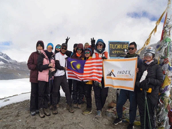
Side Trip to Tilicho Lake
Tilicho Lake sits at 4,919 metres and is one of the world's highest lakes, situated beneath the Annapurna and Nilgiri ranges. From Manang, reaching Tilicho requires 2-3 additional days (via Shree Kharka and Tilicho Base Camp), but many trekkers consider it the highlight of their entire trip.
The route branches off from the main Annapurna Circuit and is rewarded with views of Annapurna I (8,091m), Khangsar Kang, Nilgiri, and Tilicho Peak itself. If your schedule allows even a 2-day extension, take it. You won't regret it.
The people of Manang belong primarily to the Manangi community, culturally Tibetan but ethnically distinct. They grow potatoes, buckwheat, and apples at remarkable elevations. The Gurung people also have a strong presence in the broader Manang District, particularly in the lower parts of the valley.
Historically, Manangi traders were known across Asia for their commercial ventures, traveling as far as East Asia and Europe. That outward-looking heritage still shapes the village today, you'll find surprisingly well-stocked stores, functioning bakeries, and even espresso in some teahouses at 3,540 metres.
Buddhist Traditions
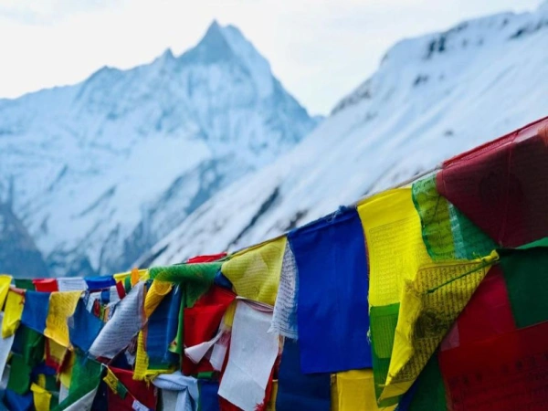
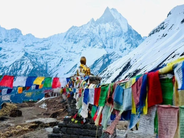
Prayer wheels, chortens, mani walls, monasteries, and traditional stone villages create a strong sense of place throughout this section of the trek. The route also follows a historic trade corridor that once connected Nepal and Tibet, adding a deeper historical layer to the adventure.
Walk slowly through the village lanes. Look at the carved mani stones. Watch the prayer flags, not as decoration, but as something that's been woven into the rhythm of daily life here for generations. The spiritual atmosphere in Manang is genuine, not performative.
Daily Life at 3,500m
About 500 people live in Manang year-round, though the population swells during the October-November trekking season. In the off-season, life here is spare and harsh, winter temperatures regularly drop below -15°C at night. Yak herding, buckwheat farming, and small-scale trade sustain the community outside of trekking months.
During season, the village transforms. Bakeries open up. Teahouses fill. The HRA clinic runs twice-daily talks. And the narrow lanes buzz with trekkers from every corner of the world, all at roughly the same stage of their journey: tired, acclimatizing, and entirely glad they came.
Annapurna Circuit Trek: Manang Section Explained
Distance and Route Breakdown
Section
Start to End
Approx. Distance
Trekking Time
Besisahar to Chame
760m to 2,670m
approx. 60 km
2-3 days walking (or drive)
Chame to Upper Pisang
2,670m to 3,300m
approx. 20 km
1 day
Pisang to Manang
3,300m to 3,540m
approx. 18 km
1 day
Manang to Yak Kharka
3,540m to 4,050m
approx. 10 km
1 day
Yak Kharka to Thorong Phedi
4,050m to 4,540m
approx. 8 km
1 day
Difficulty Level Around Manang
The approach to Manang through Upper Pisang, Ghyaru, and Ngawal is the most scenic section of the lower circuit. From Pisang, trekkers who take the higher route walk via Upper Pisang through Ghyaru and Ngawal on steeper paths, with stunning views of Lamjung Himal, Annapurna II, Annapurna III, Gangapurna, and Glacier Dome.
That upper route is harder, but significantly more rewarding than the lower valley path. If you have the legs for it, take the high road.
Manang Tour Itinerary (1-4 Days)
Here is an simple intinerary for Manang if you plan on to extend your stay, which is highly recommended from trekkers and guides all around.
Day 1: Arrive in Manang
Check in, rest, light walk around the village
Afternoon: Gangapurna Lake (30 min walk, easy)
Attend HRA altitude talk (typically 3:00 PM, confirm locally)
Day 2: Acclimatization Day
Morning: Ice Lake hike (leave by 6:30 AM, return by 1-2 PM)
Afternoon: Rest, bakery, explore Manang Bazaar
Day 3: (Optional)
Morning: Braga Monastery visit
Afternoon: Milarepa Cave or Praken Gompa hike
Day 4: (Optional Extension of Trek)
Begin Tilicho Lake side trip/trek (Manang to Shree Kharka)
How to Reach Manang Nepal (Updated 2026)
By Road, Besisahar to Chame to Manang:
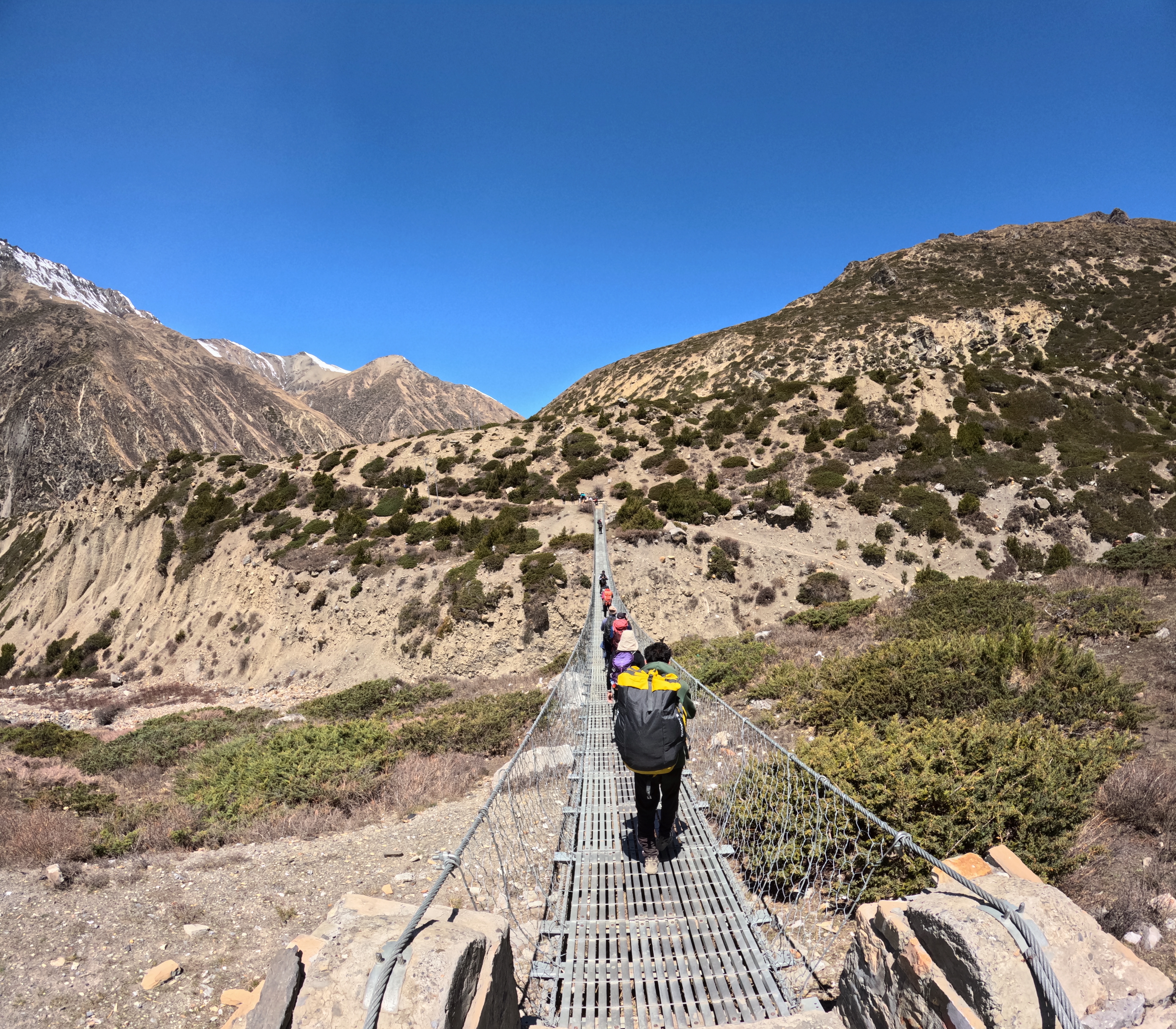
Most trekkers now take a jeep from Besisahar (or even Kathmandu directly) to Chame or Dharapani, then continue by road to Manang. The road from Besisahar to Chame is scenic but very bumpy and uncomfortable, expect a long 8-10 hour ride depending on your starting point. Road conditions can vary significantly after monsoon season or heavy snowfall.
From Chame, it's another 2-4 hours by jeep to Manang. The road is unpaved and rough, but it exists, which changes the traditional circuit considerably.
By Trekking Route:
The classic approach is to walk the entire circuit from Besisahar, which takes 5-7 days to reach Manang on foot. This gives you proper gradual acclimatization, and I think it's still the right way to do it if you have the time. Skipping the lower sections means your body hasn't had as long to adjust.
In recent years, up to 75% of the original Annapurna Circuit route has been impacted by road construction. In response, Nepalese trekking guide Prem Rai has led the creation of the Natural Annapurna Trekking Trails (NATT), consisting of various side routes that avoid much of the new roads. These are worth asking your guide about, they often lead through quieter villages and better scenery.
Way to MAnang - Yak Kharka
Distance from Kathmandu:
Route
Distance
Travel Time
Kathmandu to Besisahar (by road)
approx. 170 km
5-6 hours
Besisahar to Chame (by jeep)
approx. 60 km
3-4 hours
Chame to Manang (by jeep)
approx. 40 km
2-3 hours
Kathmandu to Manang (total)
approx. 270 km
10-13 hours
Best Time to Visit Manang (Seasonal Guide)
Spring, March to May:
Spring is one of the two peak seasons for Annapurna Circuit trek with goes hand on hand with best time to visit Manang. Skies are mostly clear, daytime temperatures are manageable, and rhododendrons are in bloom on the lower sections of the trail. Snowfall at the pass is less frequent than autumn, and the mountain views are reliably good. The downside, it gets busy, especially at popular teahouses.
Gangapurna Lake in April (Offseason)
Autumn, September to November:
This is the most popular window, and for good reason. Autumn offers the best views of the mountains in Manang Nepal, with clear views, warm weather, less rainfall, and a pleasing environment. The route may be crowded during this time. October especially sees the widest variety of trekkers on the circuit, from solo backpackers to large guided groups.
If we had to pick one month for Annapurna Circuit or Manang visit, we'd say October, the post-monsoon clarity is extraordinary, and temperatures are still tolerable before the November cold sets in.
Monsoon and Winter Considerations:
Much of the Annapurna Circuit sits within a rain shadow, so it is possible to trek most parts of the circuit year-round, including during the monsoon period. However, the days are often damp and many of the views are obscured by clouds.
Winter (December-February) brings extreme cold and heavy snowfall, most teahouses in Manang and above close entirely. Thorong La Pass can become impassable. Unless you're an experienced high-altitude trekker with a licensed guide and serious cold-weather gear, avoid the winter window.
Quick recommendation: Spring or Autumn. October is the sweet spot.
Manang is far better-equipped than most trekkers expect for a village at this altitude.
Facility
Availability
Notes
Teahouses / Lodges
Plentiful (20+ options)
Range from basic to comfortable
Room cost
NPR 300-800 (approx. $2.50-$6)
Often free/subsidized if you eat there
Hot shower
Most lodges (NPR 150-300)
Solar or gas-heated
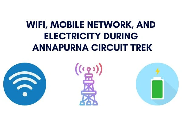
Wi-Fi
Available in most main lodges
Slow, don't expect to stream anything
Device charging
NPR 100-200 per device
Bring a power bank as backup
Bakeries
Several, standalone
Fresh cinnamon rolls, croissants, coffee
Gear shops
Available
Last place to restock before high terrain
ATM
Limited, withdraw cash before you arrive
Don't rely on finding one
Several standalone bakeries in Manang serve fresh bread, cinnamon rolls, croissants, and other baked goods, wonderful treats after days of teahouse cuisine. Honestly, the Manang bakeries are one of those small, disproportionate joys on the circuit. Visit them on your rest day, not the day you arrive tired.
Food prices during Annapurna Circuit Trek increase above 3,500m because everything is carried in by porter or mule. Expect to pay 30-50% more in Manang and above compared to Chame.
This is the primary permit. The ACAP is required for all treks inside the Annapurna region, including the Annapurna Circuit, Annapurna Base Camp Trek, and Tilicho Lake Trek. It is issued by the Nepal Tourism Board (NTB) in Kathmandu or Pokhara.
Nationality
ACAP Cost
Foreign nationals
NPR 3,000 (approx. USD 23)
SAARC nationals
NPR 1,000 (approx. USD 8)
Children under 10
Free
TIMS Card
The TIMS situation is slightly complicated right now. As of April 1, 2023, Annapurna trekkers are technically no longer required to obtain a TIMS permit, with ACAP now covering trekker registration. That said, some agencies still include it, and enforcement varies at checkpoints. Check with your registered trekking agency before departure.
Where to Get Permits:
Nepal Tourism Board offices in Kathmandu or Pokhara
Through your registered trekking agency (recommended, they handle paperwork)
Payment in Nepalese Rupees only; bring cash
Important Reminders:
Carry your original permit at all times, several checkpoints along the trail (Dharapani, Manang, Muktinath) will verify it
As of recent government directives (effective from April 1, 2023), solo trekking without a licensed guide is prohibited in most high-altitude regions including Annapurna
Digital copies are often not accepted due to poor connectivity, bring printed copies
Altitude Sickness and Safety Tips in Manang
Altitude sickness, or Acute Mountain Sickness (AMS), is the single biggest risk on the Annapurna Circuit. Manang is where it starts becoming genuinely serious.
Symptoms of AMS:
Severity
Symptoms
What to Do
Mild
Headache, fatigue, loss of appetite, dizziness
Rest, hydrate, don't ascend
Moderate
Severe headache (not resolved by pain relief), vomiting, reduced coordination
Descend immediately to lower altitude
Severe (HACE/HAPE)
Confusion, inability to walk straight, persistent cough, breathlessness at rest
Emergency descent + medical attention
Prevention Strategies:
Never skip the Manang rest day, even if you feel fine, your body isn't done adjusting
Follow the golden altitude gain rule above 3,000 metres: no more than 500 metres of sleeping altitude per day. If the trail forces a bigger gain, add an acclimatization day
Drink 3-4 litres of water per day
Avoid alcohol in Manang, it suppresses respiration and reduces your body's ability to adapt to altitude
Attend the HRA clinic altitude briefing (free, 3:00 PM, confirm locally)
Use the "climb high, sleep low" strategy, hike to Ice Lake, sleep in Manang
Mountains to See During Your Manang Stay
Standing in Manang, you're not just near the mountains, you're enclosed by them on three sides. The massive ice wall of Gangapurna (7,455m) looms directly above the village, and the Annapurna range stretches across the northern horizon. Annapurna III and Gangapurna face you directly from the village, Annapurna II sits visible in the distance to the east, and Tilicho Peak appears to the west. Annapurna IV and the Chulu peaks reveal themselves more clearly from the upper acclimatization trails above town, particularly from the Ghyaru-Ngawal ridgeline and from Ice Lake at 4,620m, where on a clear day you can see Annapurna II, III, IV, Gangapurna, Tilicho Peak, and even Dhaulagiri in the far distance.
For those wanting to go beyond viewing, three Nepal Mountaineering Association(NMA)-classified trekking peaks, Pisang Peak, Chulu West, and Chulu East, are directly accessible from the Manang area, each requiring a permit through a registered agency and ranging from moderate to technical in difficulty. All three offer summit views that extend across the entire Annapurna massif, Manaslu, Dhaulagiri, and the Manang Valley below.
Mountains you can see from Manang Village
Mountain
Altitude
Visibility from Manang
Best Viewpoint
Annapurna III
7,555m
Excellent, directly faces the village
Village floor, any teahouse rooftop
Gangapurna
7,455m
Excellent, glacier visible above rooftops
Gangapurna Lake reflection
Annapurna IV
7,525m
Good, clearer from upper trails
Ghyaru / Ngawal ridge
Annapurna II
7,937m
Visible to the east
Upper Pisang route, Ice Lake
Tilicho Peak
7,134m
Visible to the west
Gangapurna Lake trail, Chongkor Viewpoint
Glacier Dome (Tarke Kang)
7,193m
Visible from above the village
Praken Gompa, Chongkor Viewpoint
Chulu East
6,584m
Visible from upper ridgeline
Ghyaru / Ngawal, Ice Lake
Chulu West
6,419m
Visible north of the valley
Upper acclimatization trails
Pisang Peak
6,091m
Visible behind Pisang village
Lower trail approach from Chame
Peaks you can summit from Manang
Peak
Altitude
Difficulty
Permit Cost (Spring / Autumn)
Best For
Pisang Peak
6,091m
Moderate
USD 250 / USD 125
First-time peak climbers
Chulu West
6,419m
Moderate-Strenuous
USD 250 / USD 125
Climbers with good fitness
Chulu East
6,584m
Technical
USD 500 / USD 250
Experienced mountaineers
Manang vs Mustang: Key Differences
Both regions share the same rain shadow geography and Tibetan-influenced culture, but they're distinct experiences.
Feature
Manang
Mustang
Location
Annapurna Circuit route
North of Jomsom, separate area
Altitude (main village)
3,540m
approx. 3,840m (Lo Manthang)
Access
Jeep road from Besisahar
Road / flight to Jomsom + permit
Landscape
Cold desert, glacial peaks
Dramatic red canyon cliffs, eroded terrain
Culture
Manangi/Gurung, Tibetan-influenced
Loba people, ancient Tibetan kingdom
Permit
ACAP (NPR 3,000)
ACAP + Restricted Area Permit (USD 500/10 days for Upper Mustang)
Trekking integration
Naturally part of Annapurna Circuit
Separate trek or add-on from Jomsom
Crowd level
Busy during peak season
Less crowded (limited by permits)
Monasteries
Braga, Praken Gompa, Milarepa Cave
Lo Manthang walled city, Thubchen Gompa
Manang is wilder and more accessible. Mustang is more restricted and, in a way, more preserved because of that. They're not the same, and the permit difference alone makes the comparison important for planning.
Expert Tips for Visiting Manang
On acclimatization: Don't treat the rest day as optional. I've seen this mistake made dozens of times, feeling fine at 3,500m doesn't mean your body is ready for 4,500m the next day. Do the Ice Lake hike. Get your blood oxygen checked if your guide has a pulse oximeter. Go to the HRA talk.
On timing: Leave Manang for Yak Kharka in the morning, not the afternoon. The last thing you want is to arrive at 4,050m as temperatures drop after dark.
On gear: Manang has shops, but don't rely on them for critical gear. Bring your headlamp, down jacket, and trekking poles from Kathmandu or Pokhara. Items in Manang cost significantly more, altitude pricing is real.
On food: Eat dal bhat. Seriously. It's unlimited refills, locally made, calorie-dense, and the right fuel for high-altitude trekking. The bakery cinnamon rolls are wonderful, but make dal bhat your actual meals.
On the route choice from Pisang: Take the high route through Ghyaru and Ngawal, not the lower valley path. It's harder, but the panoramic views of the Annapurna range from that ridge are genuinely among the finest you'll get on the entire circuit.
Plan Your Annapurna Circuit Trek with Experts
Planning the Annapurna Circuit, especially the Manang section, is manageable on your own, but there's real value in going with a local, experienced guide. They know when the weather patterns are shifting, they carry pulse oximeters, they know the best teahouses, and they'll notice early signs of altitude sickness before you even mention a headache.
A local Kathmandu-based agency that specializes in the Annapurna region can handle your ACAP permits, arrange licensed guides, and customize your itinerary to include Tilicho Lake or additional acclimatization days in Manang, without you having to piece it together from scratch.
Manang District is in Gandaki Province, northern Nepal, within the Annapurna Conservation Area.
What is Manang famous for?
It's best known as the acclimatization hub on the Annapurna Circuit, situated at 3,540m. It's also known for Gangapurna Lake, Ice Lake, Braga Monastery, and the Tibetan-influenced Manangi culture.
How far is Manang from Kathmandu?
Approximately 270 km by road, taking 10-13 hours by jeep (Kathmandu to Besisahar to Chame to Manang).
What is the capital of Manang District?
Chame is the administrative headquarters (district capital) of Manang District, located at 2,670m.
Do we need permits to visit Manang?
Yes, the Annapurna Conservation Area Permit (ACAP) is required. Cost is NPR 3,000 for foreign nationals. A licensed guide is also mandatory as of April 2023.
Are Manang and Mustang the same?
No. They are separate districts with distinct cultures, landscapes, and permit systems. They share a rain shadow geography and Tibetan influence, but are different destinations.
Which month is best for Manang?
October is widely considered the best single month, clear skies, stable weather, and peak mountain visibility. March-May and September-November are both good windows overall.