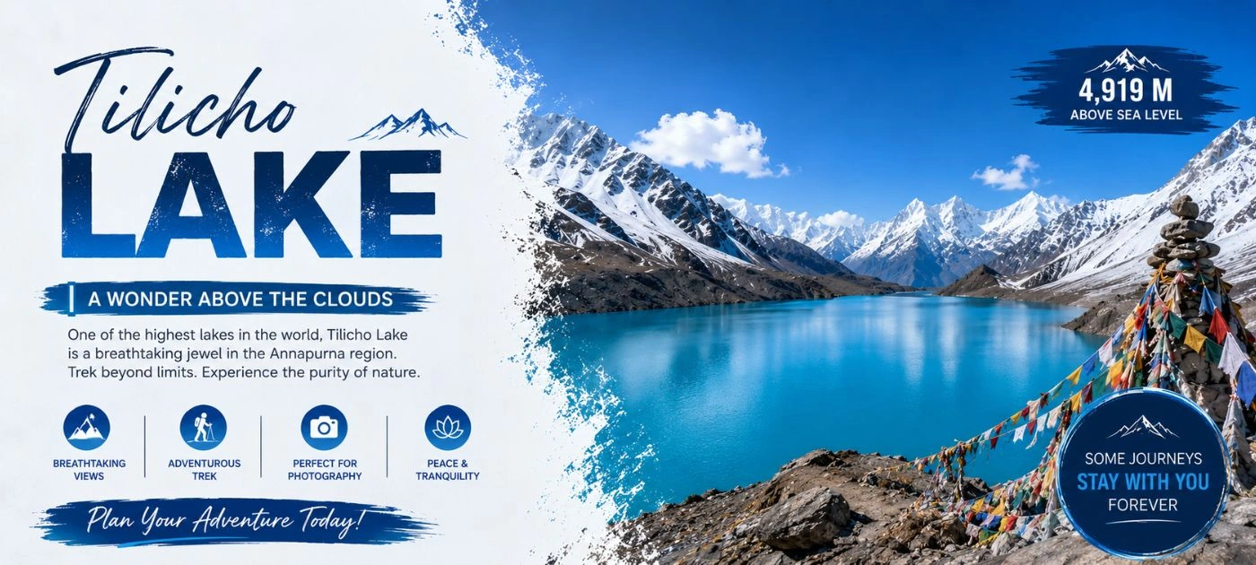
Tilicho Lake "तिलिचो ताल" sits at 4,919 meters above sea level, cradled deep inside the Annapurna region of the Nepal Himalayas. Locals call it Tilicho Tal. And honestly, no photograph does it justice. You've got turquoise water surrounded by walls of ice and rock that look like they belong on another planet. Whether you're a seasoned trekker, a spiritual seeker, or someone who just needs a serious adventure in their life, Tilicho Lake delivers something that most destinations simply can't.
At Index Adventure, we've guided hundreds of trekkers to this lake across every season. Spring, autumn, even winter. We know this trail. In this complete 2026 guide, we're sharing everything you need to plan your Tilicho Lake trek with full confidence. Routes, permits, altitude facts, the best time to visit, costs, and real on-the-ground advice you won't find anywhere else.
Tilicho Lake Overview
Tilicho Lake is a glacial lake sitting inside the Manang District of Nepal's Gandaki Province. It's protected under the Annapurna Conservation Area Project, known as ACAP. Most people encounter it as a major side trip on the Annapurna Circuit Trek, and honestly, it's the kind of side trip that ends up being the highlight of the whole journey.
What makes this lake special isn't just the altitude. It's the setting. Picture a natural amphitheater of Himalayan giants wrapping around a glassy, almost impossibly colored body of water. The lake stays frozen or partially frozen for most of the year. Even during peak trekking season, the landscape around it feels raw and untouched in a way that's getting harder and harder to find anywhere on earth.
And there's the spiritual dimension too. For Hindus, Tilicho is the legendary Kak Bhusundi Lake from the Ramayana. For Buddhists, it's the spot where the revered saint Milarepa is believed to have meditated. Two ancient faiths, one remote Himalayan lake. That combination gives Tilicho a depth that goes way beyond the physical.
Quick Facts at a Glance of Tilicho Lake
- Altitude: 4,919 m (16,138 ft)
- Location: Manang District, Gandaki Province, Nepal
- Size: Roughly 4 km long, 1.2 km wide, 4.8 sq km surface area
- Average Depth: 85 meters (279 feet)
- Conservation Area: Annapurna Conservation Area Project (ACAP)
- Trek Duration: 5 days from Khangsar; 10 to 17 days as part of the Annapurna Circuit
- Best Season: Spring (March to May) and Autumn (September to November)
- Trekking Grade: Moderate to Challenging
Where Is Tilicho Lake Located?
Tilicho Lake is located in the Manang District of Gandaki Province, Nepal. It sits within the Annapurna Conservation Area, roughly 55 kilometers from Pokhara as the crow flies. The lake is tucked into a high glacial basin along the northern flanks of the Annapurna Range.
On a map of Nepal, you'll find Tilicho in the north-central part of the country, north of Pokhara and east of the Kali Gandaki gorge. The nearest village on the approach trail is Khangsar, the last real settlement before the lake. The trail to Tilicho branches off the main Annapurna Circuit Trail at Manang (3,519 m), heading west.
Official Geographical Coordinates of tilicho lake
| Parameter |
Value |
| Latitude |
28° 41' 25" N |
| Longitude |
83° 51' 10" E |
| Province |
Gandaki Province |
| District |
Manang District |
| Conservation Area |
ACAP |
| Surface Elevation |
4,919 m (16,138 ft) |
Is Tilicho Lake the Highest Lake in the World?
This question comes up constantly. And the short answer is no.
Tilicho Lake is not the highest lake in the world. The internet loves to repeat this claim, but it just isn't accurate. The actual highest lake on earth is Ojos del Salado, a volcanic crater lake sitting on the Chile-Argentina border in the Andes at roughly 6,390 meters. That's nearly 1,500 meters higher than Tilicho.
And here's something even more surprising to most people. Tilicho isn't even Nepal's highest lake. In 2019, a group of mountaineers discovered Kajin Sara Lake in Chame, Manang District, at 5,002 meters. So Tilicho sits at number two on Nepal's own list.
But you know what? None of that changes what Tilicho actually is. It's still one of the highest trekking-accessible lakes in the world. And visually, it's hard to beat. Memang cantik, as our Malaysian trekkers always say. Truly beautiful.
Tilicho Lake Altitude and Key Facts
The Tilicho Lake altitude sits at 4,919 meters (16,138 feet) above sea level. That number matters a lot when you're planning your trek.
At that elevation, you're dealing with oxygen levels that are roughly half of what you breathe at sea level. Acute Mountain Sickness (AMS), High-Altitude Pulmonary Edema (HAPE), and High-Altitude Cerebral Edema (HACE) are all real risks here. Proper acclimatization isn't optional. It's the difference between a successful Tilicho Lake trek and a helicopter evacuation.
Altitude Comparison Table
| Location |
Altitude |
| Tilicho Lake |
4,919 m / 16,138 ft |
| Tilicho Base Camp |
4,150 m / 13,615 ft |
| Manang Village |
3,519 m / 11,545 ft |
| Khangsar Village |
~3,734 m / 12,251 ft |
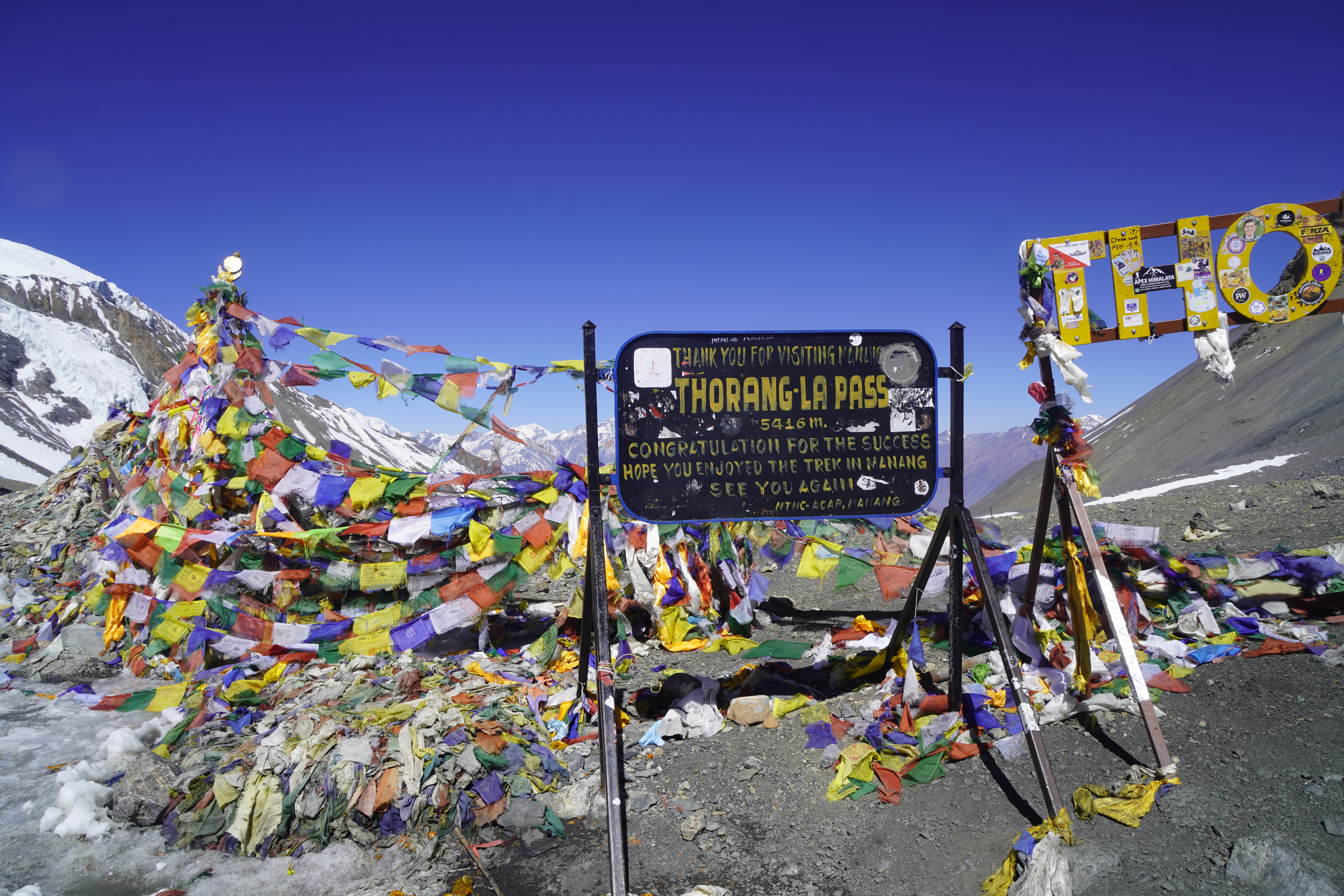
| Thorong La Pass |
5,416 m / 17,769 ft |
| Kajin Sara Lake (Nepal's highest) |
5,002 m / 16,411 ft |
Size and Depth of Tilicho Lake
The lake stretches about 4 kilometers in length and 1.2 kilometers wide. Total surface area sits around 4.8 square kilometers. Average depth comes in at roughly 85 meters (279 feet). For a Himalayan glacial lake sitting at nearly 5,000 meters, that's a substantial body of water. It's one of the defining natural features of the entire Annapurna region.
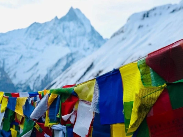
Peaks Visible from Tilicho Lake
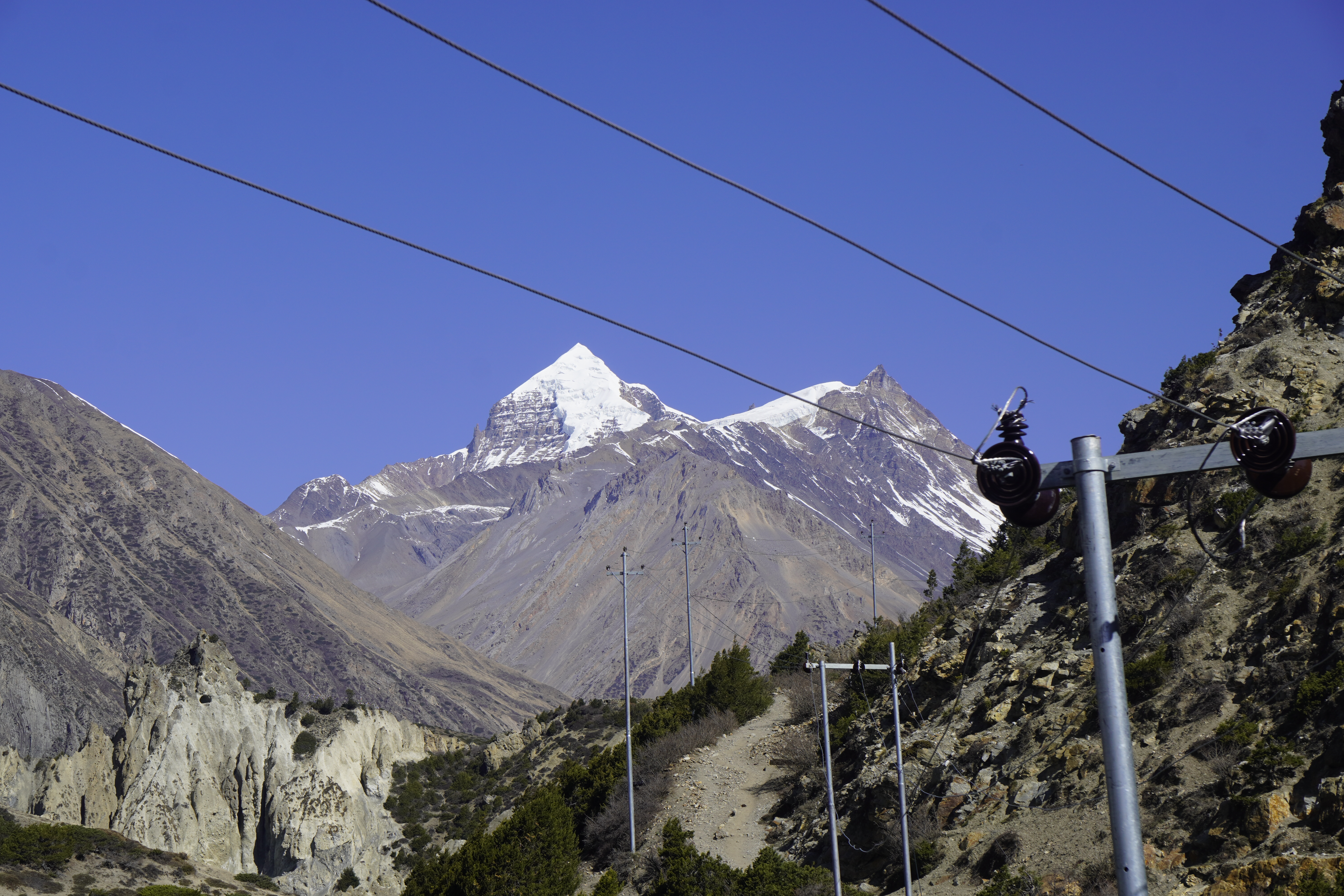
One of the biggest rewards of making it to Tilicho Lake is the view waiting for you when you arrive. The lake sits inside a natural ring of Himalayan giants, and on a clear day, the panorama is simply unmatched.
Tilicho Peak (7,134 m / 23,406 ft) rises directly above the lake. It dominates the immediate skyline and is the defining landmark of the whole scene.
To the north, the three-summited Nilgiri Himal range, Nilgiri North, Nilgiri Central, and Nilgiri South, forms a rugged northern wall. To the east, Gangapurna (7,455 m) adds serious drama. And right alongside it, Khangsar Kang, also known as Roc Noir at 7,485 m, casts its enormous shadow across the eastern edge of the lake.
Further back, Annapurna II (7,937 m), Annapurna III (7,555 m), and Annapurna IV (7,525 m) extend the panorama all the way to the broader Annapurna massif, the tenth-highest mountain system on earth. It's like the mountains just keep going and going.
Honestly, this ring of summits makes Tilicho Lake one of the finest viewpoints on the entire Annapurna Circuit route. Hands down.
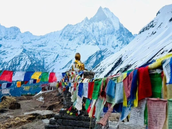
Religious and Cultural Significance of Tilicho Lake
Tilicho Lake isn't just a geographical landmark. It carries real spiritual weight, and you feel that weight the moment you arrive.
Hindu Significance
For Hindus, Tilicho is identified as the sacred Kak Bhusundi Lake from the ancient Ramayana. According to the text, the sage Kak Bhusundi appeared in the form of a crow and narrated the story of Ram to Garuda right on these shores. Many Hindu pilgrims believe that touching or bathing in these waters purifies the soul and clears accumulated karma. Those who can't make the full trek due to age or physical limitations often opt for Tilicho Lake helicopter tours from Pokhara instead, a growing pilgrimage option that's gained a lot of traction in recent years.
Buddhist Significance
Buddhists hold this lake as a place where Milarepa, one of Tibet's most celebrated yogis and poets, is believed to have meditated. His presence is felt all across the Manang Valley, and Tilicho is considered one of the most spiritually charged points in the entire region.
The Villages Along the Way
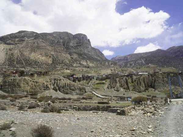
The villages on the Tilicho trekking route, Chame, Pisang, Manang, and Khangsar, are primarily inhabited by the Gurung and Thakali communities whose roots trace back to Tibet. The language, architecture, dress, and religious practices here reflect a Tibetan heritage that's been preserved remarkably well over centuries.
Trekking through these settlements is a cultural experience just as much as a physical one. And if you happen to be there during a religious festival, attending the prayers, ritual offerings, and circumambulations around the lake adds a whole other layer to the experience that no travel guide can fully capture.
How to Reach Tilicho Lake from Pokhara and Kathmandu
Getting to Tilicho Lake takes a combination of road travel and multi-day trekking. Here are all the main options available in 2026.
Route 1: Drive to Manang or Chame, Then Trek
This is the most common approach. Travel by jeep or bus from Pokhara or Kathmandu to Chame (around 238 to 254 km, 8 to 9 hours) or continue to Manang. From there, you trek to Khangsar and then on to the lake. This route follows the classic Annapurna Circuit Trail and gives you the most gradual acclimatization profile, which matters a great deal at this altitude.
From Kathmandu, the drive to Chame typically takes a full day via Dumre and Besisahar. Many trekkers break the journey overnight in Besisahar or Chame before hitting the trail.
Route 2: Trek from Bulbule or Dharapani
For those who want the full trekking experience, starting from Bulbule or Dharapani and walking the entire Annapurna Circuit toward Manang adds more acclimatization time and deeper cultural immersion. This is the approach we recommend at Index Adventure for first-time high-altitude trekkers. Your body gets to adjust at a natural pace instead of being thrown in at the deep end.
Route 3: Fly to Hongde Airport in Manang
Hongde Airport connects Manang to both Pokhara and Kathmandu via short mountain flights. Flying directly to Manang at 3,519 m is technically possible, but there's a significant caveat. Jumping to that elevation without prior acclimatization dramatically raises your AMS risk. If you do fly in, plan at least two full rest days in Manang before heading toward Tilicho.
Route 4: Bicycle or Motorbike to Khangsar
A rough dirt track runs all the way to Khangsar. Some adventurous riders have pushed even further toward Tilicho Base Camp. This is strictly for experienced riders who are completely comfortable with remote, unpaved mountain terrain. Not for the casual traveler, lah.
Route 5: Helicopter Tour
Helicopter companies operating from Pokhara and Kathmandu offer Tilicho Lake helicopter tours that fly you directly to the lake, allow 30 to 60 minutes of exploration, and return the same day. This option is popular among Hindu pilgrims and also gets used for emergency evacuation when trekkers experience severe altitude illness.
NEW in 2024: Jomsom Route via Mesokanto La Pass
A brand new official trekking trail to Tilicho Lake opened in 2024. Gharapjhong Rural Municipality in Mustang District, with support from ACAP, developed this route starting from Thini village in Jomsom. The trail passes through Namakhu Lake, Nilgiri Icefall, Chema Tal, and crosses Mesokanto La Pass at 5,099 m before reaching the lake.
The trailhead is roughly two hours from Jomsom by road, then a six-hour trek to the lake. That makes a visit and return doable within two days.
Important note: this route currently has no teahouses or restaurants. Trekkers using this trail need to carry all their own food, camping gear, and supplies. ACAP has installed information boards along the route.
Best Time to Visit Tilicho Lake
Picking the right season is one of the most critical decisions you'll make for this trek. At 4,919 m, Tilicho Lake weather can shift from comfortable to life-threatening within hours. So timing matters.
Spring: March to May (Recommended)
Spring is one of the two best windows for trekking to Tilicho Lake. Winter snow starts melting, the lower valleys fill up with rhododendrons and alpine wildflowers, and the trail gets progressively clearer from late March onward. Daytime temperatures at lower elevations sit between 12°C and 20°C. Near the lake, nights can drop to -5°C to -10°C.
April is the sweet spot. Warm, clear, and alive with color. By late May, pre-monsoon clouds can begin cutting afternoon visibility.
Autumn: September to November (Peak Season)
Autumn is the most popular trekking season across all of Nepal, and Tilicho Lake is no exception. After the monsoon clears in September, the Himalayan sky turns a deep, vivid blue and visibility reaches its annual peak. Daytime temperatures at altitude settle between 10°C and 16°C, while nights above 4,000 meters can dip below 0°C.
October is the golden month. Dry trails, clear mountain views, and the festive energy of Nepal's Dashain and Tihar celebrations adding a unique cultural backdrop. Teahouses fill up fast in October though, so book early.
Winter: December to February (Experienced Trekkers Only)
Winter turns Tilicho into a frozen, silent landscape of raw, almost brutal beauty. The lake often freezes completely. The trail beyond Base Camp becomes icy, buried in snow, and technically demanding. Temperatures at the lake can drop to -15°C overnight. This season is strictly for well-equipped, experienced mountaineers. Not for beginners under any circumstances.
Monsoon: June to August (Generally Not Recommended)
Tilicho sits in the rain-shadow zone of the Annapurna Range, so the upper sections around Manang stay surprisingly dry even during monsoon. But the lower portions of the approach trail around Chame, Pisang, and Dharapani can turn slippery, landslide-prone, and leech-heavy during heavy rains. Views are frequently blocked too.
Tilicho Lake Weather: Month-by-Month Summary
| Month |
Conditions |
Recommended? |
| January |
Very cold, heavy snow, trail closures |
Experienced only |
| February |
Cold, icy, limited visibility |
Experienced only |
| March |
Improving, rhododendrons begin |
Good |
| April |
Warm, clear, wildflowers |
Excellent |
| May |
Warm, some afternoon clouds |
Good |
| June |
Pre-monsoon clouds, lower rain at lake |
Caution |
| July |
Monsoon on lower trails |
Avoid lower trail |
| August |
Same as July |
Avoid lower trail |
| September |
Clearing skies, fresh landscape |
Good |
| October |
Crystal clear, peak season |
Best |
| November |
Cool, clear, quieter |
Excellent |
| December |
Cold, possible snowfall, icy trails |
Experienced only |
Tilicho Lake Trek: 5-Day Route Guide
The shortest dedicated Tilicho Lake trek starts from Khangsar village. Here's what a practical 5-day Tilicho Lake trek itinerary looks like on the ground.
Day 1: Arrive in Khangsar (3,734 m)
After driving from Pokhara or Kathmandu to Manang, you continue by jeep or on foot to Khangsar. This is the last inhabited village before the Tilicho trail. Rest here. Hydrate well. Get your gear sorted. Don't underestimate what that altitude adjustment does to your body on day one.
Day 2: Khangsar to Tilicho Base Camp (4,150 m) | 4 to 5 Hours
The trail climbs steadily through a stark, boulder-heavy landscape. About an hour in, you hit the landslide-prone section. This is the most technically hazardous stretch of the whole route. Narrow path, exposed sides, loose rock, and serious drop-offs. Walk carefully. Keep your pace steady. Don't stop in exposed areas.
Once you clear that section, the terrain opens into the broader glacial valley approaching Base Camp. The teahouse here is basic but functional. A warm meal and a night of acclimatization sets you up well for summit day.
Tilicho Base Camp Facilities:
- Altitude: 4,150 m (13,615 ft)
- Accommodation: Basic teahouse, shared toilets
- Meals: Dal bhat, noodle soup, tea, snacks
- Wi-Fi: Not reliably available
- Charging: Available for a fee
- Heating: Dining room only
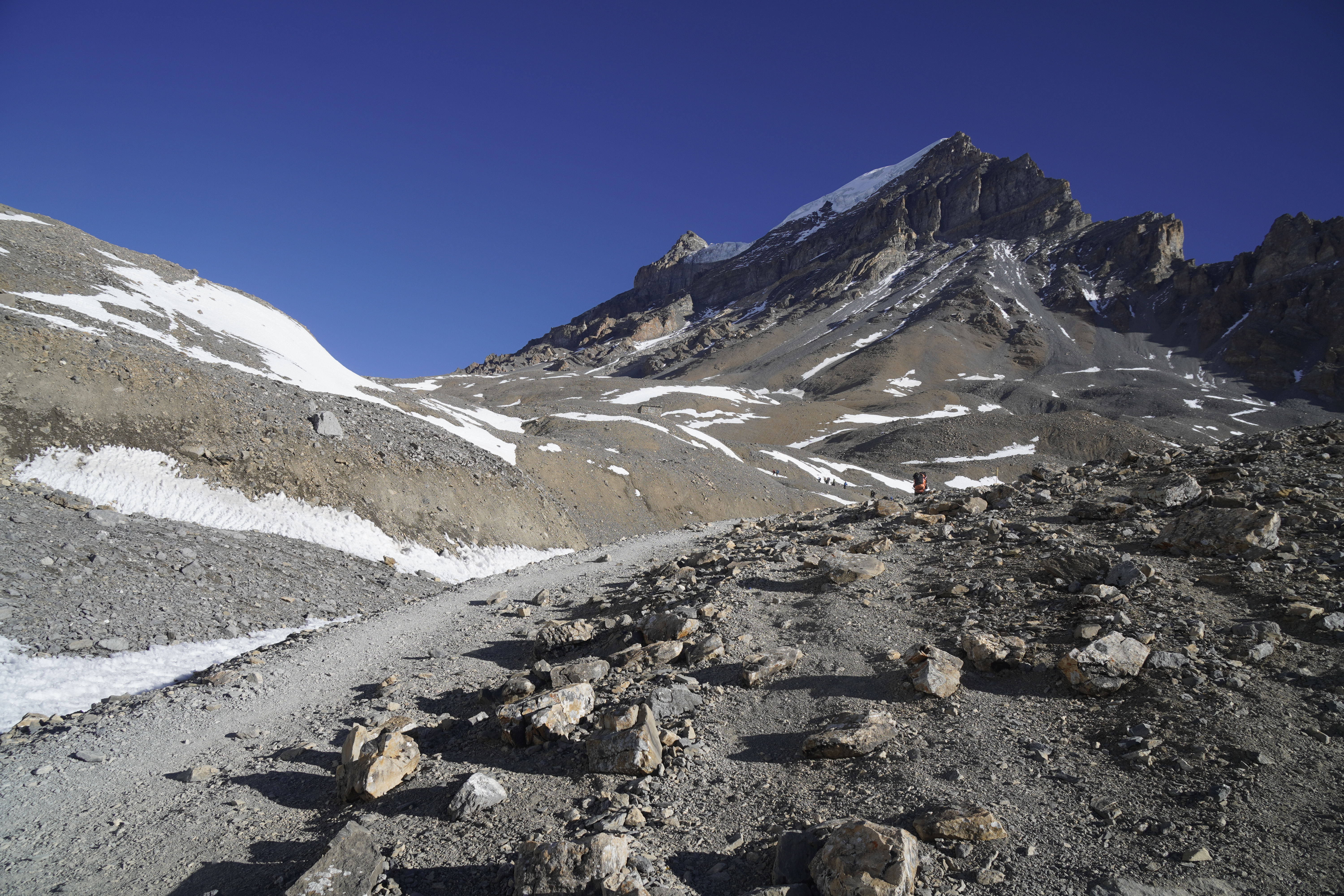
Day 3: Base Camp to Tilicho Lake (4,919 m) and Return | 5 to 6 Hours
This is the day everyone's been building toward. Start between 4:00 and 5:30 AM. That early start isn't a suggestion. Afternoon winds at Tilicho Lake can be ferocious, and cloud cover often kills visibility by midday.
From Base Camp, the trail climbs steeply for the first hour until you reach Bais Ghumti, locally called the 22 switchbacks. Twenty-two hairpin bends winding up a rocky hillside. The thinning air, steep gradient, and biting cold make every step a real effort. Take it slow. Breathe steady. Keep moving.
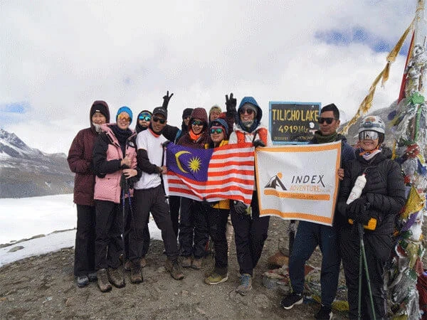
Above the switchbacks, the terrain levels into a vast snow-covered plateau. You walk for roughly 45 minutes before the first glimpse of Tilicho Lake. And when you see it, that impossibly vivid turquoise expanse framed by glaciers and peaks, something in your chest just stops. Our Malaysian trekkers always say the same thing at that moment: "Wah, syok betul!" And every single time, we agree completely.
Spend real time at the lake. Take it in. Then head back down to Base Camp for lunch before retracing your steps to Khangsar.
Day 4: Khangsar to Manang (Return and Buffer Day)
Head back to Manang for rest and additional acclimatization if you're continuing the Annapurna Circuit. This buffer day also gives you a safety margin in case of weather delays, which happen more often than people expect.
Day 5: Depart Manang
Return to Pokhara or Kathmandu by jeep via Chame and Besisahar (roughly 8 hours). Or continue along the Annapurna Circuit toward Thorong La Pass if you've got more time on your hands.
Planning a longer adventure? Check out Index Adventure's 17-Day Annapurna Circuit Trek with Tilicho Lake, which combines the full circuit, Thorong La Pass crossing, Muktinath visit, and the Tilicho Lake side trip all in one itinerary.
Tilicho Lake Trek Difficulty
The Tilicho Lake trek difficulty is rated moderate to challenging. Fit beginners who prepare properly can do this. But it pushes even experienced trekkers at certain points. So go in with honest expectations.
What Makes It Hard
The altitude is the biggest factor. At nearly 5,000 meters, oxygen levels drop to roughly half of what you breathe at sea level. Your pace slows. Breathing becomes labored. And the risk of altitude sickness is real and serious.
The landslide zone between Khangsar and Base Camp is technically hazardous. Loose rock regularly falls from the cliffs above, and the path has serious drop-offs on one side. This section gets especially risky when wet or icy.
The Bais Ghumti, those 22 switchbacks above Base Camp, is where many trekkers say they hit their wall. Not because it's technically complex, but because of the brutal combination of steep gradient and oxygen-thin air.
Above 4,500 m, the trail is frequently snow-covered. Microspikes or crampons are strongly recommended outside the peak months of October and April.
And mountain weather in the Annapurna region turns fast. Calm conditions at 6:00 AM can become dangerously windy and cold by noon. Always carry layers and listen to your guide.
Physical Fitness
You should be capable of walking 6 to 8 hours per day on uneven terrain for multiple consecutive days. Prior experience with multi-day hikes at altitude is a real advantage. At Index Adventure, we tell every trekker the same thing: start a basic training routine of hiking, stair climbing, and cardio work at least 4 to 6 weeks before you fly out.
Tilicho Base Camp: Everything You Need to Know
Tilicho Lake Base Camp sits at 4,150 m (13,615 ft) and is the critical staging post for the final push to the lake. Almost every trekker spends at least one night here. Ideally two.
Why Staying at Base Camp Matters
The elevation jump from Manang at 3,519 m to the lake at 4,919 m in a single day is too aggressive for safe acclimatization. A night at Base Camp gives your body time to start producing more red blood cells and adapting to the reduced oxygen. Skip this step and you're dramatically raising your AMS risk on summit day.
What to Expect at Base Camp
- Accommodation: Basic teahouse rooms with beds, mattresses, and quilts
- Toilets: Shared
- Food: Dal bhat, soups, noodles, eggs, tea
- Charging: Extra charge, typically NPR 200 to 500 per device
- Wi-Fi: Limited or unavailable
- Heating: Common dining room only, rooms are not heated
Camping at Tilicho Lake itself is strongly discouraged. Extreme temperature swings, high winds, and zero shelter make it a bad idea. Base Camp teahouses are the smart and recommended option.
Tilicho Lake Trek Permits and Costs 2026
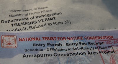
Every trekker entering the Tilicho Lake area needs two valid permits. No exceptions.
Required Permits
Annapurna Conservation Area Permit (ACAP)
- Issued by the National Trust for Nature Conservation (NTNC)
- Cost in 2026: NPR 3,000 (roughly USD 25 to 30) for foreign nationals
- SAARC nationals: NPR 1,000
- Apply at ntnc.org.np or in person at NTNC offices in Kathmandu or Pokhara
TIMS Card (Trekkers' Information Management System)
- Cost in 2026: NPR 2,000 (roughly USD 15 to 20) for individual trekkers
- Lower rates for SAARC nationals and organized group trekkers
- Available at Nepal Tourism Board offices in Kathmandu or Pokhara
Total Tilicho Lake trek permit cost for non-SAARC trekkers: approximately USD 50.
Mandatory Guide Requirement (Still in Effect from 2023)
As of April 1, 2023, Nepal's government prohibits solo trekking without a licensed guide in most high-altitude areas, including the Annapurna region and the Tilicho Lake approach. Trekking without a registered guide is a legal violation and can result in fines or removal from the trail.
At Index Adventure, all our Tilicho Lake treks include licensed, experienced, English-speaking guides as standard.
Permit Checkpoints
Permits get checked at multiple points along the Annapurna Circuit, including Besisahar, Chame, and Manang. Carry printed copies of everything. Digital versions often aren't accepted in areas with limited connectivity.
Accommodation and Food Along the Trail
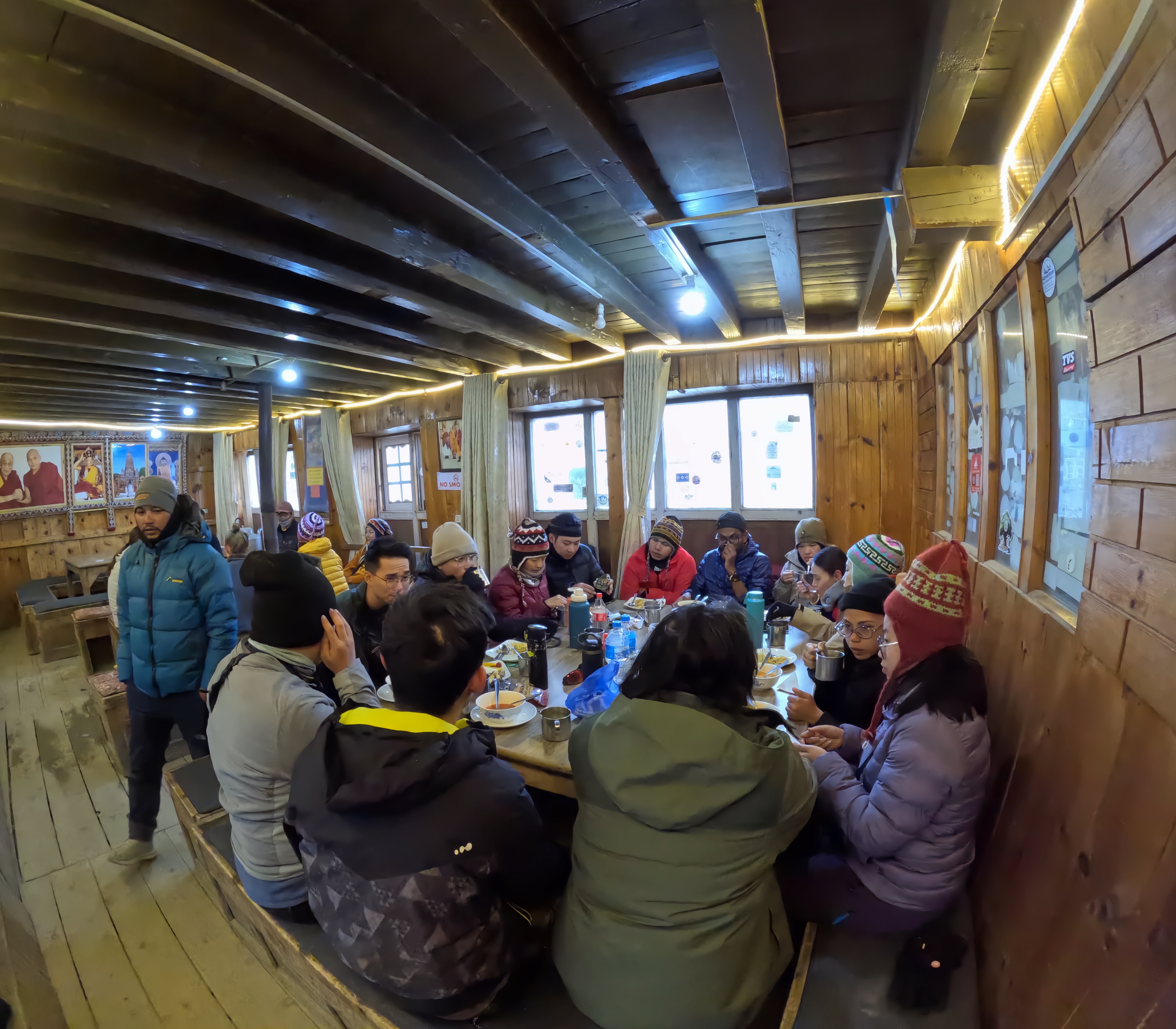
Where to Stay: Teahouses and small lodges cover all the major stops along the Tilicho route: Besisahar, Chame, Pisang, Manang, Khangsar, and Tilicho Base Camp. Standards improve noticeably at lower elevations. Manang in particular has well-developed teahouse options with attached bathrooms, some with hot showers, and limited Wi-Fi.
As you gain altitude, things get progressively more basic. At Tilicho Base Camp, expect shared toilets, unheated rooms, and the complete absence of comfort. Pack a good sleeping bag rated to at least -10°C. The thin blankets provided won't be enough on their own.
Food
Eating well at altitude is one of the most underestimated parts of high-altitude trekking in Nepal. Your body burns significantly more calories at elevation, and poor nutrition speeds up fatigue and altitude illness faster than you'd think.
Dal bhat is the trekker's staple meal: calorie-dense, nutritious, and usually available with unlimited refills at most teahouses. Other standard options include noodle soups, fried rice, pasta, eggs, porridge, and pancakes. Hot tea, lemon honey ginger tea, and warm soups are strongly recommended for hydration and warmth.
Food prices rise significantly with altitude. At Tilicho Base Camp, expect to pay three to four times what things cost in Pokhara. That's the practical reality of remote supply logistics, not price gouging.
Safety Tips for the Tilicho Lake Trek
Safety on this trek isn't about being overly cautious. It's about respecting the mountain environment and making smart decisions. Here's what we share with every trekker at Index Adventure before they set off.
Acclimatize Properly
Climb high, sleep low. That's the golden rule of high-altitude trekking Nepal. Never gain more than 300 to 500 meters of sleeping altitude per day above 3,000 meters. Spend at least two nights in Manang before heading to Tilicho Base Camp.
Know the Symptoms of Altitude Sickness
Common AMS symptoms include persistent headache, nausea, fatigue, loss of appetite, and disturbed sleep. If those symptoms worsen or come with loss of coordination, confusion, or chest tightness, those are signs of HAPE or HACE. Descend immediately. Don't sleep it off. Don't wait to see if it improves. Just descend.
Start Before Dawn
Begin the ascent to Tilicho Lake between 4:00 and 5:30 AM. Afternoon winds at the lake can exceed 60 km/h. Cloud cover drops both visibility and temperature significantly by midday. An early start is honestly your most important tactical decision of the entire trek.
Get Trekking Insurance
Travel insurance covering helicopter evacuation and high-altitude medical treatment is non-negotiable. Emergency evacuations from the Tilicho Base Camp area cost between USD 2,500 and USD 5,000. Without confirmed insurance coverage or a cash deposit, helicopters don't fly. Boleh percaya, this is serious. Don't skip it.
The Landslide Zone
Cover the landslide section at a steady, continuous pace. Don't take long breaks in exposed areas. Loose rock and falling debris are real hazards, especially in warmer months when melting triggers rock movement.
Stay Hydrated
Dehydration accelerates altitude sickness faster than most trekkers expect. Drink 3 to 4 liters of water or warm fluids per day throughout the trek, even when you don't feel thirsty. Avoid alcohol at altitude entirely.
Nearby Attractions
Tilicho Lake sits within one of the richest trekking regions anywhere on earth. Several compelling destinations are within easy reach of the Tilicho trail.
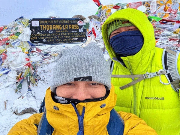
Thorong La Pass (5,416 m) is the highest trekking pass in the world and sits on the classic Annapurna Circuit route. Combining Tilicho Lake with Thorong La in a single itinerary is, in my experience, the ultimate Annapurna adventure.
Muktinath Temple is one of the most sacred pilgrimage sites in both Hinduism and Buddhism, located in the Mustang region beyond Thorong La. Thousands of pilgrims make the journey every year.
Ice Lake, also known as Kicho Tal at 4,600 m, is a popular day hike from Manang offering panoramic views of the Annapurna and Gangapurna glaciers.
Manang Village itself is worth slowing down for. Ancient monastery, stunning mountain panoramas, and solid trekker infrastructure make it a natural rest point on the route.
Jomsom and Mustang offer the ancient walled city of Lo Manthang and the dramatic, arid landscapes of Upper Mustang, accessible from Jomsom just beyond Muktinath.
The Bhotia villages of Chame, Pisang, and Braga along the Circuit trail give you cultural encounters, ancient gompas, and a way of life that feels largely untouched by the modern world.
16. New 2024 Trekking Route to Tilicho via Jomsom
A new official trekking trail to Tilicho Lake became operational in 2024, and it's worth knowing about.
Gharapjhong Rural Municipality in Mustang District, with financial and logistical support from ACAP, opened this route starting from Thini village in Jomsom. The trail runs through Namakhu Lake, Nilgiri Icefall, Chema Tal, and crosses Mesokanto La Pass at 5,099 m before reaching the lake.
The trailhead is about two hours from Jomsom by road, then a six-hour trek to the lake. That makes a visit and return possible in two days.
One important note: this route has no teahouses or restaurants right now. Trekkers using this trail need to carry all their own food, camping gear, and supplies. ACAP has installed information boards along the route.
This new trail creates a genuine loop possibility for trekkers approaching from the Mustang and Jomsom side of the Annapurna Circuit, which is a significant development for multi-day adventurers.
Frequently Asked Questions About Tilicho Lake
Is Tilicho Lake the Highest Lake in the World?
No. Tilicho Lake at 4,919 meters is not the world's highest lake. That record belongs to Ojos del Salado in the Andes at roughly 6,390 m. And Tilicho isn't even Nepal's highest lake. That distinction goes to Kajin Sara Lake in Chame at 5,002 m, discovered in 2019. But Tilicho remains one of the highest trekking-accessible lakes on earth and is genuinely one of the most beautiful anywhere on the planet.
Is the Tilicho Lake Trek Difficult?
Yes, it's rated moderate to challenging. The main challenges are the high altitude at 4,919 m, the technically hazardous landslide zone between Khangsar and Base Camp, the 22-switchback ascent above Base Camp, and unpredictable mountain weather. Most physically fit trekkers who acclimatize properly and follow a sensible itinerary can complete it. Hiring a licensed guide through Index Adventure is now mandatory under current Nepal government regulations.
How Do I Reach Tilicho Lake from Pokhara?
From Pokhara, take a private jeep or bus to Chame or Manang (6 to 9 hours) via Besisahar, then trek to Khangsar village. From Khangsar, it's a 4 to 5-hour hike to Tilicho Base Camp and another 3 to 4-hour climb to the lake itself. You can also fly from Pokhara to Hongde Airport in Manang, though mandatory acclimatization rest days are required after flying in.
Which Month Is Best to Visit Tilicho Lake?
October is generally the best single month. Crystal-clear skies, stable weather, comfortable temperatures, and the festive energy of Nepal's Dashain and Tihar holidays. April is the second-best option, with warmer weather and rhododendron blooms across the lower trail. The broader recommended windows are spring (March to May) and autumn (September to November).
How Far Is Tilicho Base Camp from the Lake?
The Tilicho Lake distance from Base Camp to the lake is roughly 5 to 6 kilometers by trail, with an elevation gain of about 769 meters. The ascent takes 3 to 4 hours at a steady pace, including the Bais Ghumti switchback section. The descent back to Base Camp takes around 2 to 2.5 hours.
How Far Is Khangsar from Tilicho Base Camp?
From Khangsar village to Tilicho Base Camp is approximately 8 to 10 kilometers depending on the exact route. The hike typically takes 4 to 5 hours, climbing through the landslide zone and the upper glacial valley.
What Is the Altitude of Tilicho Lake in Feet?
Tilicho Lake sits at 4,919 meters, which converts to 16,138 feet above sea level. Tilicho Base Camp lies at 4,150 meters (13,615 feet).
What Province Is Tilicho Lake In?
Tilicho Lake is located in Gandaki Province, within the Manang District of Nepal. It falls inside the protected boundaries of the Annapurna Conservation Area Project (ACAP).
What Is the Weather Like at Tilicho Lake?
Tilicho Lake weather is highly variable and can shift fast. In autumn, daytime temperatures at the lake sit around 0°C to 5°C, with nights dropping to -10°C to -15°C. In spring, daytime temperatures reach 5°C to 10°C at the lake, with cold nights. In winter, overnight temperatures regularly fall below -20°C and the lake freezes over completely. Strong afternoon winds are common across every season.
What Is Tilicho Lake Called in Nepali?
In Nepali, the lake is called Tilicho Tal (तिलिचो ताल). "Tal" is the Nepali and Hindi word for lake. It's also known as Kak Bhusundi Lake or Kag Bhusundi Tal in Hindu religious texts.
Final Thoughts
Tilicho Lake isn't just another trekking destination on a bucket list. I'd argue it's one of those rare places that actually exceeds whatever you imagined before you got there. Surrounded by some of the highest mountains on earth, shimmering at nearly 5,000 meters in colors that shift from deep cobalt to vivid turquoise depending on the light and the season, Tilicho sits in a category all its own.
Whether you approach it as a side trip on the Annapurna Circuit Trek, as a dedicated high-altitude adventure, as a spiritual pilgrimage, or as a personal test of endurance and will, it rewards you. From what we've seen at Index Adventure, trekkers who reach that lake come back a little different. Nothing dramatic. But something in them shifts.
At Index Adventure, we believe the only way to truly experience Tilicho Lake is safely, with proper preparation, expert guidance, and genuine respect for the mountain. Our guides have walked this trail hundreds of times. They know every switchback, every weather pattern, and every signal that says push forward or turn back now.
If Tilicho Lake is on your list, and honestly it should be, jom pergi. Let's go make it happen.
Ready to trek to Tilicho Lake with Index Adventure? Contact us for custom 2026 itineraries, group departures, and private guided packages.