How many days is Annapurna Circuit?
If you have spent any time researching the Annapurna Circuit, you have already run into the mileage problem. One source says 100 miles. Another says 160. A third says 230 km and suddenly you are not even sure if you are comparing the same trek. It is genuinely frustrating, especially when you are trying to figure out whether you have enough time, enough fitness, or enough budget to make it work.
By the end of this guide, you will know exactly how many miles the Annapurna Circuit covers for five different route variations, what the actual daily distances look like on the ground, why those numbers vary so much depending on where you start, and how to build a mileage plan that fits your timeline. No vague ranges. Specific numbers, with context.
This Annapurna Circuit Trek Distance guide blog will cover total distance of all variants of Annapurna Circuit Route, day by day mileage of standard 14-day Annapurna Itinerary, why total distance varies so much for the trekkers, the hardest day, Trekking distance compared to other treks like EBC and other logistics information of 2026.
Updated Details of Annapurna Circuit Trek Distance for 2026
- Full Circuit Length: 100–145 miles (160-230 km) or around 95 miles (153 km) for common, slightly shorter routes, avoiding road routes.
- Common Route Distance: The classic route from Besisahar to Jomsom is roughly 160–175 km
- Highest Point: The route reaches 5,416m (17,769 ft) at Thorong La Pass.
- Daily Distances: Trekkers typically cover 10–15 km daily, though days are shorter near the Thorong La pass for acclimatization.
- Road Construction: Jeep tracks have reduced the walking distance on the lower parts of the trail, such as from Besisahar to Chame or in the Muktinath area.
- Start/End Points: Modern routes often start at Dharapnai, Tal, or Chame (2,670 m) and end at Jomsom or Muktinath to avoid road walking.
- Side Trips: Detours to Tilicho Lake or Poon Hill add significant distance.
- Variation: Shortened, 12-13 day itineraries might be closer to 100-110 km.
Total Annapurna Circuit Trek Distance: 5 Route Variations
The Annapurna Circuit covers between 99 and 199 miles (160 to 320 km) depending on which version of the trek you do. There is no single correct answer and that is not a dodge. The route you choose, where you start walking, and which side trips you include genuinely change the total by 80 to 100 km.
Here is a clean breakdown of every main variation of Annapurna Circuit like Tilicho Lake, Ghorepani, Nar Phu Valley and others:
| Route Variation |
Distance (KM) |
Distance (Miles) |
Duration |
| Classic Circuit + Ghorepani |
300–320 km |
186–199 miles |
18–21 days |
| Starting from Besishahar |
220–230 km |
137–143 miles |
16–18 days |
| Starting from Dharapani |
160–170 km |
99–106 miles |
12–14 days |
| Circuit + Tilicho Lake |
190–210 km |
118–130 miles |
14–17 days |
| Circuit + Nar Phu Valley |
250–270 km |
155–168 miles |
18–21 days |
Annapurna Circuit Trek Distance starting from Dharapani
Starting from Dharapani (99–106 miles) is the sweet spot for most trekkers in 2026. You drive the lower Marshyangdi Valley sections — which now run along a jeep road and start walking from where the trail actually starts feeling like a mountain trail. Twelve to 14 days, nothing scenically significant missed.
Besishahar To Annapurna Circuit Trek Distance
Starting from Besishahar (137–143 miles) gives you the traditional experience and the full distance — but be clear-eyed about it. Parts of the trail between Besishahar and Jagat share space with a motor road. It is the kind of walking that will make you question why you did not just take the jeep.
Classic Annapurna Circuit Trek Distance (Besishahar - Thorong La - Ghorepani)
The classic circuit with Ghorepani (186–199 miles) is the version that earns a full story. You get Thorong La Pass at 5,416 meters and the rhododendron forests around Ghorepani two completely different landscapes, both unforgettable. It is long and it is demanding. But I'd argue it is also the most complete version of the trek that exists.
Day-by-Day Annapurna Circuit Mileage Table (Standard 14-Day Itinerary)
This table uses the most popular 2026 itinerary starting from Jagat after a jeep drive from Kathmandu and finishing at Nayapul.
| Day |
Segment |
Elevation |
Distance (KM) |
Distance (Miles) |
Time |
| 01 |
Kathmandu to Jagat (Drive) |
1,100m |
213 km |
132.4 miles |
8–9 hrs |
| 02 |
Jagat to Dharapani |
1,400m |
15 km |
9.3 miles |
5–6 hrs |
| 03 |
Dharapani to Chame |
2,630m |
15.5 km |
9.6 miles |
5–6 hrs |
| 04 |
Chame to Pisang |
3,300m |
15 km |
9.3 miles |
5–6 hrs |
| 05 |
Pisang to Manang |
3,370m |
16 km |
9.9 miles |
6–7 hrs |
| 06 |
Acclimatization — Ice Lake Hike |
4,600m |
10 km |
6.2 miles |
5–6 hrs |
| 07 |
Manang to Yak Kharka |
4,110m |
11 km |
6.8 miles |
4–5 hrs |
| 08 |
Yak Kharka to Thorong Phedi |
4,450m |
8 km |
5.0 miles |
3–4 hrs |
| 09 |
Thorong Phedi to Muktinath (via Thorong La) |
5,416m |
17 km |
10.5 miles |
8–10 hrs |
| 10 |
Muktinath to Marpha |
2,670m |
22 km |
13.7 miles |
7–8 hrs |
| 11 |
Marpha to Ghasa |
2,010m |
23 km |
14.3 miles |
7–8 hrs |
| 12 |
Ghasa to Tatopani |
1,190m |
14.5 km |
9.0 miles |
5–6 hrs |
| 13 |
Tatopani to Ghorepani |
2,810m |
17 km |
10.6 miles |
7–8 hrs |
| 14 |
Ghorepani to Nayapul |
1,070m |
22 km |
13.7 miles |
6–7 hrs |
Total trekking distance (Days 2–14): approximately 196.5 km / 122 miles
One thing that table does not show you Days 7 and 8 are deliberately short. That is intentional altitude acclimatization strategy, not an easy stretch. By Day 8, you are sleeping at 4,450 meters. Short kilometers at that elevation hit differently than a flat 8 km at sea level.
How Far Do You Trek Per Day on the Annapurna Circuit?
The average daily distance on the Annapurna Circuit is 15 to 20 km, or roughly 9 to 12 miles. But honestly, distance is one of the least useful numbers to focus on above 4,000 meters.
Day 9: Thorong La Pass covers just 17 km. And yet it is the day that defines the entire trek. You start at 3:30 or 4:00 AM in the dark and cold, gain over 1,000 vertical meters to reach the 5,416-meter summit, then drop a steep 1,600 meters into Muktinath. That takes 8 to 10 hours. By contrast, Day 11 from Marpha to Ghasa is 23 km through the Kali Gandaki gorge, and most people cover it in 7 to 8 hours at a comfortable pace.
The rule here is simple. Always plan using elevation gain alongside distance especially above 3,500 meters, where the altitude alone slows your pace by 30 to 40 percent compared to sea level walking.
A useful benchmark from the Wilderness Medical Society: above 3,000 meters, trekkers should gain no more than 300 to 500 meters of sleeping elevation per day to reduce the risk of Acute Mountain Sickness (AMS). The itinerary above is built around this threshold.
Note: If you experience symptoms of AMS , such as persistent headache, nausea, or loss of coordination descend immediately. Consult a travel medicine physician before your departure to discuss preventive medications and response protocols.
Why the Total Annapurna Circuit Distance Varies So Much
Three things account for most of the confusion around total mileage.
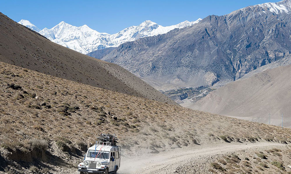
Road construction is the biggest factor. Jeep roads now push deep into both the Marshyangdi Valley on the north side and the Kali Gandaki Valley on the south. Sections that were pure trail in 2010 now either share the trail with motor vehicles or run directly on a road surface. Trekkers who take jeeps to skip those sections end up walking significantly fewer miles and most people are fine with that trade-off.
The NACT trails: New Annapurna Circuit Trails change the equation back in the other direction. These marked routes, identified by red-and-white or blue-and-white signs, route you away from the road and through forests, terraced fields, and traditional villages. Following the full NACT adds 8 to 16 km compared to road-walking the same sections. It is slower. It is also far better.
Side trips add meaningful distance that many trekkers underestimate when planning. The Tilicho Lake detour adds nearly 30 km round trip. The Ice Lake acclimatization hike from Manang adds another 10 km. None of these appear in a "standard circuit" distance figure, and none of them are easy kilometers.
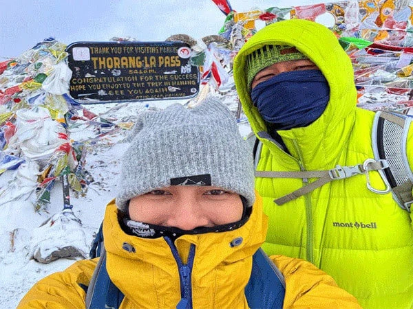
The Hardest Day: Thorong La Pass Crossing in Detail
Thorong Phedi to Muktinath via Thorong La Pass is 17 km (10.5 miles) and is universally considered the hardest single day on the entire circuit.
The pass summit sits at 5,416 meters (17,769 feet). Most trekkers leave Thorong Phedi at 3:30 to 4:00 AM to reach the top by 9:00 to 10:00 AM, before afternoon winds make the summit ridge genuinely dangerous. From the top, the descent to Muktinath drops 1,600 vertical meters over 9 km steep, loose in places, and hard on the knees.
What most guides will not tell you: the wind on the Thorong La summit shifts from westerly to a cross-wind pattern between 9:00 and 11:00 AM. Trekkers who summit after 10:00 AM consistently report significantly harder conditions than those who summit by 8:30. Start time on Day 9 is not a suggestion. It is a strategy.
The night before at Thorong Phedi or High Camp, drink more water than you think you need and eat something small before sleeping. AMS symptoms that seem manageable at 4,450 meters can intensify overnight.
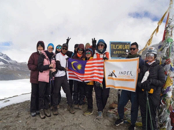
Tilicho Lake Side Trip: Distance and Time
The Tilicho Lake detour branches off from the main circuit at Manang, roughly 3 km before the village of Shree Kharka. The lake sits at 4,919 meters making it one of the highest lakes in the world.
The round-trip distance from Manang is approximately 28 to 30 km. Allow 2 to 3 extra days. The trail involves a steep, exposed section above the Mesokanto La base that catches many trekkers off guard. Altitude gain from Manang to the lake is around 1,400 meters.
From what I have seen, the trekkers who include Tilicho almost always say it was the single most memorable part of the trip — not because it is easy, but because a turquoise lake at nearly 5,000 meters surrounded by rock and ice is the kind of thing that does not look real until you are standing in front of it.
Nar Phu Valley Extension with Annapurna: Distance Added and What to Expect
The Nar Phu Valley extension branches north from Koto, just past Chame, and loops through two ancient villages — Nar and Phu — before rejoining the main circuit at Manang via the Kang La Pass at 5,322 meters.
This extension adds approximately 80 to 90 km (50 to 56 miles) to the standard circuit. It requires a special restricted area permit currently priced at USD 90 per week per person, in addition to the standard ACAP permit (NPR 3,000) and TIMS card (NPR 2,000).
Nar Phu is genuinely remote. The villages date back centuries and have preserved Tibetan plateau culture with minimal outside influence. Trail infrastructure is basic compared to the main circuit. If solitude and cultural depth matter more to you than comfort, this is the most rewarding add-on the Annapurna region offers.
Annapurna Circuit vs Everest Base Camp: Distance Comparison
| Trek |
Distance (KM) |
Distance (Miles) |
Duration |
Max Elevation |
| Annapurna Circuit (14-day standard) |
196 km |
122 miles |
14 days |
5,416m (Thorong La) |
| Annapurna Circuit (classic + Ghorepani) |
300–320 km |
186–199 miles |
18–21 days |
5,416m |
| Everest Base Camp (standard) |
130 km |
80 miles |
12–14 days |
5,364m (EBC) |
The Annapurna Circuit is longer than Everest Base Camp by a significant margin. The standard 14-day circuit covers roughly 50 percent more ground than the EBC round trip. The full classic version is more than double.
That said, EBC trekkers gain altitude more rapidly and spend more consecutive days above 4,000 meters. Neither trek is easy. They are just hard in different ways.
Annapurna Circuit Trek Cost: What to Budget
The Annapurna Circuit trek cost typically runs from USD 800 to USD 1,800 for a fully guided package, depending on group size, duration, and included services. Independent trekkers generally manage on USD 30 to USD 50 per day on the trail.
Key costs to factor in:
| Item |
Cost (2026) |
| ACAP Permit |
NPR 3,000 (~USD 22) |
| TIMS Card |
NPR 2,000 (~USD 15) |
| Nar Phu Restricted Area Permit |
USD 90 per week |
| Licensed guide (daily rate) |
USD 25–35 per day |
| Porter (daily rate) |
USD 18–25 per day |
| Tea house accommodation |
USD 5–15 per night |
| Meals on trail |
USD 3–8 per meal |
Permit fees are sourced from Nepal Tourism Board 2025–2026 data and are subject to revision. Verify current rates with the Department of Immigration Nepal or your registered trekking agency before departure.
A soft recommendation here: do not skip the guide to save money. Above 4,000 meters, in unpredictable mountain weather, an experienced licensed guide is not a luxury. They know the NACT trail markers, they know which tea houses are worth stopping at, and they know what early AMS symptoms look like before you do.
Planning an itinerary? Index Adventure offers a free route consultation tell us your timeline and we'll map the right version of the circuit for you.]
Using an Annapurna Circuit Map with Distance Markers
A good map for the Annapurna Circuit shows both the main NACT trail and the parallel jeep road so you can see exactly where they diverge and decide which sections you want to walk versus drive.
The most reliable options for 2026 are:
- Nepa Maps 1:50,000 Annapurna trekking map best printed option, widely available in Kathmandu
- Maps.me loaded with Nepal hiking trail data works offline, shows NACT trails reasonably well
- Gaia GPS with the Nepal topo layer best elevation profile view for planning daily effort
When reading any map, look at the elevation profile alongside the distance. A 10 km section with 1,200 meters of elevation gain is not the same hike as a flat 10 km through a valley. The Annapurna Circuit has both and knowing which you are facing on any given day changes how you prepare the night before.
Plan Your Annapurna Circuit with Index Adventure
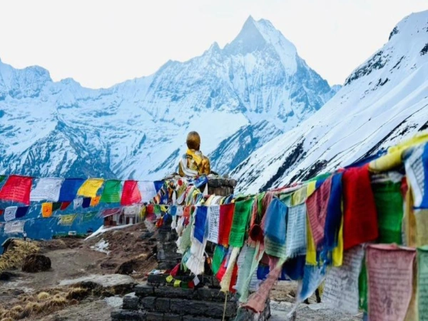
Whether you are doing 99 miles from Dharapani or committing to the full 199-mile classic circuit with Ghorepani, the Annapurna Circuit rewards every step honestly. The distance is real. The altitude is real. And the views from Thorong La at sunrise, or from Poon Hill in the early morning, are the kind of thing you will describe to people for the rest of your life.
Index Adventure has guided trekkers through every variation of this route for years. Our licensed guides know every kilometer of the NACT trail, every acclimatization checkpoint, and every tea house worth stopping at between Jagat and Nayapul. No large deposits upfront. Flexible cancellation policy. Guides with direct experience on this exact route.
Get in touch with Index Adventure to build a mileage-matched Annapurna Circuit itinerary that fits your fitness, timeline, and budget and start walking with confidence.
FAQs: Annapurna Circuit Trek Distance
How long does it take to trek the Annapurna Circuit?
The Annapurna Circuit takes 12 to 21 days depending on your route. The most popular itinerary runs 14 days from Jagat to Nayapul. Add the Tilicho Lake detour and you need 16 to 17 days. The full classic circuit with Ghorepani takes 18 to 21 days. A shortened version using jeep transport and a flight from Jomsom can be done in 10 to 12 days.
How many kilometers is the Annapurna Circuit?
The circuit covers 160 to 320 km depending on your route. The standard 14-day itinerary starting from Jagat covers approximately 196 km of actual walking. The full classic circuit from Besishahar with Ghorepani runs 300 to 320 km.
How far do you walk per day on the Annapurna Circuit?
Average daily distance is 15 to 20 km (9 to 12 miles). Deliberately short days appear in the upper circuit for acclimatization, Yak Kharka to Thorong Phedi, is only 8 km. High-altitude days are always shorter in distance but longer in time and physical effort.
What is the hardest day on the Annapurna Circuit?
Thorong Phedi to Muktinath via Thorong La Pass is the hardest day. It covers 17 km with over 1,000 meters of ascent to the 5,416-meter summit and a 1,600-meter descent into Muktinath. Most trekkers start at 3:30 to 4:00 AM to summit before the wind shifts between 9:00 and 11:00 AM.
Is the Annapurna Circuit longer than Everest Base Camp?
Yes. Everest Base Camp covers roughly 130 km (80 miles) round-trip. The standard 14-day Annapurna Circuit covers approximately 196 km (122 miles), making it about 50 percent longer. The full classic circuit is more than double the EBC distance.
How much does the Annapurna Circuit permit cost?
The Annapurna Conservation Area Permit (ACAP) costs NPR 3,000 (approximately USD 22). The TIMS card costs NPR 2,000 (approximately USD 15). The Nar Phu restricted area permit costs USD 90 per week. Permit fees are verified against Nepal Tourism Board 2025–2026 data confirm current rates before departure.
What is the NACT trail on the Annapurna Circuit?
The New Annapurna Circuit Trails (NACT) are purpose-built routes marked with red-and-white or blue-and-white signs that route trekkers away from the jeep road and through forests, villages, and traditional terrain. Following the full NACT adds 8 to 16 km to the road-walking equivalent but provides a significantly better experience. Nepa Maps and Gaia GPS both mark the NACT trails clearly.