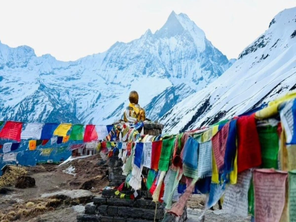

If you've ever typed "how tall is Mount Everest" into Google at two in the morning out of pure curiosity, you're not alone. Millions of people search this every year, from students doing geography homework, to trekkers planning their Everest Base Camp trip, to mountaineers researching their next expedition. And honestly, the answer isn't as simple as one number. It never has been.
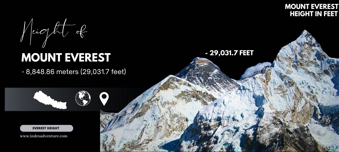
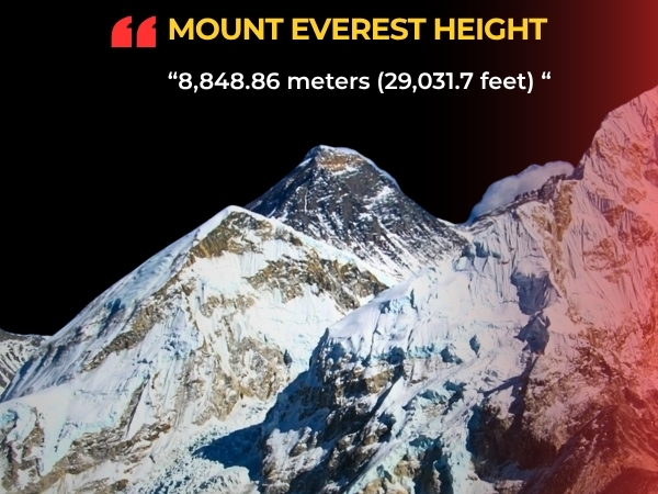
The official Mount Everest height as of 2026 is 8,848.86 meters above sea level. That translates to 29,031.7 feet, or approximately 8.85 kilometers. Nepal and China jointly announced this figure on December 8, 2020, after completing the most technologically sophisticated survey of the mountain ever conducted. But behind that single number sits 170 years of science, politics, and extraordinary human effort that most people never hear about.
So let's get into it properly.
Mount Everest Height: Official Numbers at a Glance
| Measurement | Figure |
|---|---|
| Mount Everest height in meters | 8,848.86 m |
| Mount Everest height in feet | 29,031.7 ft |
| Mount Everest height in km | 8.84886 km |
| Mount Everest height above sea level | 8,848.86 m |
| Mount Everest rock height without snow | 8,844.43 m or 29,017 ft |
Two official heights actually exist. The snow height of 8,848.86 meters measures all the way to the top of the ice and snow cap sitting on the summit. The rock height of 8,844.43 meters measures only the solid bedrock underneath all that snow. Nepal pushed for the snow height to be the recognized standard because that's physically where a person stands at the top. Honestly, that argument makes complete sense. The snow is part of the mountain you're actually climbing.
How Tall Is Mount Everest Compared to Familiar Things?
To put the Mount Everest height in perspective, the summit stands roughly 236 Burj Khalifas stacked on top of each other. It's about 8.5 times the height of Ben Nevis, the tallest peak in the United Kingdom. And from South Base Camp in Nepal at 5,364 meters, climbers still need to gain another 3,485 meters to reach the top. That's essentially climbing a separate mountain while already standing on a very tall one.
Oxygen levels at the summit sit at roughly one-third of what exists at sea level. Temperatures can drop below -60°C with wind chill. The summit push from Camp IV to the top and back covers somewhere between 16 and 20 hours for most climbers. It is, by any empirical measure, one of the most physiologically demanding feats a human body can attempt.
Mount Everest Height History: How the Number Changed Six Times
The Mount Everest height in feet and meters hasn't always been 29,031.7 feet. From the historical records, it has been officially measured at least six times, and each measurement tells a substantive story about the era and technology that produced it.
| Year | Height in Meters | Height in Feet | Measured By |
|---|---|---|---|
| 1856 | 8,840 m | 29,002 ft | British Great Trigonometrical Survey |
| 1954 | 8,848 m | 29,028 ft | Survey of India |
| 1975 | 8,848.13 m | 29,029 ft | Chinese State Bureau |
| 1999 | 8,850 m | 29,035 ft | US National Geographic Society |
| 2005 | 8,844.43 m rock | 29,017 ft | Chinese State Bureau |
| 2020 | 8,848.86 m | 29,031.7 ft | Nepal and China jointly |
1856: The First Measurement at 29,002 Feet
This is where the story really starts. And it's a genuinely remarkable one.
In 1802, the British colonial government launched the Great Trigonometrical Survey of India. The objective was cartographic precision across the entire Indian subcontinent. William Lambton initiated the project. George Everest, yes, that George Everest, took it over after Lambton's death in 1823 and drove the survey all the way to the Himalayan foothills.
The instruments they used were giant theodolites, highly specialized angle-measuring devices, each weighing 500 kilograms. It required 12 men just to carry one. Nepal was completely closed to foreigners at the time, so every observation of what surveyors called "Peak XV" happened from 150 to 240 kilometers away in the Indian Terai. That's roughly the distance between London and Birmingham, except instead of modern instrumentation, these surveyors were doing trigonometry by hand in the 1840s.
Between November 1849 and January 1850, the survey team measured Peak XV from six different stations. Each station produced a different calculated height, ranging from 28,990 feet to 29,026 feet. The arithmetic mean across all six came out to 29,002 feet.
There's a story, unverified but persistently repeated, that the original calculation landed on exactly 29,000 feet. Too round. Too suspicious. So Andrew Scott Waugh, the Surveyor General who officially announced the result, added two feet to make it appear more credible. Whether that's historical fact or just a compelling legend, the officially published figure of 29,002 feet went out in March 1856.
We'd argue the most extraordinary thing here isn't the number itself. It's the accuracy. A team of 19th-century surveyors, working from nearly 150 miles away, using hand calculations, landed within about 30 feet of what modern GPS satellites would confirm 170 years later. That's a genuinely astonishing feat of geodetic surveying.
Key figures in this measurement: Andrew Scott Waugh who announced the height and named the peak after his predecessor, Radhanath Sikdar the Indian mathematician credited with first identifying Peak XV as the world's highest point through his calculations, Henry Nicolson who led the critical field observations in 1849 and 1850, and John Armstrong who independently spotted the peak from another station.
1954: India Gets Closer at 29,028 Feet
Nepal opened its borders to outsiders in 1950. That changed everything for Everest measurement. Suddenly surveyors could position themselves much closer to the mountain rather than observing it from the distant Indian plains.
From 1952 to 1954, the Survey of India conducted a new triangulation survey under Bihari Lal Gulatee. Better instruments, improved corrections for atmospheric refraction, and observation stations far closer to the mountain than anything the British could access in the 1800s. The result was 8,847.73 meters, officially rounded to 8,848 meters, or 29,028 feet.
That number became the global standard almost immediately. It appeared in textbooks across Australia, the United States, the United Kingdom, Germany, and Japan. Basically every country teaching geography used 8,848 meters for over 60 years. Nepal formally recognized it. China independently confirmed something close to it in 1975.
1975: China Checks the Work at 29,029 Feet
China ran its own independent survey from the Tibetan north side of the mountain in 1975. Their figure came out at 8,848.13 meters, or 29,029 feet, including the snow cap. That is remarkably close to what India found in 1954. Independent confirmation from a second major geopolitical power gave the 8,848-meter figure serious international credibility that it might not otherwise have had so quickly.
1987 and 1992: Italy Tries, Gets Mixed Results
An Italian team used early satellite surveying technology in 1987 and returned a measurement of 8,872 meters. That figure was significantly higher than anything before it, and the scientific community questioned the methodology fairly quickly. Italy returned in 1992 and produced 8,846 meters after adjusting for ice depth. Neither figure received official adoption. To be fair, early satellite surveying in the late 1980s was genuinely difficult to calibrate accurately, and the technical limitations of that era were well-documented.
1999: GPS Arrives at the Summit at 29,035 Feet
In May 1999, a team sponsored by the National Geographic Society and led by Bradford Washburn physically carried GPS equipment to the Everest summit for the first time in history. They anchored a GPS unit directly into the highest exposed bedrock they could locate.
The result: 8,850 meters, or 29,035 feet, including snow.
American scientists and the National Geographic Society adopted this figure. Many English-language textbooks updated their Mount Everest height in feet to 29,035. But Nepal refused to accept it officially. Their institutional position was that they'd maintain 8,848 meters until they could conduct their own independent survey. Some geodesists also raised legitimate questions about the geoid reference model the 1999 team used. So the figure carried credibility in certain scientific circles but not universal international recognition.
2005: China Introduces the Rock Height Debate at 29,017 Feet
China's State Bureau of Surveying and Mapping returned to the summit in 2005 with GPS equipment and ice-penetrating radar. This time they specifically measured the rock height, just the bedrock, with nothing above it factored in. Their figure: 8,844.43 meters, or 29,017 feet. They also measured the snow depth sitting above the rock: 3.5 meters, or about 11.5 feet.
So China's rock height implied a total snow height of roughly 8,848 meters, basically matching Nepal's accepted figure. But publishing only the rock height created an immediate problem. Nepal was officially using 8,848 meters including snow. China was publishing 8,844.43 meters. Headlines around the world made it sound like the two countries disagreed profoundly on how tall Everest was. They actually agreed on the underlying measurement. They just disagreed on which number to officially announce.
That disagreement persisted for 15 years.
April 2015: The Nepal Earthquake Changes the Calculation
On April 25, 2015, a 7.8-magnitude earthquake struck Nepal. Nearly 9,000 people died. Avalanches swept across the Himalayas. One catastrophic avalanche tore through Everest Base Camp and killed 18 climbers and trekkers.
Then scientists started asking a consequential question: did the earthquake change Everest's height?
Satellite data showed the summit shifted roughly 3 centimeters to the southwest. Some analysis suggested the mountain may have dropped approximately 2.5 centimeters in elevation. Other analyses found no statistically significant change. Lower peaks around Nepal showed drops of several centimeters on seismic monitoring data.
The uncertainty was genuine. And it gave Nepal a concrete, scientifically defensible reason to do something it had never done before: measure its own highest mountain independently for the first time.
2020: The Definitive Mount Everest Height Measurement
This is the measurement that settled everything. And the story behind how it happened is as compelling as the number itself.
Nepal's Survey Process 2017 to 2019
Nepal's Department of Survey had been preparing since 2011. The actual fieldwork ran from 2017 to 2019. The approach combined multiple methodological techniques that would have been completely incomprehensible to the 1856 surveyors.
Traditional leveling established precise elevation benchmarks all the way from the Bay of Bengal, roughly 700 kilometers from Everest, to the base of the mountain. A network of GNSS and GPS stations extended nearly 250 kilometers toward where Everest first becomes visible from ground level. Gravimetric instruments refined the geoid model, the mathematical approximation of mean sea level that all altitude measurements ultimately reference. Ground-penetrating radar measured exactly how deep the snow and ice sat above the rock summit.
The summit team ascended on May 22, 2019. Chief surveyor Khim Lal Gautam, his colleague Rabin Karki, and Sherpa guide Tshiring Jangbu Sherpa reached the top at night, deliberately. Nighttime conditions produce less atmospheric disturbance, which means cleaner, more reliable GPS readings. They spent approximately 30 minutes at the summit placing advanced GPS equipment on the highest point of the planet. That kind of commitment to methodological precision is worth noting.
China's Survey in 2020
China measured from the Tibetan north side following a state visit by President Xi Jinping to Nepal in 2019. Both countries agreed during that visit to conduct coordinated surveys and jointly announce a single agreed height. China's 53-person survey team completed their measurements in May 2020, during the Covid-19 pandemic, using the BeiDou satellite navigation system alongside advanced radar instrumentation.
The Joint Announcement: December 8, 2020
After months of data processing and bilateral negotiations, both countries held simultaneous press conferences in Kathmandu and Beijing.
The result: 8,848.86 meters. 29,031.7 feet.
Nepal's President Bidya Devi Bhandari described completing the survey with Nepal's own technical capacity as a historic achievement. The margin of error, according to Sushil Dangol, national coordinator of Nepal's Mount Everest Height Measurement Secretariat, sits within centimeters. Both the snow height of 8,848.86 meters and the rock height of 8,844.43 meters now carry international recognition from both Nepal and China.
Why Did the Mount Everest Height Go Up by 0.86 Meters?
The new figure is 0.86 meters, about 33.8 inches, higher than the previously accepted 8,848 meters. Two explanations get offered most frequently.
Better technology is one. GPS satellites combined with accurate geoid models and precise gravimetric measurements give far more reliable data than 1950s triangulation methods could produce. The increase might simply reflect that we're measuring more accurately now, not that the mountain physically grew.
Tectonic uplift is the other. The Indian tectonic plate continues its inexorable northward movement under the Eurasian plate at roughly 4 millimeters per year. The Himalayas are still rising because of that ongoing lithospheric collision. Over the 65 years between 1954 and 2019, this tectonic movement alone could account for up to 26 centimeters of verifiable geological uplift. So some portion of the 86-centimeter increase likely reflects real physical change, not just measurement improvement.
Both factors probably contributed. Science rarely delivers one clean, unambiguous answer.
Why Does Mount Everest's Height Keep Changing?
Three distinct geophysical forces work on Everest's elevation continuously.
Tectonic uplift keeps pushing the Himalayas higher. The Indian and Eurasian plates collided roughly 50 to 60 million years ago and they haven't stopped. Scientists estimate Everest rises somewhere between 1.27 centimeters and 7.6 centimeters per year because of this continuous orogenic process. The long-term trajectory is upward.
Seismic events cause sudden and sometimes dramatic shifts. The 2015 Nepal earthquake moved the summit approximately 3 centimeters to the southwest. A major 1934 earthquake is believed to have dropped Everest's height by roughly 60 centimeters. Large seismic events can undo decades of gradual tectonic uplift in a matter of seconds.
Snow and ice depth fluctuates seasonally. The summit accumulates snow during monsoon season every summer. Wind erosion and sublimation strip it back during the remainder of the year. The snow height can shift by several centimeters just across the seasons. The bedrock underneath stays relatively stable. Only tectonics and earthquakes meaningfully move that.
Snow Height vs Rock Height: Why Nepal and China Disagreed for 15 Years
This debate comes down to a fundamental epistemological question about what you think you're actually measuring.
- Nepal's position: the snow height, measured all the way to the top of the ice and snow cap, is the correct figure. That's where climbers stand. That's the physical summit as it actually exists. Measuring only the rock ignores the mountain in its real, inhabited form.
- China's position in 2005: measuring the solid bedrock gives a more scientifically stable and replicable figure since snow depth changes constantly with seasons, weather patterns, and interannual variability.
The 2020 joint survey resolved it by doing both comprehensively. The agreed official Mount Everest height is 8,848.86 meters as the snow height. The rock height is 8,844.43 meters. Both now carry international recognition. The 15-year dispute is resolved.
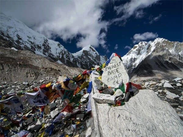
Mount Everest Base Camp to Summit: Elevation Gain
Most trekkers and climbers focus on the total Mount Everest height from sea level. But the elevation gain from base camp to the summit is the number that actually matters physiologically.
| Point | Elevation |
|---|---|
| South Base Camp Nepal | 5,364 m or 17,598 ft |
| North Base Camp Tibet | 5,150 m or 16,900 ft |
| Summit | 8,848.86 m or 29,031.7 ft |
| Vertical gain from South Base Camp | 3,485 m or 11,434 ft |
Climbers ascend nearly 3,500 meters of vertical distance after already spending weeks at altitude acclimatizing. They do it through extreme cold, wind speeds that can exceed 200 kilometers per hour, and oxygen levels at roughly one-third of what exists at sea level. The summit push from Camp IV to the top and back covers around 16 to 20 hours for most climbers. It is one of the most demanding physical feats available to human beings.
Mount Everest Height by Country: How Different Nations Recognize It
| Country | Official Figure Used |
|---|---|
| Nepal | 8,848.86 m or 29,031.7 ft since December 2020 |
| China | 8,848.86 m snow height and 8,844.43 m rock height since December 2020 |
| India | Updated to 8,848.86 m following 2020 joint announcement |
| United States | Historically 29,035 ft from 1999 GPS survey; increasingly updated to 29,031.7 ft post-2020 |
| United Kingdom | Historically 29,028 ft from 1954 survey; updated sources now recognize 29,031.7 ft |
| Australia and most other nations | Updated to reflect 2020 measurement following joint announcement |
Frequently Asked Questions About Mount Everest Height
What is Mount Everest height in feet?
The official Mount Everest height in feet is 29,031.7 feet, declared by the Nepal-China joint survey in December 2020. Older sources may still show 29,028 feet based on India's 1954 survey or 29,035 feet based on the 1999 National Geographic GPS measurement. The current internationally recognized figure is 29,031.7 feet.
What is Mount Everest height in meters?
Mount Everest's official height is 8,848.86 meters above sea level. This is the snow height, measured to the top of the ice and snow cap on the summit. The rock height underneath is 8,844.43 meters.
What is Mount Everest height in km?
Everest's height is 8.84886 kilometers above sea level. Rounded, that's 8.85 kilometers. The vertical gain from South Base Camp to the summit is approximately 3.5 kilometers.
What is the height of Mount Everest above sea level?
8,848.86 meters or 29,031.7 feet above sea level. The reference point for sea level used in Nepal's 2019 survey is the Bay of Bengal, approximately 700 kilometers from Everest. Precise leveling benchmarks were established from the Bay of Bengal all the way to the mountain's base before any summit measurements were taken.
Did the 2015 earthquake change Everest's height?
Possibly by a small amount. Satellite data showed the summit shifted roughly 3 centimeters to the southwest. Some analysis suggested a drop of up to 2.5 centimeters in elevation. The uncertainty from those initial post-earthquake analyses was actually one of the primary motivating factors for Nepal to conduct its own full independent survey, which ultimately produced the 2020 measurement.
Why did Nepal and China disagree on Everest's height for 15 years?
Nepal recognized 8,848 meters as the official snow height. China in 2005 published 8,844.43 meters as the rock height. The disagreement wasn't really about measurement accuracy. It was about what constitutes the correct measurement. The 2020 joint survey resolved it by measuring both heights rigorously and agreeing on a single official snow height of 8,848.86 meters.
Who first measured Mount Everest?
British Surveyor General Andrew Scott Waugh officially announced the first measurement in March 1856, based on calculations from the Great Trigonometrical Survey of India. Radhanath Sikdar, an Indian mathematician, is credited by multiple sources as the first person to computationally identify Peak XV as the world's highest mountain. The survey itself collected observational data from six stations in northern India between 1849 and 1850.
What is the first known height of Mount Everest?
29,002 feet, or 8,840 meters, announced in 1856. That figure came from trigonometric calculations made from observation stations 150 to 240 kilometers away from the summit across the border in India, because Nepal was entirely closed to foreign nationals at the time of the survey.
What is Sagarmatha height?
Sagarmatha is the Nepali name for Mount Everest. Its official height is 8,848.86 meters or 29,031.7 feet, the same internationally recognized measurement announced jointly in December 2020.
What is Qomolangma height?
Qomolangma is the Tibetan and Chinese name for Mount Everest. The height is 8,848.86 meters or 29,031.7 feet, the same measurement agreed between China and Nepal in December 2020 following their coordinated bilateral survey.
Is Everest still growing?
Yes. The Indian tectonic plate continues pushing northward at roughly 4 millimeters per year. Scientists estimate Everest rises between 1.27 centimeters and 7.6 centimeters per year because of ongoing tectonic uplift. Earthquakes can periodically push it down, but the long-term geological trajectory is upward.
The Bigger Picture
The story of Mount Everest height goes far beyond a single number. It runs through 170 years of science, geopolitics, national pride, and extraordinary human effort. From surveyors dragging 500-kilogram theodolites across the Indian plains in the 1800s, to Nepalese surveyors climbing through the night in 2019 to place GPS equipment on the roof of the world, each measurement reflects both the technology of its era and the enduring human compulsion to know precisely how high the highest thing on earth actually is.
The number will change again. Geology doesn't pause. Ice shifts. New measurement technologies will arrive. But as of 2026, the answer is definitively clear. Mount Everest stands at 8,848.86 meters, 29,031.7 feet, above sea level.
Whether you call it Everest, Sagarmatha, or Qomolangma, that elevation commands the same sense of awe from every corner of the planet beneath it.
Sources: Survey of India, Nepal Department of Survey, Chinese State Bureau of Surveying and Mapping, National Geographic Society, Xinhua News Agency, Kathmandu Post.