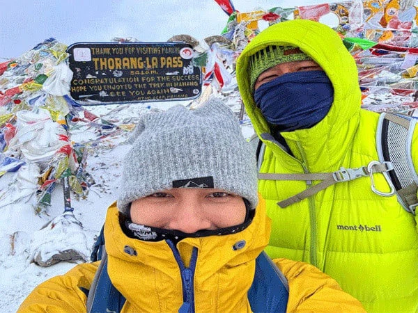
Most people who sign up for the Annapurna Circuit know it's going to be hard. But crossing Thorong La Pass; standing at 5,416 metres (17,769 ft) above sea level; has a way of making every other hard thing you've done feel like a warm-up. This is the highest point of the entire Annapurna Circuit Trek, the moment the whole trek builds toward, and arguably the most demanding single day in Himalayan trekking for non-technical climbers.
So if you're wondering what awaits you at the top; and what it takes to get there safely; this guide covers everything: the altitude, the difficulty, the best season to cross, the itinerary, permits, risks, and a few things experienced guides always tell trekkers before the big day.
Quick Answer: What Is the Highest Point of the Annapurna Circuit?
|
Detail |
Info |
|
Name |
Thorong La Pass (also spelled Thorung La) |
|
Altitude |
5,416 m / 17,769 ft |
|
Location |
Between Manang and Mustang Districts, central Nepal |
|
Mountain Range |
Damodar Himal, north of Annapurna Himal |
|
Direction |
East to west (Manang to Muktinath) |
|
Trekking Type |
Non-technical; no ropes or crampons in normal conditions |
Thorong La is a mountain pass sitting at 5,416 metres above sea level in the Damodar Himal, north of the Annapurna range, in central Nepal; and it's the highest point on the Annapurna Circuit Trek, a roughly 300 km route around the Annapurna massif.
About Thorong La Pass
Location and Geography
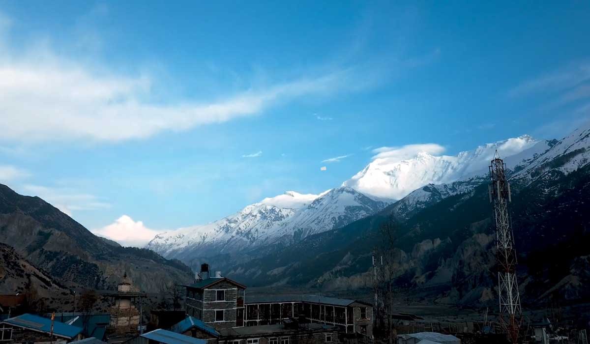
The pass sits on a trail connecting the village of Manang in Manang District to the east, with the temple of Muktinath and the nearby village of Ranipauwa in Mustang District to the west. Thorong Ri is on the slope of Khatung Kang, and Yakawa Kang are the mountains that form Thorong La.
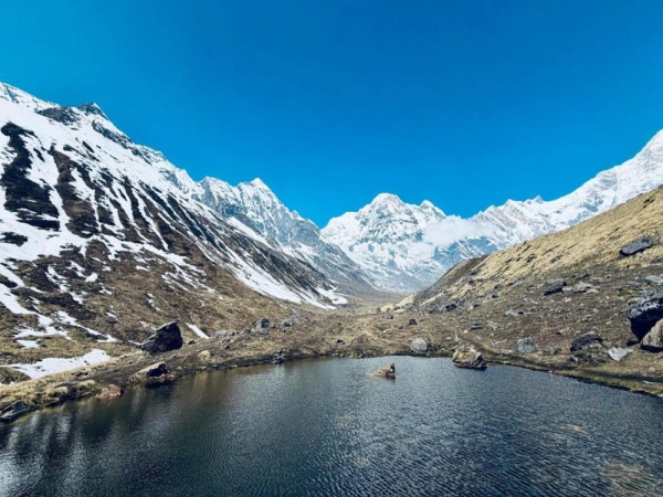
Standing at the pass is, in a way, like standing between two completely different countries. The eastern side; Manang; is lush, relatively green, and dotted with Buddhist villages. The western side descends into the arid Mustang region, influenced by Tibet and lined with ancient monasteries and stark desert vistas. The contrast is dramatic and it's one of the things that makes this crossing genuinely memorable, not just physically but visually.
Altitude and Significance
5,416 metres is extraordinarily high. It's higher than Everest Base Camp (5,364m), higher than Mont Blanc in the Alps (4,808m), and higher than any peak in North America, Europe, or Antarctica. At this altitude, the air contains roughly 50% of the oxygen available at sea level.
To put it even more plainly; walking slowly at Thorong La feels like sprinting at home. Simple decisions take more effort. And that's completely normal.
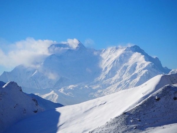
What you see from the top:
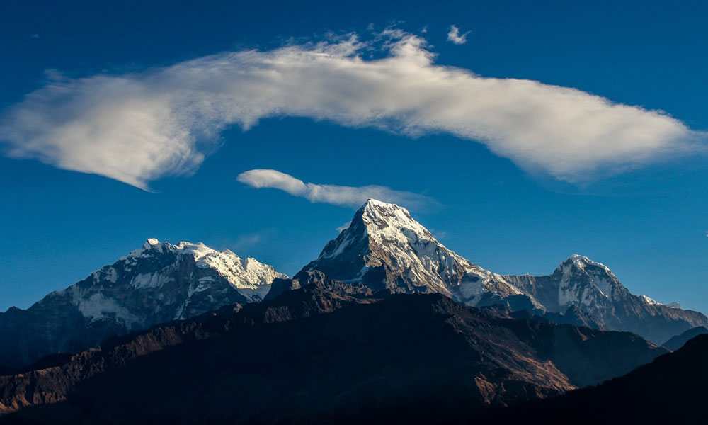
- Panoramic views of the Annapurna Massif (Annapurna I through IV)
- Dhaulagiri; the world's 7th highest peak
- Gangapurna and Tilicho Peak
- The deep Kali Gandaki Gorge descending below you on the western side
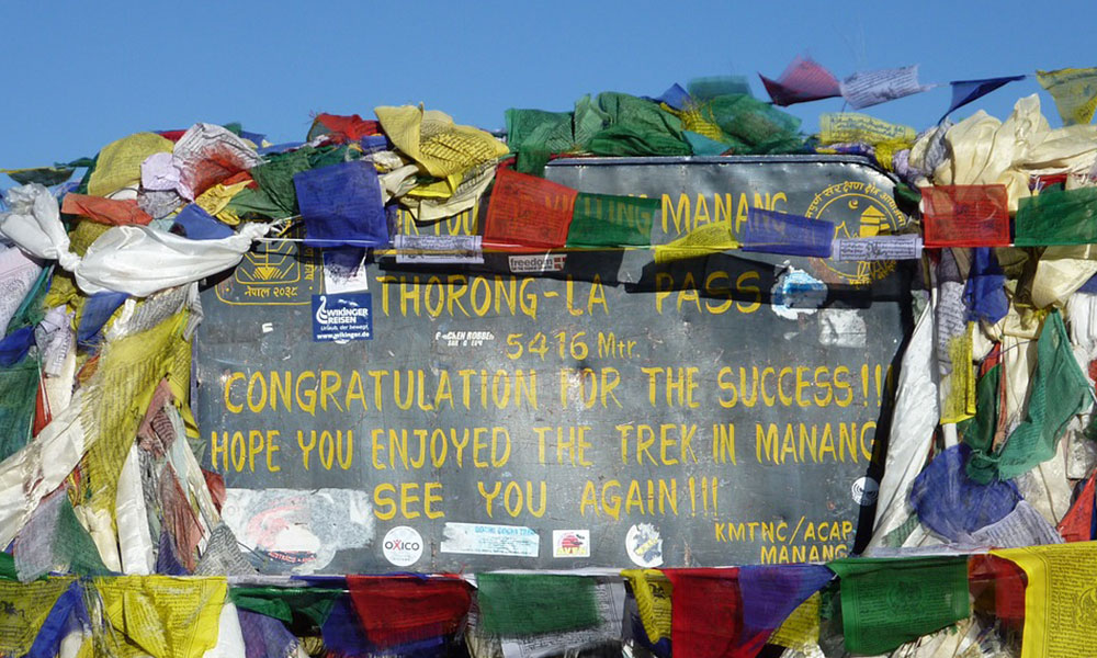
- Prayer flags, stone cairns, and the occasional fellow trekker who looks as exhausted as you feel
How Difficult Is Thorong La Pass?
The physical difficulty is moderate to challenging. The crossing itself is a long, difficult day; typically 7 to 9 hours of continuous walking at high altitude. The ascent from High Camp is steep in places, the trail is rocky and uneven, and the final push to the summit will test your lungs and legs even if you're fit. The descent to Muktinath Mustang is long and hard on the knees.
And that's honestly on a good day. Add wind, cold, and altitude-induced fatigue, and it becomes a different experience entirely.
Key difficulty factors:
- High altitude: Roughly 50% oxygen at the summit compared to sea level
- Long crossing day: 7 to 10 hours from High Camp to Muktinath
- Extreme cold: Early morning temperatures often range between minus 10 and minus 20 degrees Celsius
- Strong afternoon winds: Gusts can reach 60 to 80 km per hour; the weather starts deteriorating from midday onward
- No technical climbing required: No ropes, crampons, or mountaineering skills needed under normal conditions
Difficulty Comparison:
|
Factor |
Thorong La Pass |
|
Technical Skill Required |
None; stamina and acclimatization matter most |
|
Total Elevation Gain (crossing day) |
approx. 900-1,100 m from High Camp |
|
Total Elevation Loss (to Muktinath) |
approx. 1,600 m descent |
|
Typical Duration |
7-10 hours |
|
Fitness Level Required |
Moderate to good; prior hiking experience helps significantly |
Acclimatization and Altitude Safety
This is, honestly, the most important section in this entire guide. Most issues on Thorong La; and the Annapurna Circuit in general; come down to people underestimating acclimatization or rushing it.
The Himalayan Rescue Association post in Manang recommends that trekkers spend five nights between their arrival in Manang and the crossing to Muktinath. The additional time in Manang allows sufficient acclimatization to minimize the risk of acute mountain sickness (AMS).
The standard advice is to do a day hike to Tilicho Lake or the Ice Lake near Manang on your rest day; this lets your body adapt to higher altitude without sleeping at it, following the classic "climb high, sleep low" principle.
AMS symptoms to watch for:
- Persistent headache that doesn't improve with paracetamol
- Nausea or vomiting
- Dizziness or loss of coordination
- Shortness of breath at rest
- Fatigue disproportionate to exertion
Acclimatization schedule (recommended):
|
Location |
Altitude |
Recommended Nights |
|
Chame |
2,650 m |
1 night |
|
Pisang / Upper Pisang |
3,300 m |
1 night |
|
Manang |
3,540 m |
2 nights (including rest day) |
|
Yak Kharka |
4,020 m |
1 night |
|
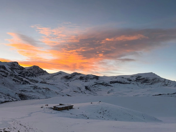
Thorong Phedi or High Camp |
4,540-4,880 m |
1 night |
|
Thorong La Summit |
5,416 m |
Crossing only; no overnight |
The golden rule here is simple: if you're feeling unwell, don't push up. The pass will still be there tomorrow.
Best Time to Cross Thorong La Pass
The safest months to cross the pass are March-May and September-November. Attempting to cross at other times is dangerous due to increased risk of avalanches, frostbite, and the likelihood of a storm or whiteout that can disorient trekkers.
That said; "safe season" doesn't mean risk-free. The 2014 snowstorm disaster (more on that below) happened in October, which is peak trekking season. Mountain weather is fundamentally unpredictable, and checking conditions daily while you're on the trail is non-negotiable.
Season overview:
|
Season |
Months |
Conditions |
Verdict |
|
Spring |
March-May |
Clear skies, rhododendrons blooming, moderate temperatures |
Excellent |
|
Summer/Monsoon |
June-August |
Heavy rain, landslide risk, pass often unclear |
Avoid unless experienced |
|
Autumn |
September-November |
Most popular, stable weather, superb mountain visibility |
Best overall |
|
Winter |
December-February |
1 to 3 inches of snowfall common, temperatures between -3 and -7°C, some closures |
Experienced trekkers only |
Why early morning matters:
Afternoon winds on Thorong La can be extremely strong, with gusts reaching 60 to 80 km per hour. Trekkers who have the safest and most enjoyable experience are always the ones who reach the summit before 9 AM. Most experienced guides recommend leaving High Camp no later than 4:30 to 5:00 AM.
Typical Itinerary to Reach the Highest Point
The Annapurna Circuit is usually done counterclockwise; Manang to Muktinath; and for good reason. The counterclockwise direction spreads altitude gain over more days and ends at higher elevations by gradual descent, which is far safer for the body.
Sample itinerary for the Thorong La crossing section:
|
Day |
Route |
Altitude |
Duration |
|
Day 1 |
Besisahar to Chame (drive or trek) |
760 m to 2,650 m |
Drive + short walk |
|
Day 2 |
Chame to Upper Pisang |
2,650 m to 3,300 m |
5-6 hours |
|
Day 3 |
Upper Pisang to Manang |
3,300 m to 3,540 m |
5-6 hours |
|
Day 4 |
Manang (rest + acclimatization hike) |
3,540 m |
Rest day |
|
Day 5 |
Manang to Yak Kharka |
3,540 m to 4,020 m |
3-4 hours |
|
Day 6 |
Yak Kharka to Thorong Phedi / High Camp |
4,020 m to 4,540-4,880 m |
3-4 hours |
|
Day 7 |
High Camp to Thorong La to Muktinath |
4,880 m to 5,416 m to 3,762 m |
7-10 hours |
Note: Modern itineraries often begin with a jeep to Chame or Dharapani, reducing the total duration to 10-14 days. The classic route from Besisahar takes 14-21 days.
Trek Permits and Regulations (2026)
Required permit:
For the Annapurna Circuit Trek, the only mandatory permit is the ACAP (Annapurna Conservation Area Permit). The TIMS card is no longer enforced, and restricted permits are required only for special side trips like Upper Mustang Trek or Nar Phu Valley Trek.
TIMS cards are no longer required for trekking in the Annapurna region. Checkpoints verify ACAP permits only.
- Permit costs (2026):
|
Permit |
Foreign Nationals |
SAARC Nationals |
Children under 10 |
|
ACAP |
NPR 3,000 (approx. $22 USD) |
NPR 1,000 |
Free |
|
TIMS |
Not enforced in Annapurna |
— |
— |
- Where to get it: Nepal Tourism Board officesin Kathmandu (Pradarshani Marg) or Pokhara. Carry a printed hard copy; digital copies are often not accepted at remote checkpoints.
- Guide requirement: As of April 1, 2023, solo trekking without a licensed guide is prohibited in most high-altitude regions including Annapurna. Hiring a registered guide is mandatory, not optional.
- Permit checkpoints on the Circuit: Besisahar (or Bhulbhule), Chame, Manang, and the Lower Mustang (Jomsom) area.
Risks and Safety Considerations
It's important to be honest about this; Thorong La Pass has a sobering record when conditions go wrong.
The 2014 disaster: On October 14, 2014, a snowstorm and series of avalanches struck the Annapurna and Dhaulagiri area. According to experts, the storm arose from Cyclone Hudhud; the worst in a decade; with almost 1.8 metres of snow falling within 12 hours. The storms resulted in the deaths of at least 43 people, including 21 trekkers from several countries.
Since then, safety has improved: lodges now have satellite weather systems, emergency shelters exist along the trail, and licensed guides know when to call off a crossing.
Ongoing risks:
- During fiscal year 2023-2024, the Annapurna Conservation Area recorded 21 deaths attributed to altitude sickness; most occurring in the Muktinath area of Mustang.
- Whiteouts and sudden storms remain a real possibility even in peak season
- HAPE (High Altitude Pulmonary Edema) and HACE (High Altitude Cerebral Edema) can develop rapidly if acclimatization is rushed
When NOT to cross:
- If you have any unresolved AMS symptoms; headache, nausea, confusion
- If a snowstorm is forecast in the next 24 hours
- After midday; afternoon winds make the exposed ridge genuinely dangerous
- If visibility is poor and you're without a guide
The pass is manageable; thousands of trekkers cross it safely every season. But it doesn't forgive carelessness.
What Makes Thorong La Pass Special?
Beyond the altitude and the physical challenge, there's something about Thorong La that goes beyond trekking stats. It's one of the few places in the world where a non-technical trekker; no climbing background, no ropes, no special gear; can stand higher than any peak in Europe or North America.
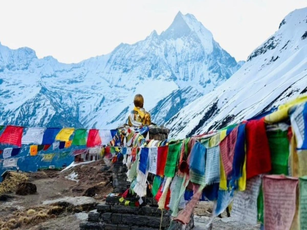
- The cultural shift is unlike anything else. You leave Buddhist Manang, cross the pass, and descend into a world that feels distinctly Tibetan; dry, windswept, ancient. Muktinath Temple at the bottom is sacred to both Hindus and Buddhists, and arriving there after crossing 5,416 m feels genuinely meaningful.
- The prayer flags at the summit have been placed by generations of traders, pilgrims, and trekkers. Standing among them on a clear morning, with the Annapurna Massif behind you and Mustang stretching out ahead, is one of those rare moments that's hard to describe accurately.
- It's a historic trade route, not just a trekking highlight. For centuries, local traders crossed Thorong La with yak caravans carrying salt, wool, and grain between Manang and Mustang. Walking this trail means following footsteps that date back generations.
Thorong La Compared to Other High Passes
There is a common question worth clearing up honestly:
Is Thorong La the highest trekking pass in the world?
There's a popular trekking myth that Thorong La is "the highest trekkable pass in the world"; but that's not accurate. Several passes in the Ladakh region of India sit higher.
|
Pass |
Altitude |
Location |
Trekking Access |
|
Thorong La |
5,416 m (17,769 ft) |
Nepal; Annapurna Circuit |
Yes; popular trekking route |
|
Khardung La |
5,359 m (17,582 ft) |
India; Ladakh |
Yes; accessible by road and foot |
|
Semo La |
approx. 5,565 m |
India; Ladakh |
Yes; remote trekking |
|
Marsiemik La |
approx. 5,582 m |
India; Ladakh |
Restricted, limited access |
Thorong La is, however, the highest point on the Annapurna Circuit and one of the highest well-established trekking passes in the Himalayas accessible without technical climbing skills. For the vast majority of trekkers, the distinction hardly matters; 5,416 m is extraordinary by any measure.
Expert Tips from Seasoned Guides
These come from guides who've crossed Thorong La dozens of times and know what separates a good crossing from a dangerous one.
- "Leave by 4:30 AM on crossing day; without exception." The afternoon winds are not a suggestion. Get to the summit before 9 AM and your experience will be completely different from someone who starts at 7.
- "Garlic soup from Manang onward." It's not just tradition. Most guides recommend it consistently for its vasodilating properties. Trekkers who eat it regularly through Manang and High Camp tend to report fewer headaches at altitude.
- "Eat something before you leave High Camp; even if you have no appetite." Half a bowl of porridge is better than nothing. Your muscles will notice the difference four hours into the ascent.
- "Spend two nights in Manang, not one." This single decision makes more difference to your pass-day performance than almost anything else on the trek. Use the extra day to hike up to Ice Lake (4,600 m) and come back down; your body adapts significantly overnight.
- "Carry a filter water bottle." Brands like Lifestraw or Sawyer work well on this route. Stop spending NPR 300-400 per bottle on plastic water above Manang; it adds up fast on a 15-day trek.
- "Descend if you're unsure." If symptoms worsen above 4,000 m and paracetamol isn't helping after a few hours, descend. No viewpoint or summit is worth HACE or HAPE.
- "Take your time on the descent to Muktinath." Most trekkers are so focused on the ascent that they underestimate the 1,600 m knee-grinding descent on the western side. Trekking poles are your best friend on the way down.
What Are the Best Months to Undertake This High-Altitude Trek?
The best time for the Annapurna Circuit Trek is autumn (September to November) and spring (March to May): when weather is stable, skies are clear, and Thorong La Pass is safe to cross. Every other season comes with trade-offs that beginners should think carefully about.
Autumn (September to November): Top Pick
Autumn is the most recommended season. After the summer monsoon, the landscape is washed clean, dust and haze disappear, and mountain views are the clearest and sharpest of the year.
- October is the single best month. Expect stable weather, crystal visibility, and firm trails: ideal conditions for crossing Thorong La Pass.
- November is quieter than October. Average daytime temperatures sit around 15°C, with nights dropping to 7°C to 8°C in mid-altitude areas. Near Thorong La, temperatures can fall to -5°C. Pack heavier layers and aim to finish the pass crossing before late November.
Spring (March to May): Strong Alternative
Spring offers mild temperatures, blooming rhododendron forests in the lower sections, and generally stable weather. Mountain views are often excellent, and the trail atmosphere is lively without being overwhelming.
- April is the standout month: warm days, rhododendrons in full bloom, and reliable pass conditions.
- March suits trekkers who want fewer crowds and don't mind colder nights.
|
Season |
Why Beginners Should Skip It |
|
Monsoon (June & Aug) |
Heavy rain increases the risk of landslides, floods, and avalanches. Trail conditions are poor and visibility is low. |
|
Winter (Dec & Feb) |
High altitudes can drop below -20°C, and snow may block Thorong La Pass entirely. Recommended only for experienced trekkers with proper winter gear. |
If your dates are flexible, book October or April. October delivers the full Annapurna Circuit experience as close to perfect as weather allows. April delivers the same with color, warmth, and a slightly different energy. Both are safe, rewarding windows for first-time Himalayan trekkers.
Conclusion
Thorong La Pass; at 5,416 m; is the defining moment of the Annapurna Circuit. It's where the trek earns its reputation, where months of planning either pay off or don't, and where most trekkers find themselves standing with prayer flags snapping in the wind wondering how they got so high.
The fundamentals are straightforward: acclimatize properly in Manang, start before sunrise on crossing day, eat garlic soup, hire a licensed guide, and listen to your body above 4,000 m. Cross at the right time of year; spring or autumn; and check conditions daily as you approach the pass.
Done right, it's one of the most rewarding single days in all of Himalayan trekking. And from the summit, staring out at the Annapurna Massif and the Mustang desert unfolding below, it's pretty hard to argue otherwise.
Planning your Annapurna Circuit trek? Contact Index Adventure to book with experienced local guides, a structured acclimatization itinerary, and full support from Kathmandu to the top of Thorong La.
FAQs about Thorang La Pass
What is the highest point on the Annapurna Circuit?
Thorong La Pass, at 5,416 m (17,769 ft), located between Manang and Mustang districts in central Nepal.
How difficult is Thorong La Pass?
Moderate to challenging. No technical skills are needed, but the altitude, cold, long duration (7-10 hours), and steep ascent make it demanding. Good physical fitness and proper acclimatization are essential.
Can beginners do the Annapurna Circuit?
Yes, with the right preparation. Beginners can successfully complete Thorong La Pass if they follow proper acclimatization procedures and choose the recommended counterclockwise route from Manang to Muktinath. Physical training three to four weeks before the trek; hiking, stair climbing, and cardio; greatly improves comfort and safety.
How fit should you be?
You should be able to hike 6 to 8 hours a day on consecutive days before you start. Regular cardio fitness, some hiking experience, and strong knees for the descent all make a meaningful difference.
Can you solo trek the Annapurna Circuit?
You can trek independently in terms of booking and planning, but as of April 2023, a licensed guide is mandatory for all trekkers in the Annapurna region. Trekking without one is not permitted.
In which district is Thorong La located?
The pass sits on the boundary between Manang District (east) and Mustang District (west).
Which Annapurna trek is best?
It depends entirely on what you're after. The Annapurna Circuit is longer, more varied, and reaches higher altitude; Thorong La at 5,416 m. The Annapurna Base Camp (ABC) trek is shorter and more accessible, topping out at 4,130 m. For a once-in-a-lifetime experience that covers the widest range of terrain and culture, the Circuit wins.