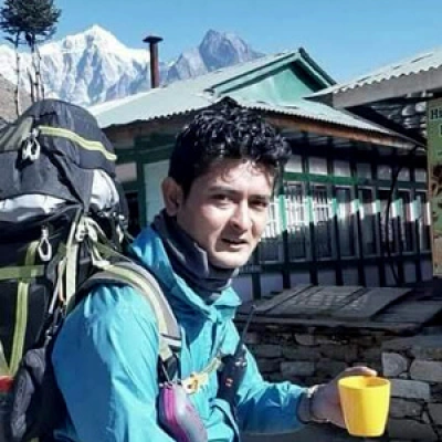
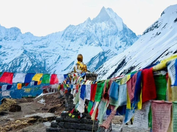
The Annapurna circuit trek is one of the most loved treks in the world. Trekking the natural landscapes of the pristine Annapurna region is every avid trekker's fantasy. The trails of the scenic trek passes through the stunning landscapes of the region and provides incredible views of the majestic Himalayas.
Annapurna Circuit trek is famous for the geographical diversity that ranges from lush green forests to barren, desert-like landscapes. The cultural exploration of the Tibetan Buddhist influenced settlements of the Gurung, Thakali, and Magar community is the prime attraction of the trek.
But how long is the Annapurna Circuit Trek? You might wonder. The length of the Annapurna Circuit trek depends upon the use of transportation and the starting point of the trek. Moreover, the Annapurna Circuit Trek has a total length between 160-230 Kilometres and takes around 14 to 18 days to complete.
For beginners, the Annapurna Circuit Trek is an excellent introduction to the natural landscapes of the Annapurna region. For avid trekkers, the trek is an exceptional trekking experience. Overall, the Annapurna circuit trek is an adventure of a lifetime for all. Read further to know how long is the Annapurna circuit and other important details regarding the trek.
Key Distance Factors of Annapurna Circuit:
- Highlights: Highlights include the Muktinath to Tatopani section and the high altitude crossing at Thorong La
- Total Distance: Ranges between 160–230 km (100–145 miles) for the full circuit, with actual trekking often closer to 100 miles due to road development.
- Daily Walking: Trekkers usually walk 6–22 km per day.
- Variations: Shorter 14-day itineraries exist (approx. 110–117 km) that use transportation to skip lower, paved road sections.
Annapurna Circuit Trek Route and Total Distance
The total length of the Annapurna Circuit Trek ranges between 160-230 Kilometres and the trek route takes around 14 to 18 days to finish. Annapurna Circuit trek starts with a drive from Kathmandu to Besisahar. From Besisahar, we continue our ascend to Manang, passing through the settlements of Syange, Chame, and Pisang.
The trails pass through the Marshyangdi valley and the meadows of Yak Kharka to finally arrive at the majestic Thorung La Pass. The Thorung La Pass is the highest point of the trek situated at an altitude of 5,416m. From Thorung-La pass, we arrive at the settlements of Mustang in the upper Kali Gandaki Valley.
We also pay our pilgrimage to the sacred temple of Muktinath. Muktinath temple is highly revered by both Buddhists and Hindus community. The temple features holy 108 showers and according to popular beliefs, bathing in them cleanses the sins committed in the mortal life.
We then pass through the settlements of Marpha and Tatopani to arrive at the viewpoint of Poonhill. From the Poonhill viewpoint, we observe the spectacular sunrise and then drive back to Pokhara. Besides that, we are also blessed with majestic views of the entire Annapurna Massif from various points of the trek.
Annapurna Circuit Trek Itinerary and Distances
Drive Distance from Kathmandu to Dharapani (1860m/6102ft), 228 km (141.6 miles)
The overland expedition begins at kilometer zero in the chaotic urban basin of Kathmandu (1,400m), clearing the valley rim to descend along the winding Prithvi Highway. The initial 70-kilometer stretch of tarmac traces the Trishuli River to the roadside market town of Malekhu, a mandatory pitstop where the air is thick with the scent of woodsmoke and fried river fish. Pushing another 40 kilometers deeper into the river canyon brings the journey to the 110-kilometer mark at Mugling, the bustling vehicular crossroads of central Nepal. From this chaotic junction, the route tracks northwest for a brief 25-kilometer span to arrive at Dumre at the 135-kilometer milestone. Dumre serves as the definitive point of divergence, where vehicles abandon the primary highway and pivot sharply north into the Marsyangdi River valley, embarking on a secondary 42-kilometer paved corridor that snakes through terraced fields to Besisahar.
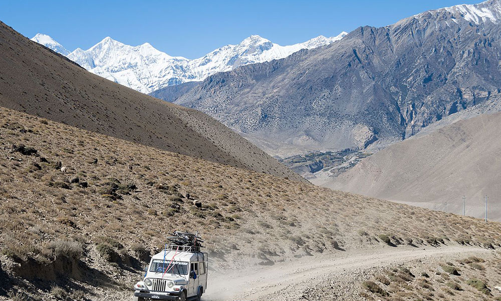
Arriving at Besisahar (760m) at the 177-kilometer mark, the character of the journey shifts fundamentally as the smooth blacktop abruptly terminates. This bustling district headquarters is the final bastion of civilization before the wild mountain terrain takes over, and it is where trekkers transition into high-clearance four-wheel-drive jeeps. The subsequent 15-kilometer interval transitions through the subtropical foothills, rolling past the emerald rice terraces of Bhulbhule and the steep cliffsides of Syange. Here, the track devolves into a narrow, single-lane dirt shelf blasted directly into vertical rock faces. The physical toll of the road intensifies along this stretch; the vehicle covers distance at a snail's pace, tossed over boulders and splashing through exposed mountain streams that cascade across the roadbed, offering a bone-rattling introduction to the sheer scale of the landscape.
The final, deeply dramatic 36-kilometer segment of the drive penetrates the deep gorges of the upper Marsyangdi, bypassing the cliff-hanging hamlets of Jagat and Chamje near the 210-kilometer boundary. The sheer drop-offs into the thundering river below are dizzying, but looking upward on a clear day rewards travelers with fleeting, monumental views of the snow-capped Ganesh Himal and Lamjung Himal looming far above the canyon walls.
At approximately 220 kilometers into the trans-district voyage, the claustrophobic gorge unexpectedly opens into the wide, flat, sandy basin of Tal (1,700m), marking the geographical threshold of the Manang District.From this tranquil riverbed oasis, a final, grueling 8-kilometer rocky ascent conquers the remaining elevation to deposit travelers at the ultimate destination of Dharapani (1,860m). Reaching this stone-built river convergence village at the cumulative 228-kilometer mark concludes an exhausting eight-to-nine-hour overland odyssey, leaving you at the true, rugged trailhead of the foot trek.
Trek from Dharapani to Chame (2630m/8625ft), 15-16 km (9.3–9.9 miles)
- Starting Point: Dharapani (1,860m / 6,102ft)
- Final Destination: Chame (2,630m / 8,625ft)
- Distance Covered: 15 km (9.3 miles)
- Duration: 5–6 hours of foot trekking
Setting off from kilometer zero at Dharapani (1,860m), the foot trek officially commences as you transition away from the dusty vehicular tracks onto the classic, stone-paved mule trails. Tracing the Marsyangdi River upstream, a gentle 2-kilometer warm-up through a tightening gorge leads to Bagarchhap (2,160m). Here, the cultural landscape shifts noticeably; the architecture transitions to Tibetan-style flat-roofed stone houses, and the village entrance is marked by prayer-flag-adorned mani walls.
Moving deeper into a dense canopy of blue pine, spruce, and ancient oak forests, the trail logs another 2 kilometers to reach the valley-floor settlement of Danakyu (2,200m) at the 4-kilometer mark. This quiet hamlet serves as a vital resting point to hydrate before the landscape demands its first serious physical exertion.
Immediately after departing Danakyu, the trail confronts a notoriously punishing, steep switchback climb that ascends nearly 400 vertical meters through a forested ridge, successfully bypassing the modern jeep road. Climbing through a lush wilderness of rhododendrons and firs, the path finally breaks out at the 7-kilometer milestone onto the high-altitude plateau of Timang (2,630m). This dramatic clearing offers an incredible reward for the morning's steep climb: an unobstructed, monumental vista of the snow-capped Lamjung Himal and the sheer, icy face of Mount Manaslu directly across the canyon.
After catching your breath, the route levels out into a undulating rhythm, rolling through the crisp mountain air for another 4 kilometers to the rustic farming village of Thanchowk (2,570m) at the 11-kilometer mark, a settlement celebrated for its traditional architecture and high-altitude apple orchards.
The final leg of the day's journey covers a steady, scenic 4-kilometer stretch toward the district hub. At the 13.5-kilometer boundary, the path enters Koto (2,600m), a critical military and police checkpoint that serves as the restricted-area gateway to the remote Nar Phu Valley. After a brief pause for permit logging, an easy, flat 1.5-kilometer walk alongside the roaring river deposits you at the ultimate destination of Chame (2,630m).
Reaching the cumulative 15-kilometer mark concludes a rewarding day on the trail. As the administrative headquarters of the Manang District, Chame greets weary trekkers with unexpected amenities, dramatic close-up views of Annapurna II looming directly overhead, and natural, riverside hot springs perfect for soothing trail-worn muscles.
Trek from Chame to Pisang (3300m/10825ft), Distance:14-15 km (8.7–9.3 miles)
- Starting Point: Chame (2,630m / 8,625ft)
- Final Destination: Pisang (3,300m / 10,825ft)
- Distance Covered: 15 km (9.3 miles)
- Duration: 5–6 hours of foot trekking
Your walk starts from narrow valley of Chame with a loud river and tall green pine trees. After walking for 3 kilometers, you arrive at a small village called Talekhu. Here, the trees clear up, and you get your first amazing view of two massive, snowy mountains: Pisang Peak and Annapurna II.
At the 6-kilometer mark, you reach Bhratang. The trail here is very famous because the path is cut directly into a giant rock cliff. Bhratang is a great place to rest because it has huge, modern apple farms where you can buy fresh apple juice and apple donuts.
At kilometer 8, you cross a high, shaking suspension bridge over the river. Right after the bridge, the hardest part of the day begins. You have to walk up a long, steep, zigzag hill through the forest. It will make you breathe hard because the air is starting to feel thin. At kilometer 11, the steep hill ends at a flat place called Dhukur Pokhari, where most hikers stop for lunch. From here, you can see a giant, smooth rock wall called Paungda Danda. It looks like a massive wave made of stone.
The last 4 kilometers of the day are an easy, mostly flat walk across a very wide valley. The weather here becomes much drier and very windy. At the 15-kilometer mark, you finish your walk and enter the village of Pisang. You will stay in a local stone teahouse, relax by the fire, and watch the sunset over the massive white mountains right outside your window.
Trek from Pisang to Ngawal (3,660m). 4–5 hours,10–12 km (6.2–7.5 miles)
- Start: Pisang (3,300m / 10,825ft)
- End: Ngawal (3,660m / 12,008ft)
- Total Distance: 11 km (6.8 miles)
- Walking Time: 4–5 hours
The journey begins with an easy, flat walk out of Pisang through a quiet pine forest. After crossing a long suspension bridge over the rushing river, the trail completely changes. You are hit with the toughest challenge of the day: a steep, dusty zigzag climb up the mountain wall. It takes about two hours of slow, steady stepping to conquer this hill. Because you are gaining altitude quickly, the air gets thin, and you will need to stop often to catch your breath.
The brutal climbing finally ends as you top out at the ancient cliffside village of Ghyaru (3,670m). This is a traditional Tibetan-style settlement made of old stone houses and narrow dirt alleys where locals farm the high fields. Ghyaru offers a perfect place to rest your legs at a local teahouse. The view from here is unforgettable. You are standing high above the valley floor, looking straight across at the massive, icy walls of Annapurna II and Annapurna III.
From Ghyaru, the walking becomes much friendlier. The trail turns into a gentle, rolling path that hugs the high mountain slopes. You have left the forests behind and are now walking through wide-open alpine landscapes with low bushes and massive Himalayan views all around you. Along the way, the path passes white Buddhist chortens and long walls of carved Mani stones.
After a final, gentle downhill stretch, you arrive at the quiet village of Ngawal (3,660m). The village has a deeply peaceful atmosphere, filled with fluttering prayer flags and old monasteries. Once you check into your teahouse and drop your gear, you can spend the late afternoon exploring the village alleys or just watching the sun go down over the giant peaks right from your guest house.
Note: If you are feeling energetic and want to trek more you can reach Manang in this day. It takes around 4-5 hours to reach Ngawal and further 2-3 hours to arrive at Manang via Manang airstrip and Braga monastery.
Trek from Ngawal to Manang (3540m/11614ft), Distance: 9-10 km (5-6.2 miles)
- Start: Ngawal (3,660m / 12,008ft)
- End: Manang (3,540m / 11,614ft)
- Total Distance: 9–10 km (5–6.2 miles)
- Walking Time: 4–5 hours
The walk from Ngawal to Manang is mostly a gentle downhill and flat traverse, making it a very comfortable and scenic day on the trail. Leaving the high ridge of Ngawal, the path gradually descends back toward the main valley floor. As you walk, you are treated to wide-open, dusty landscapes with the giant, icy walls of the Annapurna range standing right beside you. After a few hours of easy walking, the trail reaches the small riverside village of Mungji, where the upper and lower trekking routes meet up again.
From Mungji, it is a very short walk to Braga, an incredible old village where stone houses are built directly into the face of a high cliff. Here, you will stop to visit the ancient Braga Monastery. It is more than 500 years old and stands as the largest and most historically important monastery in the entire Manang district. Inside, you can see old Buddhist statues, paintings, and religious treasures.
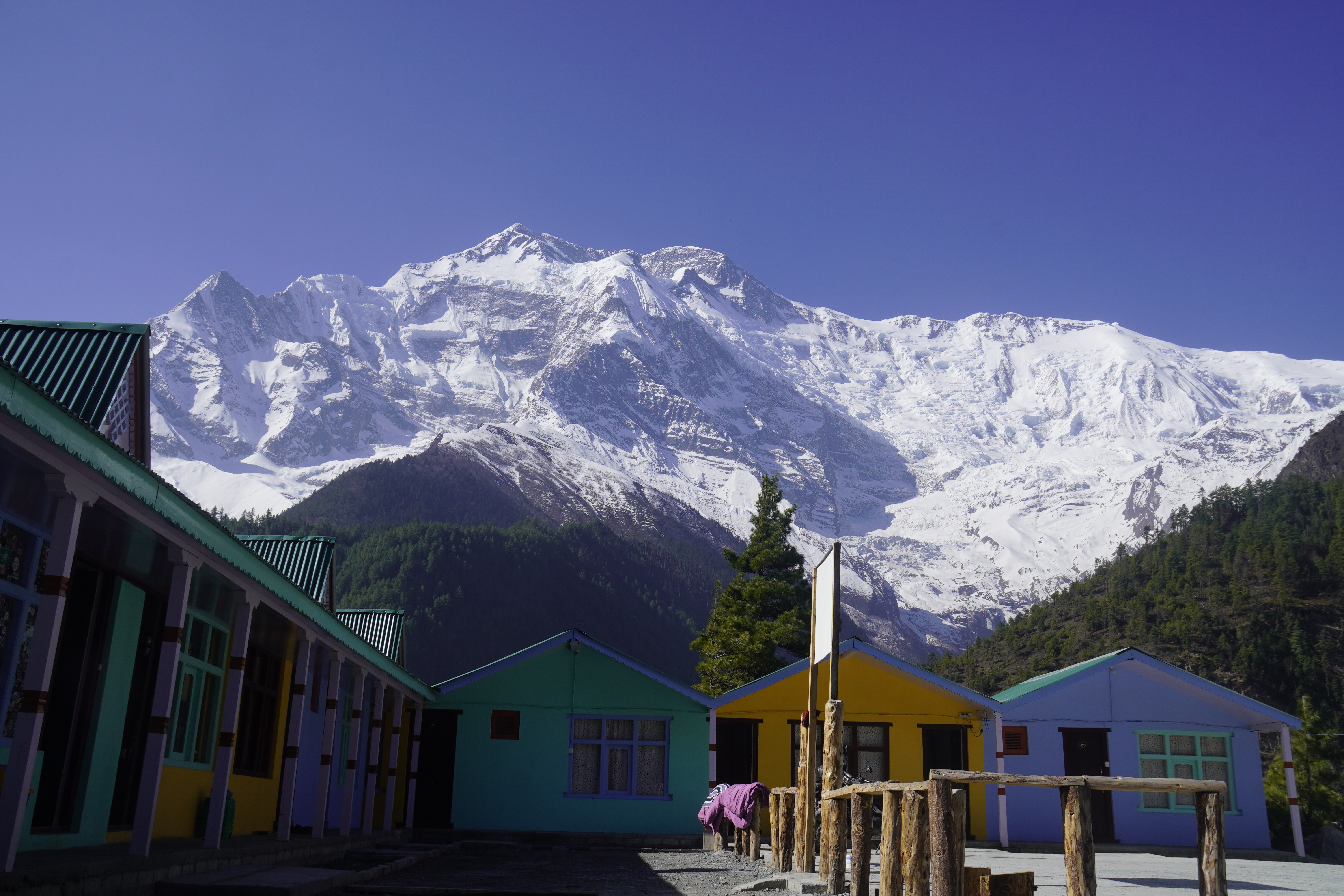
After exploring the monastery, a final, easy one-hour walk along the flat valley floor brings you into the bustling mountain town of Manang (3,540m). Manang feels like a small mountain city, complete with lively bakeries, gear shops, and cozy guesthouses. It is the perfect place to unpack your bags, grab a hot drink, and settle in for a long, restful sleep.
Acclimatization Day in Manang
- Location: Manang (3,540m / 11,614ft)
- Activity: Rest and short day hikes
This is a mandatory rest day designed to help your body safely adjust to the thin mountain air before you climb toward the high pass. Staying active but not overworking your body is the best way to prevent altitude sickness. You can start your morning sleeping in, enjoying a hot breakfast, and visiting the local village to see the traditional lifestyle of the Manangi people.
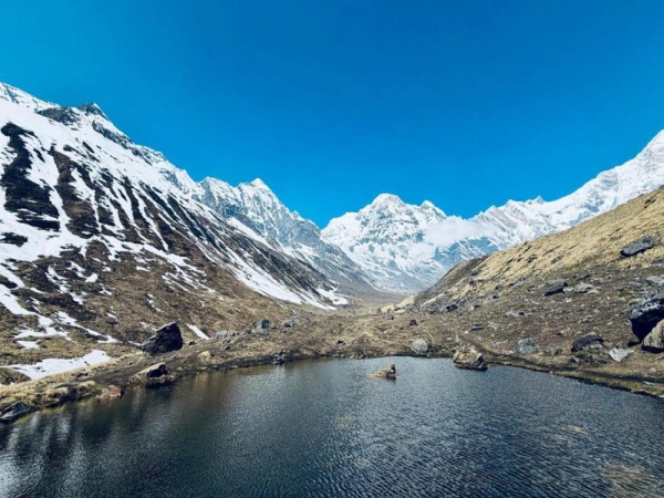
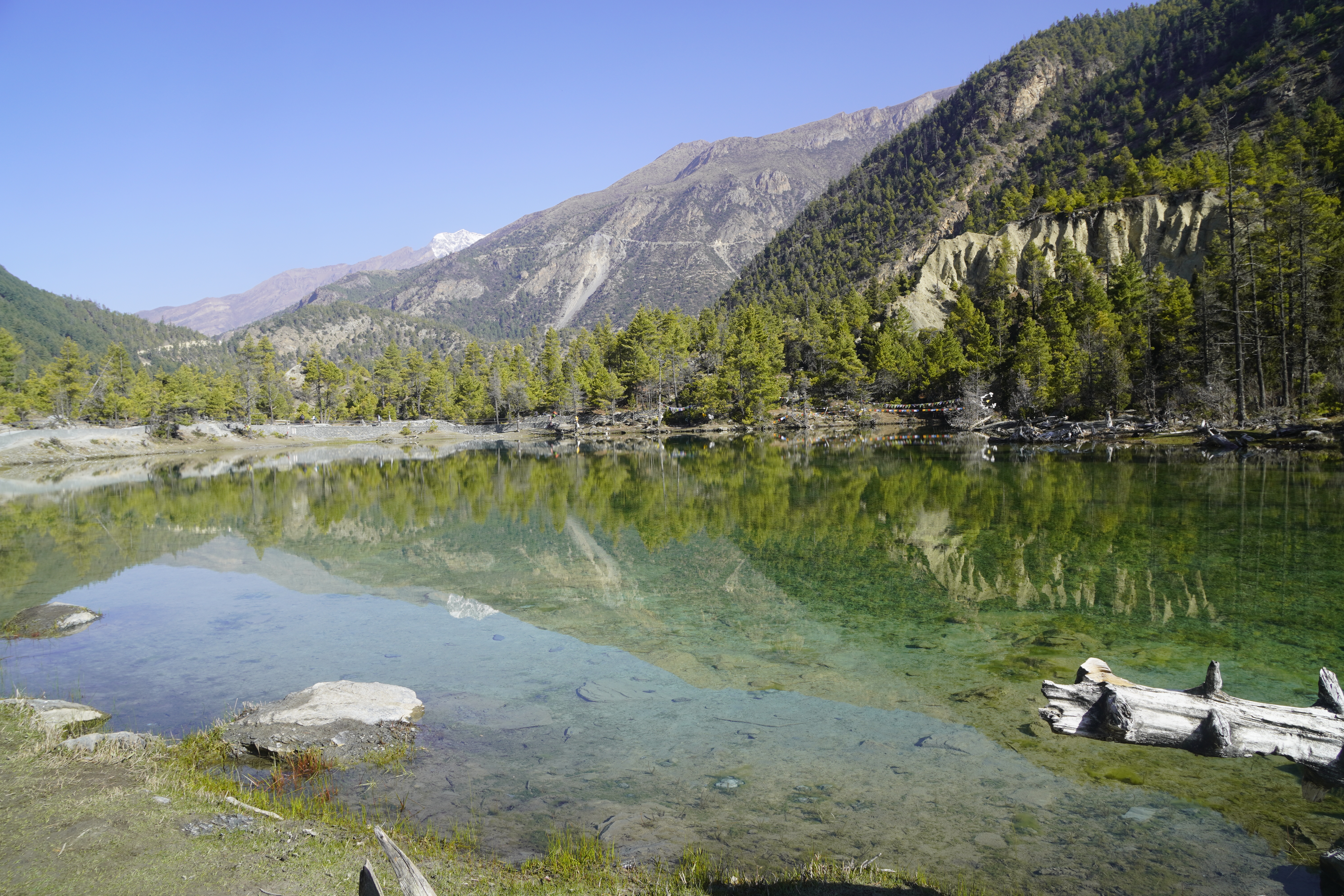
For a relaxing afternoon activity, you can take a short, gentle walk to Gangapurna Lake. This is a beautiful, cold, green-blue lake formed by a glacier sitting right on the edge of the town. You can sit by the water, look up at the massive icefalls, and enjoy the peaceful mountain scenery.
If your body feels strong and you prefer a more challenging workout, you can choose to do a day hike to Milarepa’s Cave. This trail climbs steeply up the hills across the river to a sacred cave where a famous Buddhist monk and poet meditated hundreds of years ago. The hike to the cave is about 5 to 6 kilometers each way and takes around 5 to 6 hours for the round trip. After your hike or rest, you will return to your comfortable guesthouse for dinner and another night of sleep in Manang.
Ice Lake / Kicho Tal (Hard - Best for Acclimatization)
If your body feels very strong and you want the best possible training for the high pass, you can hike to Ice Lake (called Kicho Tal by locals).
To start this hike, you walk about 30 minutes back down the main road to the neighboring village of Braga. From there, a well-marked trail climbs very steeply up the mountain walls. This is a tough, all-day hike that takes about 6 to 8 hours round trip and covers around 14 kilometers.
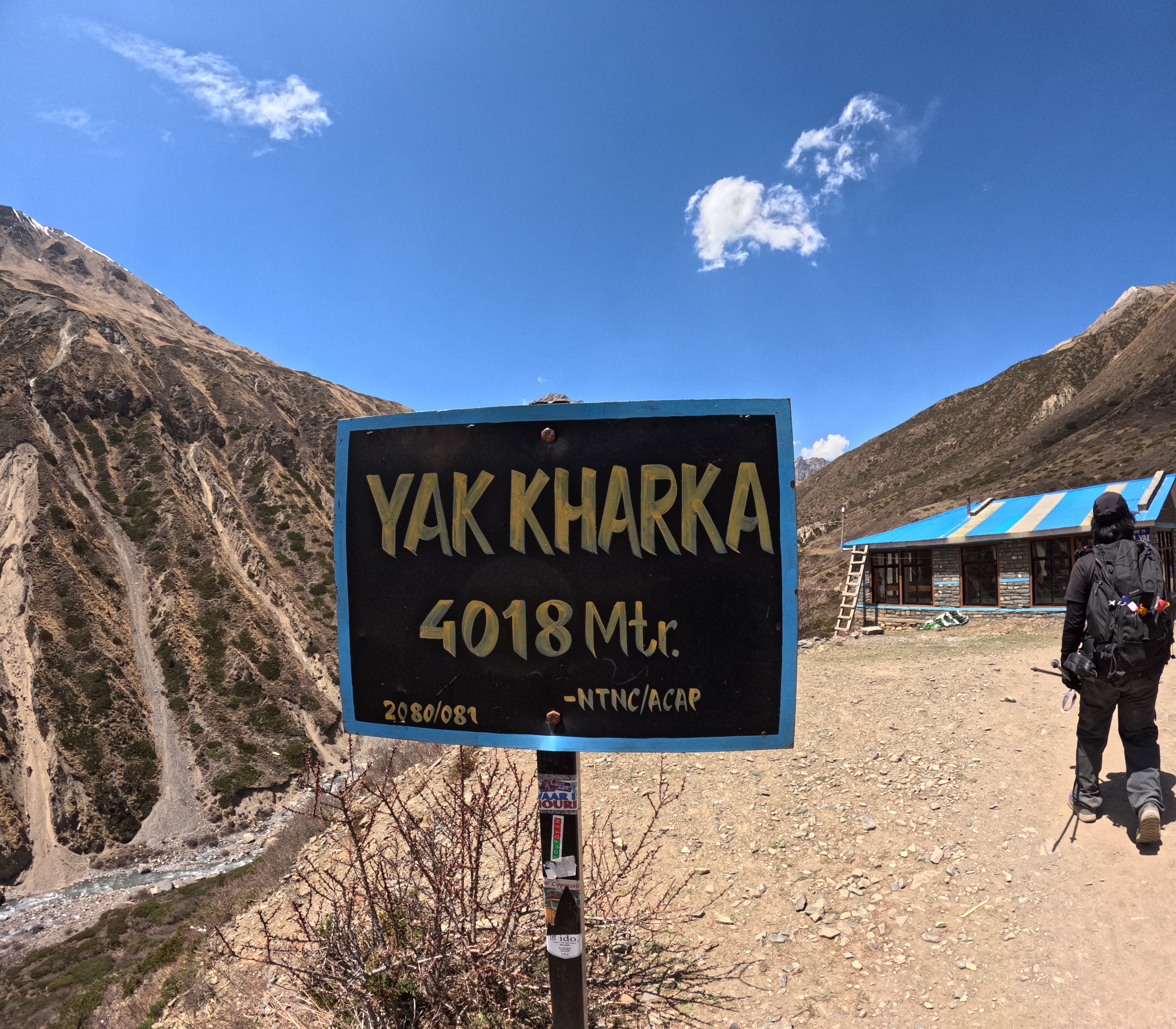
Manang to Yak Kharka (4,110m) Distance: 10 km Duration: 5-6 hours
- Start: Manang (3,540m / 11,614ft)
- End: Yak Kharka (4,110m / 13,480ft)
- Total Distance: 11 km (6.8 miles)
- Walking Time: 3–4 hours
The morning begins with a steady uphill climb out of the main town up to the old, traditional village of Tenki Manang. This marks a very exciting change in your trek because the jeep road ends completely in Manang. From this point forward, there are no more cars, motorbikes, or road dust, just a quiet, narrow mountain footpath. As you hike higher into the Jarsang Valley, the tall trees disappear completely, replaced by low, sweet-smelling juniper bushes and wide alpine grass.
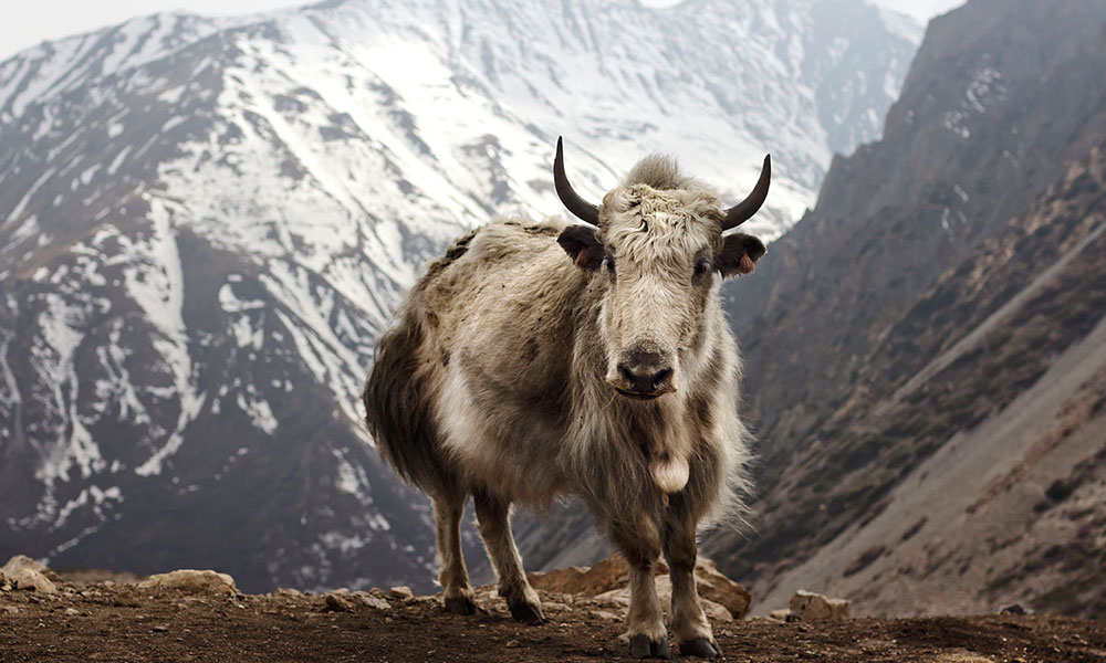
After walking about 4.5 kilometers, you will arrive at the small settlement of Ghunsang. This is a tiny group of stone teahouses on the hillside, making it the perfect place to stop for a hot drink and look at the mountains. Leaving Ghunsang, the path becomes a beautiful, gentle walk through wide pastures. Here, you will see groups of local horses and large, hairy yaks eating grass at their own peaceful pace. The trail then drops down slightly to cross a rushing river over a traditional wooden bridge, right next to an ancient stone Mani wall covered in Buddhist carvings.
A final, gentle uphill walk through the green meadows brings you right into Yak Kharka. What used to be a basic stop for yak herders has now grown into a comfortable village with upgraded lodges that offer warm food and Wi-Fi. Because this walk takes only 3 to 4 hours, you will arrive around lunchtime. A great way to train your body for the high altitude is to unpack your gear, rest a bit, and take a short 45-minute afternoon walk up to the next tiny outpost of Ledar (4,200m). Walking up there and coming back down to sleep in Yak Kharka is the perfect way to prevent altitude sickness.
Yak Kharka - Thorong Phedi - High Camp Maximum altitude: 4,540m Distance: 6km Duration: 4-5 hours
- Start: Yak Kharka (4,110m / 13,480ft)
- End: Thorong Phedi (4,450m / 14,465ft)
- Total Distance: 7–8 km (4.3–5 miles)
- Walking Time: 3.5–4 hours
The walk from Yak Kharka to Thorong Phedi is short in distance but demands a lot of energy because you are entering very high altitudes. The day begins with a gradual, easy uphill walk along the side of the valley for about one kilometer until you reach the tiny outpost of Ledar (4,200m). This is the last small spot with a couple of teahouses before the real wilderness sets in. As you walk past Ledar, the scenery changes completely into a barren, rocky, grey landscape that looks like the surface of the moon.
After leaving Ledar, the path climbs steadily before making a short, steep descent down to the river. You will cross a long suspension bridge over the Jarsang Khola river and climb right back up the other side to a tiny resting spot called the Deurali Tea House. This is a great place to stop for a warm drink, catch your breath, and look up at the cliffs. If you are lucky, you might spot herds of blue sheep moving across the steep rocks. They blend in perfectly with the grey stone, but you can see them when they move. Massive birds like the bearded vulture also fly through the wind here.
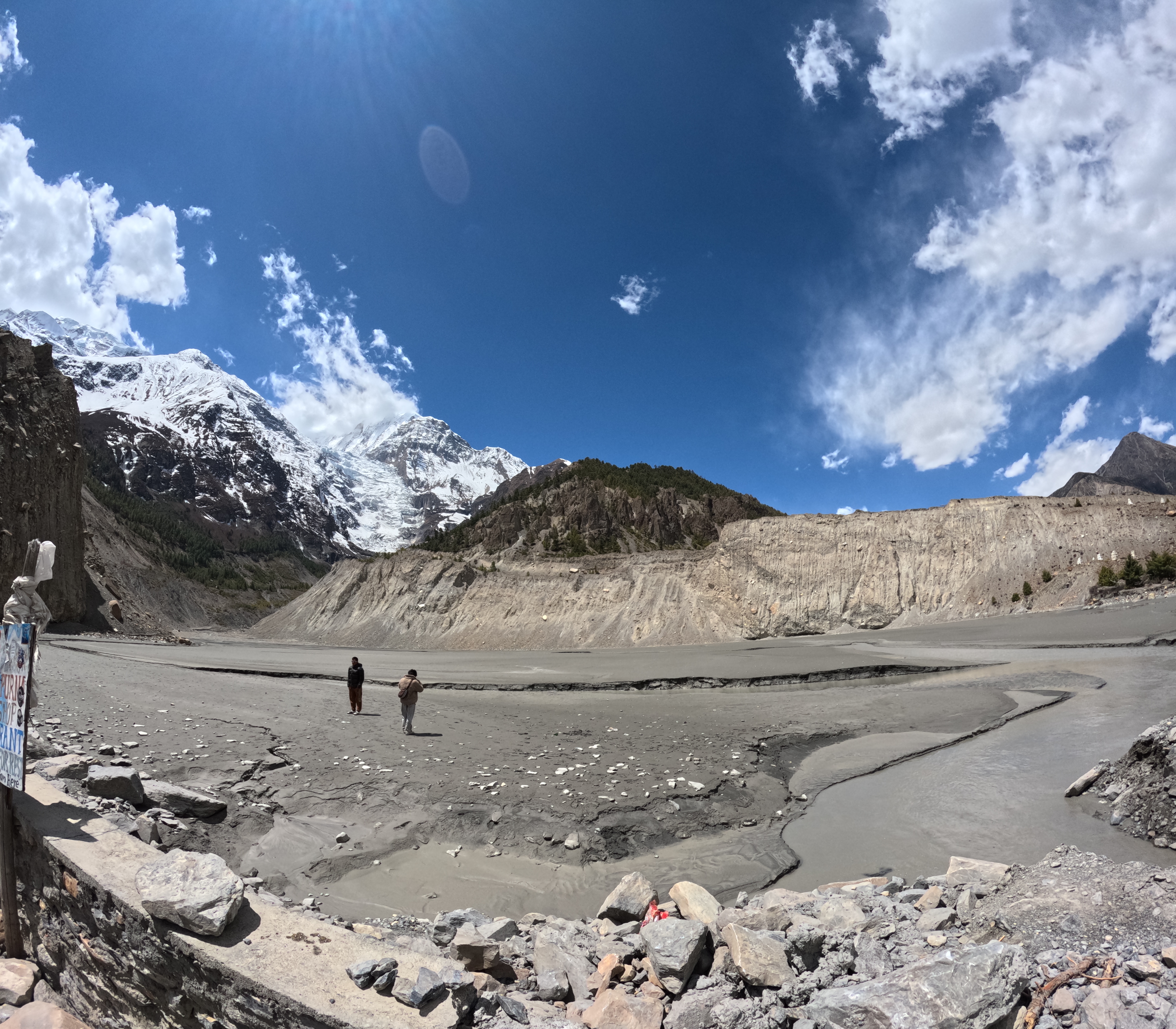
The final stretch before reaching your destination is the most famous and cautious part of the day: the Landslide Zone. This is a narrow, dusty trail carved into a giant cliff of loose rocks and scree. Because rocks can occasionally roll down from the top of the mountain, there is a very important safety rule here: keep your eyes up, do not stop for photos, and walk across this section as quickly and steadily as possible.
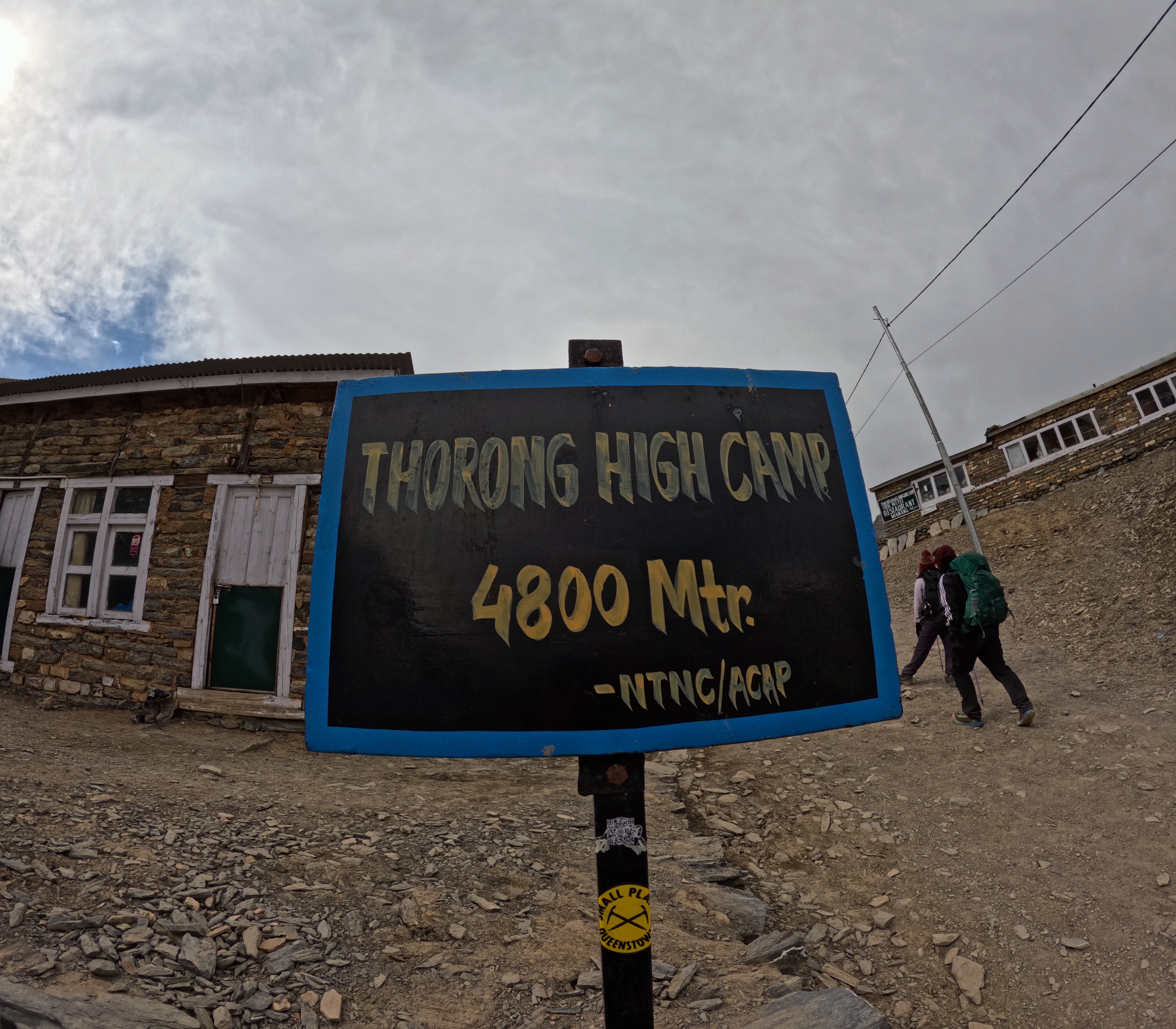
Once you clear the landslide area, you will walk straight into the small hub of Thorong Phedi (4,450m), which serves as the base camp for the high pass. While it is located in a cold, isolated canyon, the local lodges have upgraded over time and now feature a bustling bakery where you can get warm pastries, hot coffee, and chocolate cake. After checking in and resting, a common routine to help your body adapt to the altitude is to take a slow, unburdened 45-minute afternoon walk up the steep hill toward High Camp, before coming back down to Phedi to eat a big dinner and get an early sleep before your big pass day tomorrow.
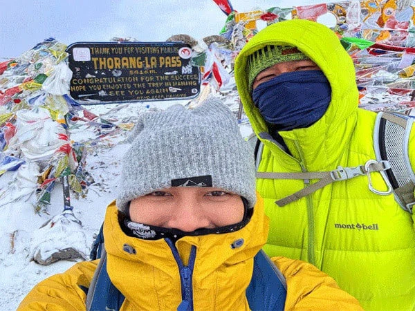
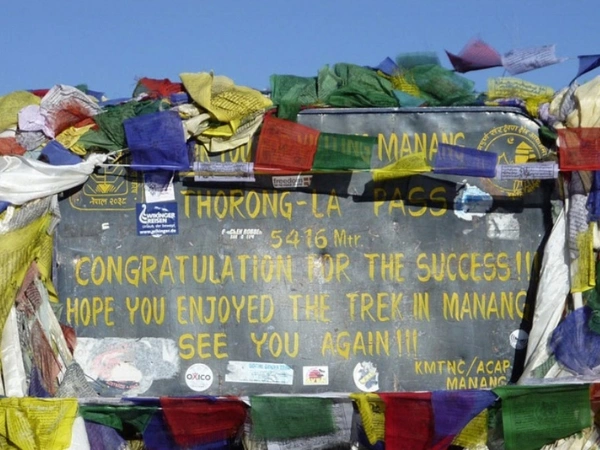
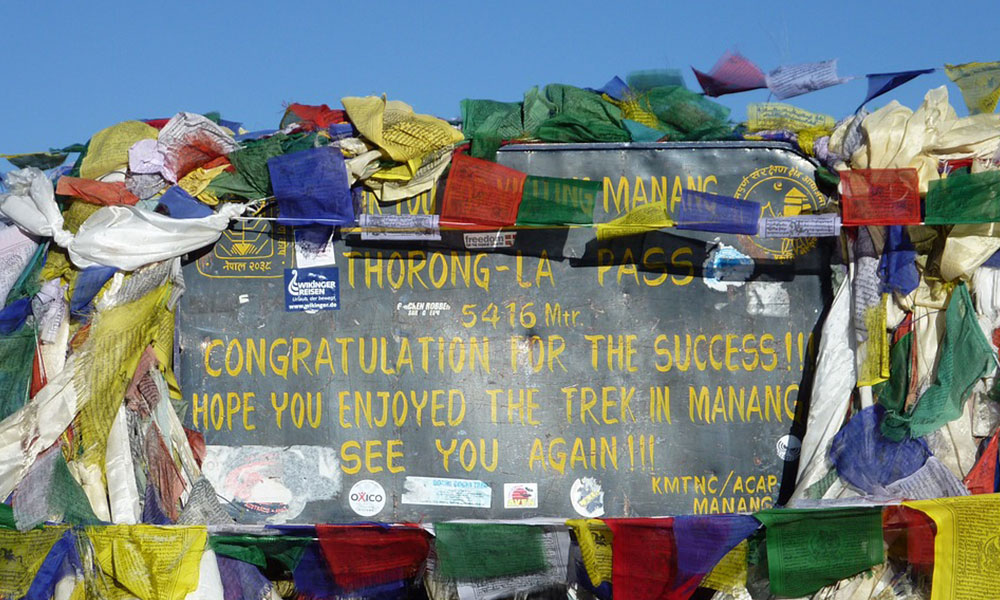
Thorong Phedi - Thorung La Pass - Muktinath Altitude: 5,416m (Thorung-La Pass) &(Muktinath) Distance: 12 km
- Start: Thorong Phedi (4,450m / 14,465ft)
- Highest Point: Thorong La Pass (5,416m / 17,765ft)
- End: Muktinath (3,800m / 12,456ft)
- Total Distance: 16 km (10 miles)
- Walking Time: 7–9 hours
The biggest and hardest day of the trek begins in the freezing, pitch-black darkness, usually between 3:00 AM and 4:00 AM. Wearing headlamps and your warmest layers, you immediately face a brutally steep climb up a loose, rocky trail. After about an hour of slow, heavy breathing, you reach Thorong High Camp (4,800m). This is a lonely outpost with a few lodges where some trekkers choose to sleep, but most people just use it as a quick breath-catching stop. Leaving High Camp, the path continues to climb through a wide, silent, and often snowy mountain valley. The air here is incredibly thin, and the freezing temperatures mean you must keep moving slowly and steadily to stay warm.
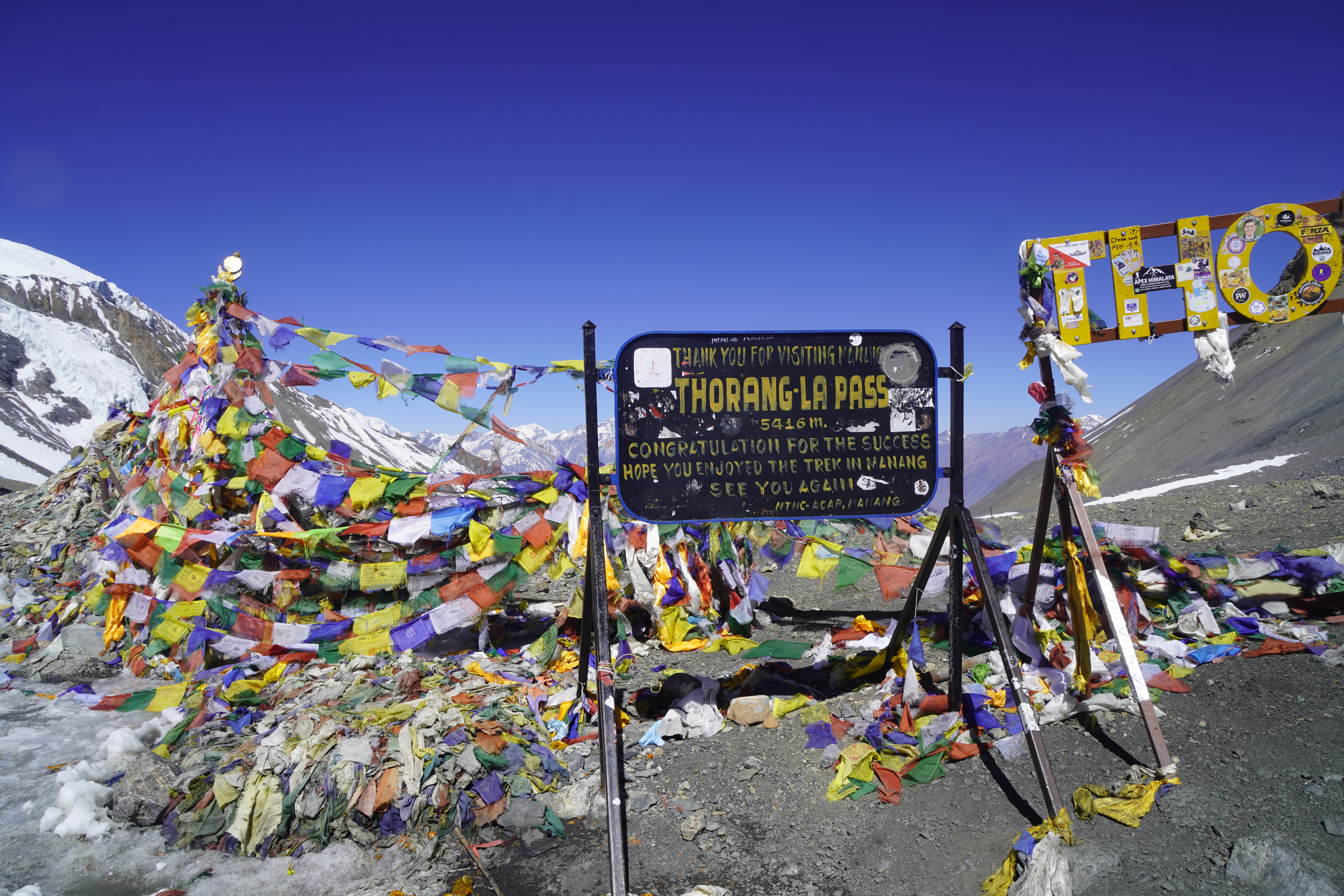
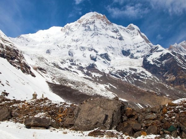
After roughly four to five hours of continuous uphill walking from the start, the trail finally flattens out, and you will see a massive sea of colorful Buddhist prayer flags fluttering violently in the freezing wind. You have made it to the top of Thorong La Pass (5,416m), the highest point of the entire Annapurna Circuit. Right at the top, a local vendor runs a tiny, famous stone tea hut where you can buy an expensive but incredibly well-deserved cup of hot tea. Standing here gives you an unforgettable reward: the giant, icy peaks of the Annapurna range stand behind you, while the vast, dry, desert-like mountains of the Mustang region stretch out all the way toward Tibet in front of you.
Once you finish taking your celebration photos, the second half of the day's challenge begins. You must conquer a long, relentless downhill march that drops more than 1,600 vertical meters. This path is very steep, dusty, and covered in loose gravel that can be incredibly painful on your knees and toes, making trekking poles an absolute necessity. After about three to four hours of continuous descent, the trail flattens out past a few seasonal tea shops at the bottom of the slopes and enters the sacred grounds of Muktinath (3,800m). Muktinath is a deeply spiritual pilgrimage site for both Hindus and Buddhists. You can walk past the famous temple complex to see its 108 holy water spouts and natural gas fires before walking a final few minutes into the main town, where a hot shower, a great meal, and a soft bed are waiting for you.
Trek from Muktinath to Marpha (2670m/8760ft), 22 km (13.7 miles)
- Start: Muktinath (3,800m / 12,456ft)
- End: Marpha (2,670m / 8,760ft)
- Total Distance: 22 km (13.7 miles)
- Walking Time: 6–7 hours
The trek today is a long but beautiful downhill journey that takes you deep into the famous Kali Gandaki Valley. Leaving the sacred temples of Muktinath behind, the standard path drops steadily through the old villages of Jharkot and Khingar, offering wide views of the dry, desert-like hills of Lower Mustang. The route then leads down into the wide, gravel riverbed of the Kali Gandaki River. By mid-morning, a very strong wind starts blowing up the valley from the south, so it is important to wear a windproof jacket and sunglasses to protect yourself from flying dust as you walk toward the busy regional hub of Jomsom (2,720m).
Alternative NATT Route (Lubra Pass Detour): To completely avoid walking alongside the dusty jeep road, you can take the official NATT (Natural Annapurna Trekking Trails) option via Lubra Pass (also spelled Lupra Pass). This trail climbs slightly out of Muktinath to cross a high ridge before making a steep, scenic descent into the isolated Panda Khola gorge. Here, you will find Lubra Village (3,020m), a quiet, hidden settlement that is one of the very few remaining places in Nepal practicing the ancient, pre-Buddhist Bon religion. After exploring the village's unique old monastery, the path follows the riverbed out to join the main valley floor shortly before reaching Jomsom.
From Jomsom, a flat and easy 1.5-hour walk brings you straight into the beautiful village of Marpha (2,670m). Marpha is famous for its clean, stone-paved alleys, traditional white-washed houses, and clever drainage canals running right under the streets. The village is surrounded by thick green orchards, making it the apple capital of the region. After a very long day of walking, checking into a comfortable local lodge and trying a glass of Marpha's famous local apple brandy or a slice of fresh apple pie is the perfect reward.
Travel Note (Jeep Option): Because the trail from this point forward shares a lot of space with the modern motor road connecting Muktinath and Pokhara, many travelers choose to skip the next two days of walking along the riverbed. If your feet are tired or you want to save time, you can hire a private jeep or take a local bus from Muktinath or Jomsom straight down to the natural hot springs of Tatopani. This drive takes about 4 to 5 hours and saves you two whole days of trekking.
Marpha - Ghasa Maximum altitude: 2,010m Total distance: 22 km Time duration: 6-8 hours
The trek from Marpha to Ghasa is 22 km long and takes around 6-8 hours to complete. Then, the descending trail passes through the banks of the Kali Gandaki river. We also pass through various suspension bridges to arrive at the settlement of Ghasa. This is another long duration trek covering a total distance of 22 km.
Ghasa - Tatopani Maximum altitude: 1,190m Total distance: 13 km Time duration: 4-5 hours
The trek distance from Ghasa to Tatopani is 13 km, and it takes around 4-5 hours to complete the trek. The trails pass through the forested area, overlooking the spectacular Annapurna massif.
Furthermore, the trails pass through the natural landscapes, terraced paddy fields, and Rupsi waterfall to arrive at the natural hot water springs of Tatopani. Dipping in the hot waters of Tatopani will relax your mind, muscles, and nerves.
Tatopani - Ghorepani Maximum altitude: 2,874m Total distance: 14 km
Time duration: 6-7 hours
The total distance from Tatopani to Ghorepani is about 14 km and takes around 6-7 hours to complete. Ghorepani village is famous for its awe-inspiring views of sunrise and Annapurna mountain range.
There are several suspension bridges over the Kali Gandaki river. The uphill climb is steep for a few hours and then gets relatively easy. After 6-7 hours of trekking, we arrive at Ghorepani.
Maximum altitude: 3,210m
Total distance: 3 km & 35 km(drive)
Time duration: 8-10 hours
Poon Hill viewpoint provides trekkers with an incredible fantastic panoramic sunrise view overlooking the entire Annapurna range. The uphill climb has a total distance of 3 km and takes around 1-2 hours to complete.
The trail leads us back to Ghorepani from where we drive back to the lake city of Pokhara. The scenic drive to Pokhara takes further 5-6 hours. Pokhara is a tourist city with many hotels, restaurants, cafes, pubs, etc.
Pokhara - Kathmandu
Maximum altitude: 1,400m
Total distance: 200 km
Time duration: 6-7 hours drive
Annapurna Circuit trek ends with a drive back to Kathmandu to Pokhara. The 6-7 hours drive covers around a distance of 200 km. The scenery provides you with green landscapes and the view of the snow-capped mountains.
You may also like to read:
We have Annapurna Circuit Trek package which will cost you less. For price contact us.
Tips to Minimize the Distance Related Difficulties of the Annapurna Circuit Trek
Customize the Trek
The transportation used and the starting point of the trek also determines how long is the Annapurna Circuit. The Annapurna Circuit Trek starts with a drive from Kathmandu to Besi Sahar. You can customize the trek and take the jeep drive directly to Syange or Chame and reduce the trek itinerary by a few days.
There are some individual sections of the trek where you can take a jeep ride. These newly constructed roads are not in great condition but you can manage. So, taking a jeep or any vehicle available will reduce the total trekking days.
Moreover, you will also get to observe the beautiful scenarios of the hilly landscapes, terrace farms, charming villages, and magnificent mountain views, and others. Besides that, you can also take the flight from Jomsom to Pokhara. This will reduce the total distance and itinerary of the trek as your trip comes to an end at Jomsom.
Hire a Porter
Hiring a porter reduces the difficulty of the trek by a significant amount. It is incredibly hard to trek with heavy weight on your back. The porter can carry the weight of your clothing and gear.
So, if you are trekking in the high altitude region for the first time or are not comfortable trekking with a backpack, you should hire a porter. You can thus enjoy the trek and complete it with ease.
Trek in a Group
Trekking in a group will keep your mind occupied through fun interactions. Hence, you won’t feel the taxing length of the trail. Trekking along with friends, guides, and porters, will not only reduce the fatigue of the trek but will also make it exciting and memorable.

Comfortable Trekking shoes
The Annapurna Circuit trek is a long duration trek on the harsh terrain of the Annapurna region. Therefore, you will require a great pair of comfortable trekking shoes to trek in the region.
A pair of comfortable hiking shoes with sturdy soles will give you the extra push you need for the trek. It will also save you from any injuries, blisters, ankle pain, and others.
Get a Training Routine
The Annapurna circuit trek is a long duration trek through the most remote parts of Nepal. The trails are harsh and require immense strength and stamina to complete. Thus, a good training routine before the trek will help you immensely.
Moreover, the training should include cardiovascular activities like hiking, cycling, running, swimming, and others. These aerobic exercises will increase your stamina and boost your endurance. These training routines will also help you with altitude sickness.
Is Distance a Major Factor for Annapurna Circuit Trek Difficulty?
The Annapurna Circuit Trek is challenging, and the distance plays a significant role in determining the difficulty poolevel of the trek. The Thorong La pass is the highest point of the trek. There are several uphill and downhill climbs, along with steep and narrow ridges.
The altitude, weather, duration, and temperature are some of the factors that make the trek challenging. Besides that, the distance is another major factor that determines the difficulty of the Annapurna circuit trek. Longer distance means that the treks are longer and thus increase in the overall difficulty of the trek.
For the Annapurna Circuit Trek, you will have to walk 6-7 hours. Therefore the trekking distance and trekking duration are interdependent on each other. Beginner trekkers might find it challenging to trek continuously for long distances. Hence, trekking distance is a significant factor in the difficulty of the trek.
The Final Say
Annapurna Circuit Trek is one of the beautiful trekking destinations of the world. The diverse landscapes, lush forests and the majestic snow-capped mountains will make you fall in love with the place. The length of the trip is an important factor to consider before starting on any trekking adventure.
I hope this article answered the pertinent question of how long is the Annapurna circuit. You can customize the trek to either shorten or lengthen the trip. Overall, the Annapurna Circuit Trek is an ultimate trekking adventure in the pristine landscapes of the Annapurna region.
We have Annapurna Circuit Trek package which will cost you less. For price contact us.