The Upper Mustang Trek is a moderately challenging route that follows a scenic loop through the "forbidden kingdom," starting and ending in Jomsom via Kagbeni. The primary destination is the ancient walled city of Lo Manthang.
Upper Mustang Trek, a precious and medieval Trek in Nepal's Himalayas, is one of the country's most incredible treks. The upper Mustang excursion is a limited-access excursion. The area is restricted to conserve the Himalayas' historical, religious, ecological, and geographical diversity.
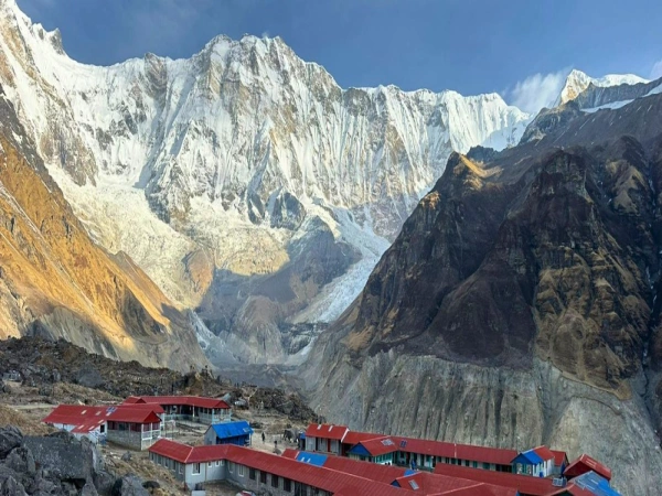
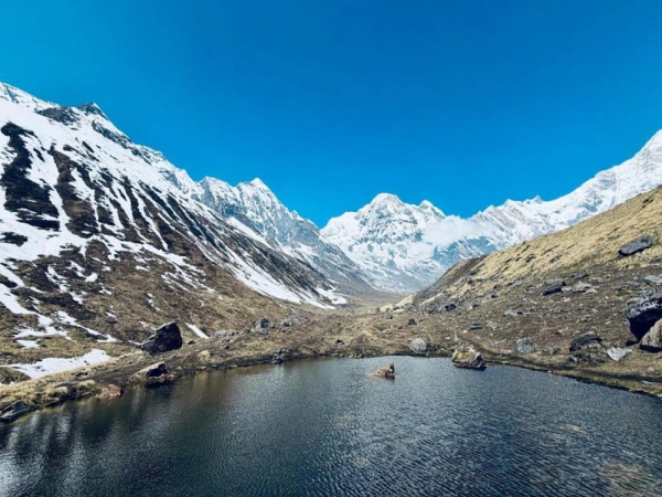
The vibrant colors and hues of the Upper Mustang's Mountains are breathtaking at any time of year. It is a relatively low to moderate altitude trek that has no high passes to cross, thus rendering it suitable for a wide range of people. Upper Mustang also has a high grade of accommodation and dining, making it an excellent alternative for those seeking comfort. The Upper Mustang Trek is great for people looking for unknown locations, off-world vistas, and unique civilizations. The trek between Upper Mustang's vistas, culture, and people is definitely among the most magnificent trek in the world.
If you want to go trekking in Upper Mustang, the Upper Mustang trek map can help you gain a clear concept of the Upper Mustang Trekking. The 15 -days Upper Mustang Trek map assists trekkers to find out about the hiking trails and sites along the way. You might also receive ideas about the small towns and communities in the area.
Venturing the Upper Mustang Trek you will discover Upper Mustang Trekking's hidden beauty. You can also learn about Mustang's customs, socioeconomic beliefs, and cultural values. By participating in this trek, you are not only having fun and gaining life-changing experiences, but you are also boosting Upper Mustang's tourism industry. This will also assist the locals promote their economy.
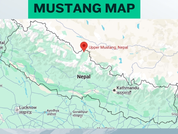
Where is Upper Mustang Located? District, Country, Province, Co-ordinates
Upper Mustang is a remote Trans-Himalayan region located in the northern part of Mustang District, within Gandaki Province, in the country of Nepal.
Geographically, it lies near the northern border with the Tibet Autonomous Region, making it one of the most culturally Tibetan-influenced areas in Nepal. The region is centered around the ancient walled city of Lo Manthang (approx. 29.2347° N, 83.9257° E), which serves as the cultural and administrative heart of Upper Mustang.
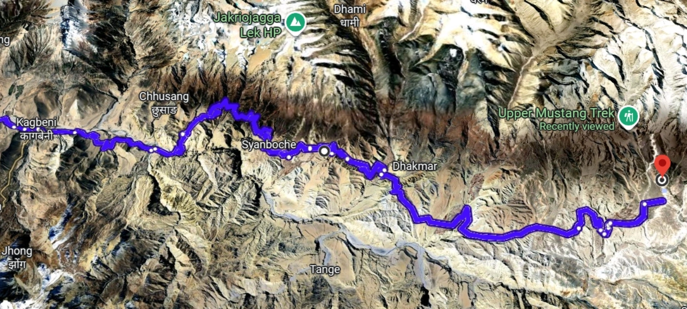
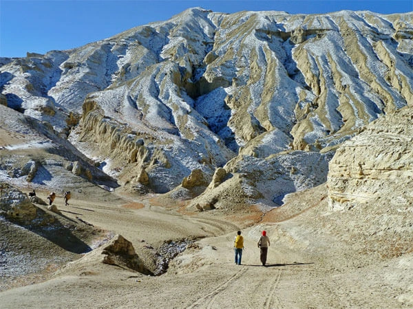
Positioned between the massive Annapurna Range and Dhaulagiri Range, Upper Mustang lies in a rain shadow zone, giving it a unique dry, desert-like landscape unlike the greener regions of Nepal. The gateway to Upper Mustang begins at Kagbeni, north of Jomsom, following the deep valley of the Kali Gandaki River.
Upper Mustang Location Details
Category
Details
Country
Nepal
Province
Gandaki Province
District
Mustang District
Region Type
Trans-Himalayan (Rain Shadow Area)
Coordinates
29.2347° N, 83.9257° E
Main Center
Lo Manthang
Entry Point
Kagbeni
Nearby Town
Jomsom
Mountain Ranges
Annapurna Range & Dhaulagiri Range
Border
Tibet Autonomous Region
Landscape Type
High-altitude desert, rocky cliffs, dry valleys
Accessibility
Restricted Area (Special Permit Required)
Upper Mustang Interactive and Digital Maps
For trekkers heading into the "Forbidden Kingdom," digital resources have become as essential as a physical map. Navigating the high-altitude desert of Upper Mustang requires a mix of pre-trek visualization and reliable offline tools.
Below is a detailed breakdown of the interactive maps, planning tools, and GPS files available for the Upper Mustang Trek.
Interactive & Digital Maps
Digital platforms allow you to visualize the dramatic rain-shadow landscape before you even arrive in Jomsom. These tools are primarily used for route planning and identifying key side trips.
Detailed Topographic Maps (Index Adventure)
Index Adventure provides high-resolution topographic maps that emphasize the unique geological formations of the region. Their interactive maps allow you to:
Identify Landmarks: Locate specific "Sky Caves" (cliff burials), ancient monasteries (Gompas), and the iconic walled city of Lo Manthang.
Altitude Profiling: Hover over different sections of the trail to see real-time altitude readings, helping you prepare for the steep climbs between Chele and Syangboche.
Visualizing the Rain Shadow: The map clearly displays the transition from the lush lower regions to the arid, Tibetan-style plateaus of the north.
Planning Tool with Index Adventure
Index adventure offers a specialized planning tool designed for itinerary customization. It is particularly useful for:
Side-Trip Integration: Easily add detours to the sacred Chungsi Cave or the remote Yara and Luri Gompa villages to see how they impact your total trekking time.
Route Comparison: Toggle between the "Main Road" (often used by Jeeps) and the "Traditional Trekking Trails" to ensure you stay on the most authentic paths.
Offline GPS Files
Cell service is notoriously unreliable once you pass Kagbeni. To navigate safely without a data connection, you can download GPX or KML files specifically formatted for outdoor navigation apps.
Compatibility & Tools
Downloads: You can download curated GPS tracks from any online platform. These tracks are verified by local guides to ensure they reflect the most current trail conditions (avoiding areas affected by recent road construction).
Maps.me: Best for general orientation. You can import KML files to see your real-time location as a blue dot on a pre-downloaded map of Nepal. It includes marked guest houses and water sources.
Gaia GPS: The preferred choice for technical trekkers. Gaia allows you to layer topographic maps with satellite imagery, providing better context for the "red cliff" canyons and river crossings in the Kali Gandaki valley.
Pro Tip: Always download the "Nepal" or "Gandaki" region maps for offline use while you still have high-speed Wi-Fi in Kathmandu or Pokhara.
Segmented Maps & Leg Data
For daily pacing, segmented maps break the trek into digestible "legs." This data is crucial for managing your energy and avoiding altitude sickness.
The Upper Mustang Trek Distance Itinerary provides a leg-by-leg breakdown of the journey. Below is a sample of the data found in these segmented guides:
Trekking Leg
Distance (Approx.)
Elevation Gain/Loss
Key Landmarks
Kagbeni to Chele
10 km
+250m
Kali Gandaki River, Tangbe Village
Chele to Syangboche
11 km
+800m
Taklam La Pass, Dajori La Pass
Syangboche to Ghami
12 km
-300m
Yamada La Pass, Nyi La Pass
Ghami to Tsarang
11 km
+50m
Longest Mani Wall in Nepal
Tsarang to Lo Manthang
13 km
+250m
Lo La Pass (Windy Pass)
Using the Segmented Data
Daily Distance: Most segments average 10–15 km, which takes roughly 5–7 hours at high altitude.
Vertical Gain: The data highlights the "big climb" days (like Chele to Syangboche), allowing you to plan for a slower pace or an earlier start.
Landmark Checkpoints: Use the listed landmarks to verify you are on the correct path, especially near the riverbeds where trails can occasionally branch off.
Are you looking for the specific GPS file links to download for your device, or do you need help comparing the elevation difficulty of specific trekking legs?
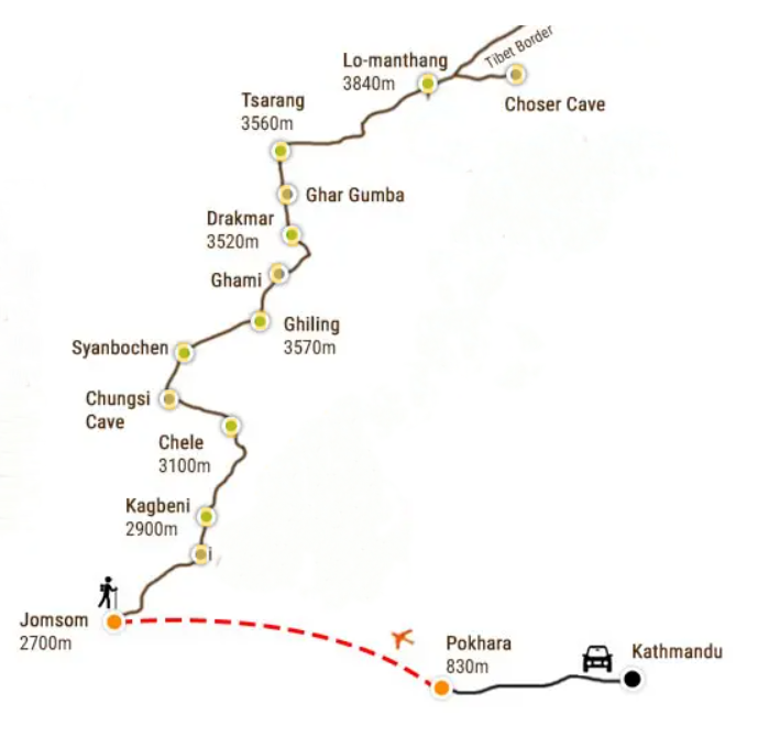
Upper Mustang Trek Map from Kathmandu and Pokhara with Itinerary
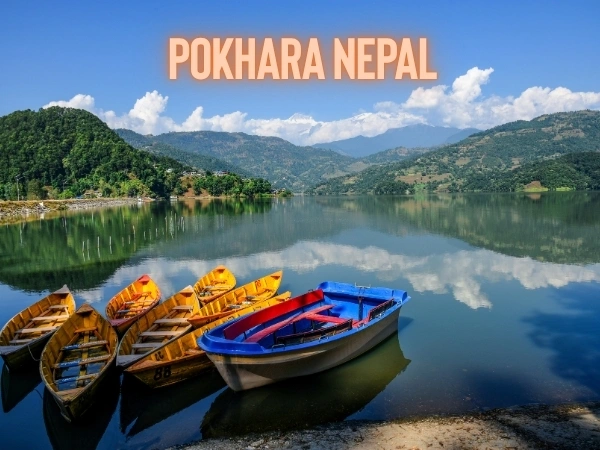
Day 01: Drive from Kathmandu to Pokhara, check-in at hotel, optional boating on Fewa Lake.
Day 02: Fly to Jomsom and trek to Kagbeni, explore village and checkpoint.
Day 03: Trek from Kagbeni to Chele via Tangbe and Chhusang villages.
Day 04: Trek from Chele to Syangboche via Taklam La, Samar village, Chungsi Cave, and Dajori La pass.
Day 05: Trek from Syangboche to Ghami over Yamda La and Nyi La passes, explore Ghami Monastery and Mani wall.
Day 06: Trek from Ghami to Charang via Choya La pass, visit Charang Monastery and White Palace.
Day 07: Trek from Charang to Lo Manthang via Lo-Gekar Gompa.
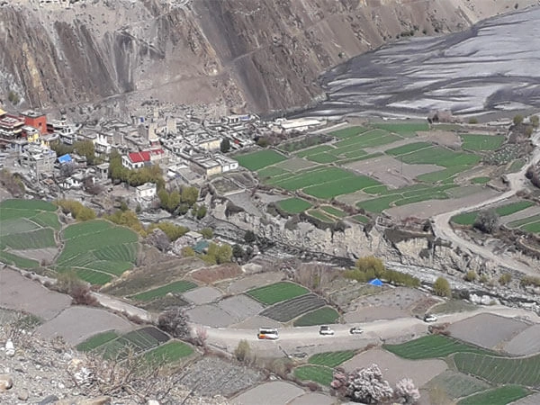
Day 08: Explore Lo Manthang, visit major Gompas and experience traditional lifestyle.
Day 09: Trek from Lo Manthang back to Ghami via Mui La pass, Dhakarjung, and Ghar Gumba.
Day 10: Trek from Ghami to Samar via Nyi La pass, Geling, Chungsi Cave, and Yamdo La pass.
Day 11: Trek from Samar to Chhusang via Dajori La and Taklam La passes, passing Chele village.
Day 12: Trek from Chhusang to Muktinath via Tetang and Gyu La pass, visit temples and fossil stones.
Day 13: Trek from Muktinath to Jomsom via Jharkot village and monastery.
Day 14: Early morning flight from Jomsom to Pokhara, free afternoon for sightseeing.
Day 15: Drive back from Pokhara to Kathmandu.
Where is Mustang located on the map of Nepal | Mustang Location on Nepal map
Mustang location on the Nepal map
Mustang is located in north-central Nepal, in the Gandaki Province, along the upper part of the Kali Gandaki River valley. It is a landlocked Himalayan district bordered by:
North: Tibet Autonomous Region
South: Myagdi District and Dolpa District
East: Manang District
West: Kaski District
On the map of Nepal, Mustang sits between the Annapurna Range to the west and the Dhaulagiri Range to the east, forming part of the Trans-Himalayan region. Its northern part, called Upper Mustang, is closer to Tibet and is a high-altitude desert, while Lower Mustang near Jomsom is greener and more accessible.
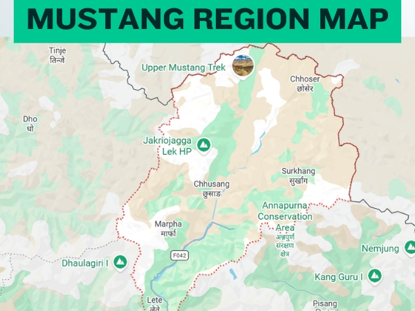
Map of Mustang District (Upper and Lower Mustang Map in District)
Mustang Region Nepal Map
Upper Mustang Google Map | Exact location with Co-ordinates
This shows Upper Mustang (Lo Manthang area) directly on the map.
In conclusion
Upper Mustang is truly a hidden gem of Nepal, offering trekkers a rare glimpse into a remote Trans-Himalayan world. From the walled city of Lo Manthang to the dramatic cliffs, high-altitude desert, and centuries-old Tibetan culture, this trek combines adventure, culture, and breathtaking landscapes like nowhere else. Whether you’re exploring ancient monasteries, walking through quiet villages, or witnessing panoramic Himalayan views, Upper Mustang promises an unforgettable journey for every traveler.
If you’re looking for an Upper Mustang trek this summer, remember Index Adventure for a safe, well-organized, and fully guided experience. Join now for our 2026 | 2027 Upper Mustang Trek package and make memories in one of Nepal’s most enchanting regions!
Book your trek with Index Adventure today for the 2026/27 season and step into the heart of Upper Mustang!