The round-trip trekking distance for the Annapurna Base Camp (ABC) trek is approximately 70 to 115 km (43 to 71 miles), depending on your route. Trekkers typically cover 7 to 15 km (4 to 9 miles) per day, walking 5 to 7 hours daily over 7 to 12 days.

Annapurna Base Camp Trek Distance: Every Stage, KM and Route
How long is the trek to Annapurna Base Camp?
The total Annapurna Base Camp trek distance is approximately 70 to 95 kilometers round trip (43 to 59 miles), and the figure can extend to 115 kilometers depending on your chosen trailhead, the pace of your acclimatization schedule, and whether you incorporate the Ghorepani and Poon Hill loop into the itinerary. The ABC trek distance is not a fixed number, and any source that presents it as one is compressing a set of highly variable logistical choices into a misleadingly clean statistic.
If you start from Jhinu Danda or Matkyu, using the modern jeep track access deep into the Modi Khola valley, your ABC trekking distance stays close to 70 km round trip. If you opt for a classic approach from Nayapul or Birethanti, walking the full lower valley, the total ABC trek km figure rises to approximately 90 to 95 km. Add the sunrise detour to Poon Hill at 3,210 meters, and the route stretches further still.
Index Adventure Pvt. Ltd., a Kathmandu-based operator with deep institutional knowledge of the Annapurna Conservation Area, structures customized ABC treks across all five major route variations, calibrating itineraries to your available time, fitness level, and the specific experience you are seeking from the trail.
ABC Trek Distance: Quick Facts
|
Topic |
Answer |
|---|---|
|
Total trekking distance |
Approximately 70 to 95 km round trip |
|
Distance in miles |
About 43 to 59 miles round trip |
|
Shortest common route |
Jhinu Danda or Matkiu to ABC and back, around 70 km |
|
Route with Poon Hill |
About 90 to 95 km depending on trailhead and exit |
|
Daily walking distance |
Usually 5 to 13 km per day |
|
Walking hours per day |
About 5 to 7 hours per day |
|
Highest elevation |
4,130 m / 13,550 ft at Annapurna Base Camp |
|
Difficulty |
Moderate, with stone steps, steady climbs, forest trails, altitude gain |
|
The main reason distance varies |
Trailhead choice, road access, route variation, Poon Hill inclusion |
|
Nayapul to ABC (one way) |
Approximately 45 to 48 km |
|
Jhinu Danda to ABC (one way) |
Approximately 35 km |
|
Ghandruk to ABC (one way) |
Approximately 40 to 42 km |
Complete Stage-by-Stage ABC Trek Distance Reference Table
This is the most accurate stage-by-stage distance breakdown available for the Annapurna Base Camp route, verified against trekker GPS logs, ACAP trail data, and the operational experience of Index Adventure Pvt. Ltd. guides who lead this route year-round. Use this table to answer every specific segment distance question before building your itinerary.
Ascending Stages: Trailhead to Annapurna Base Camp
|
Stage |
Distance |
Elevation |
Duration |
|---|---|---|---|
|
Nayapul to Birethanti |
1.5 km |
+30 m |
30 min |
|
Birethanti to Tikhedhunga |
3.5 km |
+250 m |
1.5 hours |
|
Tikhedhunga to Ulleri (3,300+ stone steps) |
2 km |
+600 m |
2 hours |
|
Ulleri to Ghorepani |
10 km |
+900 m |
5 to 6 hours |
|
Ghorepani to Poon Hill (3,210 m) |
1.5 km |
+350 m |
45 min |
|
Ghorepani to Tadapani |
7 km |
varies |
3 to 4 hours |
|
Tadapani to Chhomrong (via Chuile) |
13 to 15 km |
varies |
6 to 7 hours |
|
Nayapul to ABC (one way, via Poon Hill) |
approx. 48 km |
- |
4 to 5 days |
|
Ghandruk to ABC (one way) |
approx. 40 to 42 km |
- |
3 to 4 days |
|
Jhinu Danda to Chhomrong |
3 to 4 km (uphill) |
+390 m |
1.5 to 2 hours |
|
Pokhara to Chhomrong (road + walk via Jhinu) |
approx. 59 km combined |
- |
3 to 4 hours total |
|
Chhomrong to Sinuwa |
2 to 3 km |
-300 m / +200 m |
1 to 1.5 hours |
|
Sinuwa to Bamboo |
2 to 3 km |
-150 m / +100 m |
1 to 1.5 hours |
|
Chhomrong to Bamboo (combined) |
7 to 8 km |
- |
3 to 4 hours |
|
Bamboo to Dovan |
2 to 3 km |
+290 m |
1.5 hours |
|
Chhomrong to Dovan |
10 to 11 km |
+800 to 900 m net |
5 to 6 hours |
|
Dovan to Himalaya Hotel |
3 to 4 km |
+320 m |
1.5 to 2 hours |
|
Chhomrong to Himalaya Hotel |
12 to 13 km |
- |
6 to 7 hours |
|
Himalaya Hotel to Deurali |
2 to 3 km |
+310 m |
1.5 hours |
|
Himalaya Hotel to Deurali |
2 to 3 km |
+310 m |
1.5 hours |
|
Himalaya Hotel to MBC |
7 to 8 km |
+780 m |
4 to 5 hours |
|
Himalaya Hotel to ABC |
11 to 12 km |
+1,210 m |
6 to 7 hours |
|
Dovan to Deurali |
6 to 7 km |
+630 m |
3 to 4.5 hours |
|
Bamboo to Deurali (via Dovan and Himalaya) |
8 to 10 km |
+920 m |
4 to 5 hours |
|
Dovan to MBC |
9 to 10 km |
+1,100 m |
5 to 6 hours |
|
Dovan to ABC |
approx. 19 to 20 km (one way) |
+1,530 m |
2 days |
|
Deurali to MBC |
4 to 5 km |
+470 m |
2 to 2.5 hours |
|
MBC to ABC |
3 to 4 km |
+430 m |
1.5 to 2 hours |
|
Deurali to ABC (via MBC) |
8 to 9 km |
+900 m |
5 to 6 hours |
|
Jhinu Danda to ABC (one way) |
approx. 35 km |
+2,350 m |
3 to 4 days |
Descent Stages: Annapurna Base Camp to Road Point
|
Stage |
Distance |
Elevation Loss |
Duration |
|---|---|---|---|
|
ABC to MBC |
3 to 4 km |
-430 m |
1 to 1.5 hours |
|
ABC to Deurali |
8 to 9 km |
-900 m |
3 to 4 hours |
|
ABC to Bamboo |
12 to 13 km |
-1,780 m |
6 to 7 hours |
|
Bamboo to Jhinu Danda (via Chhomrong) |
9 to 10 km |
-570 m net |
5 to 6 hours |
|
Jhinu Danda to Road Point (Matkiu / Samrung) |
3 to 5 km |
gradual descent |
1 to 2 hours |
How Far is the Annapurna Base Camp Trek?
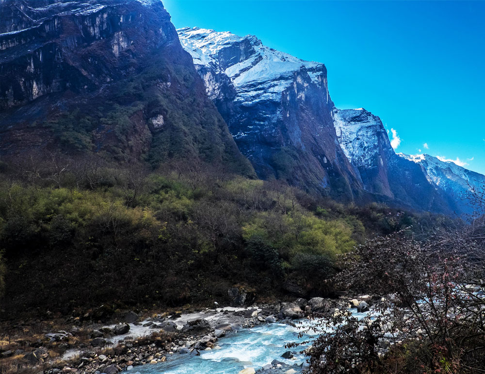
The Annapurna Base Camp (ABC) trek distance ranges between 70 and 95 kilometers round trip (43 to 59 miles). Shorter routes starting from Jhinu Danda or Matkiu, where modern road infrastructure allows jeep access deep into the Modi Khola valley, keep the total ABC trek km figure close to 70 km. Classic itineraries branching out to include the sunrise viewpoint at Ghorepani and Poon Hill extend the trek to approximately 90 to 95 kilometers, with the precise figure depending on your final trailhead and exit arrangement.
Most trekkers complete the Annapurna Base Camp trek in 7 to 11 days. On paper, the daily numbers appear manageable, but mountain geography completely rewrites how that distance actually registers in the body.
Daily distance: Expect to cover an average of 5 to 13 kilometers per trekking day. Time on trail: You will typically be walking for 5 to 7 hours per day at a measured, deliberate pace. Maximum altitude: The trail culminates at Annapurna Base Camp itself, standing at 4,130 meters (13,550 feet) above sea level.
The ABC trek is rated moderate in difficulty. Community data from TripAdvisor and trekking forums consistently emphasizes one point: do not underestimate the relentless terrain. There are no technical climbing hazards on this route, but the character of the trail, defined by thousands of hand-cut stone steps around Ulleri and Chhomrong, steady bamboo forest climbs, high suspension bridge crossings, and sustained altitude gain through the upper Sanctuary, imposes a cumulative physical demand that raw km figures fail to communicate accurately.
Why the Annapurna Base Camp Trek Distance Varies
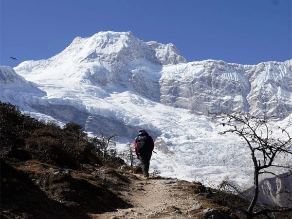
The total Annapurna Base Camp trek distance is not a fixed number, which is precisely why different sources cite conflicting figures. The mileage fluctuates across four primary variables.
1. Modern Road Access and Closer Trailheads
Expanding road infrastructure inside the Annapurna Conservation Area has substantially altered the lower sections of the classic trail.
Traditional approach: Trekkers who prefer the full historical experience begin walking from Birethanti or Nayapul, covering every kilometer of the lower valley on foot. Modern shortcut: Others use jeep tracks to push deeper into the valley, beginning their foot journey from Ghandruk, Jhinu Danda, or Matkiu directly. Distance impact: Skipping the lower dirt tracks by vehicle can reduce your total round-trip walking distance by 20 kilometers or more.
2. Route Variations and the Poon Hill Factor
Direct route: A straightforward ascent pushes immediately toward Chhomrong and up into the Annapurna Sanctuary. Scenic loop: Many trekkers integrate the celebrated Ghorepani and Poon Hill detour for the pre-dawn sunrise panorama over Dhaulagiri and the Annapurna range before connecting back to the main base camp trail. This single detour adds substantial ABC trek km to the overall total.
3. Trailhead and Exit Point Combination
Some itineraries require a complete round-trip retrace of the same ascent trail. Others exit through entirely different lower sections, such as descending directly to the Jhinu Danda hot springs rather than retracing the upper valley to the original entry point. The combination of your entry trailhead and your descent exit point together determines your total ABC trekking distance.
4. Acclimatisation Pace and Rest Days
Structured rest days at Chhomrong or Deurali, which Index Adventure recommends for most first-time high-altitude trekkers, do not increase horizontal distance but do extend the total itinerary duration, which in turn affects how the daily walking load is distributed across the trek.
Pokhara to Annapurna Base Camp Distance
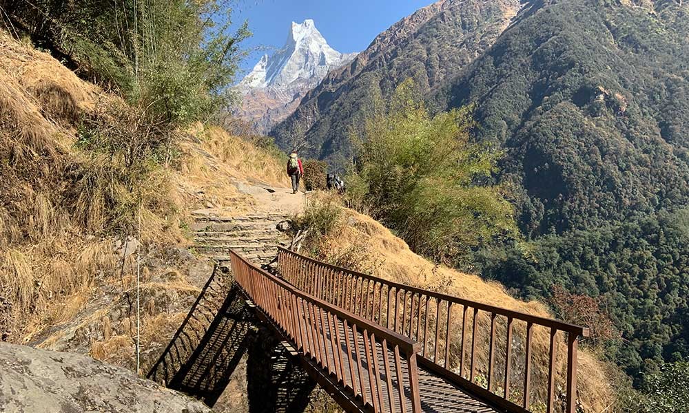
A common source of confusion across travel blogs is conflating the Pokhara to Annapurna Base Camp distance into a single trekking figure. Pokhara functions as the absolute gateway city for this region, but you do not begin walking from the shores of Phewa Lake. The Pokhara to ABC distance is systematically divided into two completely distinct phases: a road transfer by vehicle, followed by the multi-day trekking distance on foot.
How far your vehicle takes you determines precisely how far you walk. The deeper your jeep penetrates the valley, the shorter your foot journey becomes.
|
Starting Point |
Road Transfer from Pokhara |
Approximate Trekking Distance Round Trip |
Notes |
|---|---|---|---|
|
Birethanti or Nayapul |
approx. 42 km by road (1.5 to 2.5 hours) |
approx. 90 to 95 km |
Full lower valley on foot; frequently combined with Poon Hill circuit |
|
Ghandruk Village |
approx. 35 km by road (1.5 to 2 hours) |
approx. 80 to 85 km |
Immediate cultural immersion; more direct line to ABC |
|
Jhinu Danda |
approx. 55 km by road (2 to 3 hours) |
approx. 70 km |
Shortest common walking route; skips lower valley entirely |
|
Matkiu |
approx. 55 to 60 km by road (2 to 3 hours) |
approx. 70 km |
Identical footprint to Jhinu Danda; best for tight, fast-paced schedules |
|
Ghorepani and Poon Hill Route |
approx. 42 km to Birethanti (1.5 to 2.5 hours) |
approx. 90 to 95 km |
Adds the iconic Poon Hill sunrise; highly scenic extended loop |
Pokhara to Annapurna Base Camp distance by road only: The road distance from Pokhara to the nearest jeep-accessible trailhead ranges from 42 km (Nayapul) to approximately 60 km (Matkiu). These road segments are not trekking distance. They are driven, not walked.
Pokhara to Annapurna distance (combined road and trek): Accounting for both the road transfer and the round-trip trekking distance, the total pokhara to abc distance you will cover by any mode of transport ranges from approximately 160 to 210 km, depending on your chosen trailhead and route variation.
Kathmandu to Annapurna Base Camp Distance
The Kathmandu to Annapurna Base Camp distance cannot be expressed as a single trekking number. The journey from Nepal's capital to the Sanctuary consists of three structurally distinct logistics segments that must never be conflated into a composite walking figure.
|
Segment |
Transit Type |
Distance |
Typical Duration |
|---|---|---|---|
|
Phase 1: Kathmandu to Pokhara |
Highway Drive or Domestic Flight |
approx. 204 km via Prithvi Highway |
6 to 8 hours driving, or 25 minutes by air |
|
Phase 2: Pokhara to Trailhead |
Local Road Transfer (Jeep or Bus) |
approx. 35 to 60 km depending on trailhead village |
1.5 to 3 hours on unpaved mountain roads |
|
Phase 3: The Sanctuary Trek |
High-Altitude Hiking Round Trip |
approx. 70 to 95 km on foot |
7 to 11 days |
Phase 1: Kathmandu to Pokhara
The physical map distance between Kathmandu and Pokhara is approximately 204 kilometers via the Prithvi Highway, but heavy traffic, ongoing highway expansion projects, and the winding river bends along the Trishuli River reliably extend the overland driving time to 6 to 8 hours. A domestic flight covers the same Kathmandu to Annapurna base camp corridor in 25 minutes, bypassing the road segment entirely.
Phase 2: Pokhara to Trailhead
Once in Pokhara, a secondary road transfer by jeep or local bus delivers you to your chosen trailhead. This Kathmandu to ABC base camp distance segment adds 35 to 60 km of road travel before a single trekking step is taken.
Phase 3: The Trek
Your actual Annapurna Base Camp trek distance on foot, measured as a round trip, is a consistent 70 to 95 km depending entirely on trailhead choice and route variation. The Annapurna Base Camp to Kathmandu distance for the return journey follows the same three-phase structure in reverse.
Annapurna Base Camp Trek Daily Walking Distance
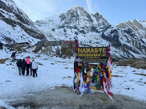
On paper, covering 5 to 13 kilometers per day on the ABC trek looks relatively modest. In the Himalayas, however, daily horizontal mileage is a secondary metric. Terrain, vertical gain, and altitude are the primary determinants of actual physical effort. A 7-kilometer day negotiating several thousand vertical stone steps imposes more physiological demand than a 12-kilometer stretch across a gradual forest floor.
Most itineraries require 5 to 7 hours of walking per day, building in sufficient time for acclimatization pauses, meals, and the landscape photography that the trail consistently demands. The pace naturally and necessarily slows above Deurali at 3,230 meters, where the progressively thinning atmosphere requires a measured, conservative stride across the open glacial terrain approaching the Sanctuary.
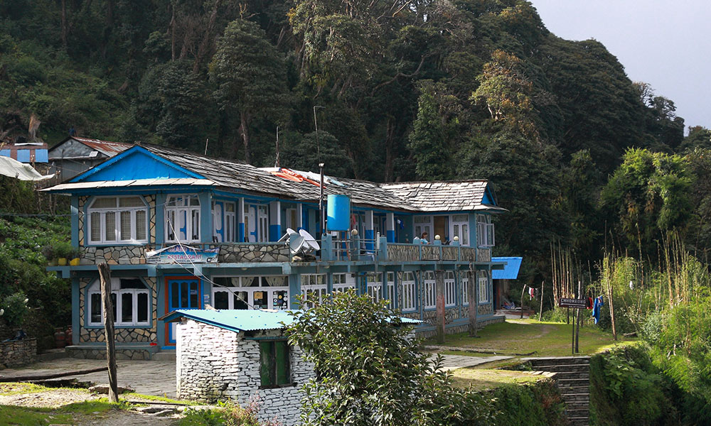
Classic 10-Day Itinerary: Full Distance Breakdown (Via Poon Hill)
This stage-by-stage distance matrix reflects verified trekker data and the operational itinerary structure used by Index Adventure Pvt. Ltd. for their flagship ABC departure.
|
Day |
Route |
Approx. Distance |
Duration |
Elevation Change |
Trail Note |
|---|---|---|---|---|---|
|
Day 1 |
Drive Pokhara to Birethanti, Trek to Ulleri |
approx. 9 km |
5 to 6 hours |
+750 m (Ends at 1,960 m) |
Relentless stone stairs from Tikhedhunga to Ulleri; a steep introduction to the trail |
|
Day 2 |
Ulleri to Ghorepani |
approx. 10 km |
6 to 7 hours |
+1,100 m (Ends at 2,860 m) |
Gradual, sustained climb under dense rhododendron and oak forest canopies |
|
Day 3 |
Ghorepani to Poon Hill to Chuile |
approx. 13 km |
6 to 7 hours |
+200 m / -1,000 m |
Pre-dawn push to Poon Hill (3,210 m), followed by a long forest descent to Chuile |
|
Day 4 |
Chuile to Chhomrong |
approx. 7 to 9 km |
5 to 6 hours |
+700 m / -400 m |
Sharp drop to Kimrong Khola before a heavy climb up into the gateway hub of Chhomrong |
|
Day 5 |
Chhomrong to Dovan |
approx. 10 km |
5 to 6 hours |
+800 to 900 m |
Plunges down to Chhomrong Khola, then climbs through bamboo forests tracing the Modi River |
|
Day 6 |
Dovan to Deurali |
approx. 6 to 7 km |
3 to 4.5 hours |
+630 m (Ends at 3,230 m) |
Forest tracks with waterfalls; landscape shifts abruptly to alpine terrain past Himalaya Hotel |
|
Day 7 |
Deurali to MBC to Annapurna Base Camp |
approx. 8 to 9 km |
5 to 6 hours |
+900 m (Ends at 4,130 m) |
Crosses open glacial fields above MBC; pace defensively to manage the altitude |
|
Day 8 |
Annapurna Base Camp to Bamboo |
approx. 12 to 13 km |
6 to 7 hours |
-1,600 m |
A massive, knee-punishing descent back down the valley as the air thickens toward Bamboo |
|
Day 9 |
Bamboo to Jhinu Danda |
approx. 9 to 10 km |
5 to 6 hours |
-500 m (Ends at 1,780 m) |
Classic forest trails and high suspension bridges; finishes at the natural hot springs |
|
Day 10 |
Jhinu Danda to Road Point, Drive to Pokhara |
approx. 3 to 5 km |
1 to 2 hours |
Gradual descent |
A brief morning walk to the jeep pickup point, followed by a 2 to 3 hour drive to Pokhara |
Day-by-Day Stage Breakdown with Full Distance Data
Day 1: Drive Pokhara to Birethanti, Trek to Ulleri
Drive distance: approx. 42 km (1.5 to 2.5 hours) Walking distance: approx. 9 km (5 to 6 hours) Elevation change: +935 m (From 1,025 m to 1,960 m)
Trail Map: Pokhara (Drive 42 km) → Nayapul → Birethanti (Permit Checkpoint) → Sudame → Hille → Tikhedhunga (Lunch) → 3,300+ stone steps → Ulleri (Overnight)
Your morning begins with a scenic drive from Pokhara to Nayapul, where you step onto the trail. A short walk brings you to Birethanti, a riverside village where your guide will process your trekking permits. From Birethanti, a relatively flat dirt track follows the Bhurungdi Khola through the farming settlements of Sudame and Hille to Tikhedhunga. After crossing the suspension bridge at Tikhedhunga, the infamous Ulleri staircase begins: over 3,300 hand-cut stone steps scaling a relentless vertical climb that tests your legs from hour one. The day ends at Ulleri, a traditional Magar village offering unobstructed evening views of Annapurna South and Hiunchuli.
Day 2: Ulleri to Ghorepani
Walking distance: approx. 10 km (6 to 7 hours) Elevation change: +900 m (From 1,960 m to 2,860 m)
Trail Map: Ulleri → dense forest canopy → Banthanti (Lunch) → Nangge Thanti → Ghorepani (Overnight)
The day is defined by a sustained climb through a dense oak and rhododendron forest canopy. Approximately 5 kilometers into the ascent, Banthanti provides an ideal midway lunch stop. The trail continues past Nangge Thanti before the treeline opens near the ridgeline, delivering sweeping views of Annapurna South, Hiunchuli, and Machhapuchhre (Fishtail) as Ghorepani comes into sight.
Day 3: Ghorepani to Poon Hill, Trek to Chuile
Walking distance: approx. 13 km (6 to 7 hours) Elevation change: +350 m morning ascent / -1,040 m afternoon descent
Trail Map: Ghorepani → pre-dawn climb (1.5 km) → Poon Hill (3,210 m, sunrise) → back to Ghorepani for breakfast → Deurali Pass → Banthanti → Tadapani (Lunch) → steep forest descent → Chuile (Overnight)
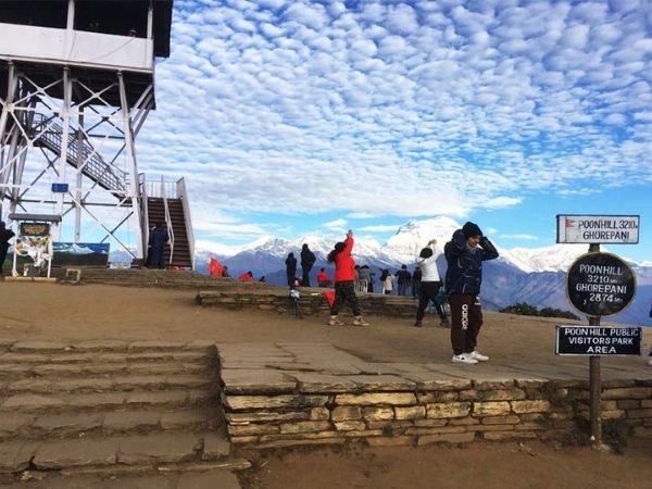
The morning begins before dawn with a 45-minute headlamp ascent to Poon Hill at 3,210 meters, where the sunrise over Dhaulagiri and the Annapurna range is among the most photographed moments in Himalayan trekking. After returning to Ghorepani for breakfast, the trail traverses the Deurali Pass, passes through a second Banthanti settlement, and descends through moss-covered forest to the quiet settlement of Chuile.
Day 4: Chuile to Chhomrong
Walking distance: approx. 7 to 9 km (5 to 6 hours) Elevation change: -400 m descent / +700 m climb (Ends at 2,170 m)
Trail Map: Chuile → steep descent → Siprung → Kimrong Khola (Suspension Bridge) → Taungroo → Gurjung → Chhomrong (Gateway Hub, Overnight)
The day opens with a knee-testing descent through Siprung to the floor of the Kimrong Khola valley. After crossing the suspension bridge over the river, the trail reverses into a demanding sustained climb through the traditional Gurung farming hamlets of Taungroo and Gurjung. The final push delivers you into Chhomrong, a massive cliffside settlement that serves as the last major resupply hub before the upper Sanctuary and which faces directly toward the towering south face of Annapurna.
Day 5: Chhomrong to Dovan
Walking distance: approx. 10 km (5 to 6 hours) Elevation change: -310 m descent / +740 m climb (Ends at 2,600 m)
Stage distances within this day:
- Chhomrong to Sinuwa: approx. 2 to 3 km (1 to 1.5 hours)
- Chhomrong to Bamboo (via Sinuwa): approx. 7 to 8 km (3 to 4 hours)
- Chhomrong to Dovan total: approx. 10 to 11 km (5 to 6 hours)
- Bamboo to Dovan: approx. 2 to 3 km (1.5 hours)
Trail Map: Chhomrong → 2,500 stone steps down → Chhomrong Khola (Suspension Bridge) → Lower Sinuwa → Upper Sinuwa (Rest Stop) → Khuldighar → Bamboo → Dovan (Overnight)
The Chhomrong to Dovan distance of approximately 10 kilometers packs more vertical geometry per kilometer than almost any other stage on the trek. The day opens with a sharp descent down 2,500 hand-cut stone steps to the Chhomrong Khola suspension bridge. From the riverbed, the trail immediately reverses into a grueling uphill climb through Lower Sinuwa and Upper Sinuwa, where the mountain views above the valley justify a proper rest. The Chomrong to Sinuwa distance of 2 to 3 kilometers takes 1 to 1.5 hours despite its modest length, because the descent and climb within it are both substantial.
The second half of the day enters a damp, shaded world. You cross the Khuldighar checkpoint, descend through Bamboo Village deep in the forest, and trace the edge of the rushing Modi River through dense bamboo canopy to Dovan. The bamboo to Dovon distance of 2 to 3 kilometers is short but rises steadily.
Day 6: Dovan to Deurali
Walking distance: approx. 6 to 7 km (3 to 4.5 hours) Elevation change: +630 m (From 2,600 m to 3,230 m)
Stage distances within this day:
- Dovan to Himalaya Hotel: approx. 3 to 4 km (1.5 to 2 hours)
- Himalaya Hotel to Deurali: approx. 2 to 3 km (1.5 hours)
- Dovan to Deurali total: approx. 6 to 7 km (3 to 4.5 hours)
Trail Map: Dovan → steady forest climb → wooden bridges over avalanche chutes → Himalaya Hotel (Lunch) → Hinku Cave → treeline drops → Deurali (3,230 m, Overnight)
The Dovan to Deurali distance of 6 to 7 kilometers is the shortest trekking day of the ascending route, but the sustained elevation gain of 630 meters means the effort is proportionately demanding. The trail cuts through a damp, mossy gorge with cascading waterfalls on both sides before arriving at the Himalaya Hotel settlement for lunch. Beyond Himalaya, the distance from Himalaya to Deurali of 3 to 4 km gives way to the Himalaya to Deurali section of 2 to 3 km, where the lush bamboo forest dissolves rapidly into raw, rocky alpine shrubs. Arriving at Deurali marks a decisive environmental transition: the treeline falls away entirely, and the open, windswept terrain of the Annapurna Sanctuary stretches ahead.
Day 7: Deurali to Machhapuchhre Base Camp to Annapurna Base Camp
Walking distance: approx. 8 to 9 km (5 to 6 hours) Elevation change: +900 m (From 3,230 m to 4,130 m)
Stage distances within this day:
- Deurali to MBC: approx. 4 to 5 km (2 to 2.5 hours)
- MBC to ABC: approx. 3 to 4 km (1.5 to 2 hours)
- Deurali to ABC (total): approx. 8 to 9 km (5 to 6 hours)
Trail Map: Deurali → rocky river gorge → Bagal Avalanche Zone → Machhapuchhre Base Camp (MBC) (3,700 m, Lunch) → high-altitude glacial valley → Annapurna Base Camp (4,130 m, Overnight)
The Deurali to MBC distance of 4 to 5 kilometers is deceptively demanding. The trail tracks along a rocky path flanking the Modi River, navigating dynamic debris zones on the valley floor before climbing sharply into Machhapuchhre Base Camp at 3,700 meters. MBC sits directly beneath the shadow of Fishtail Peak and provides the ideal rest and hydration stop before the final push. The MBC to ABC distance of 3 to 4 kilometers is the most altitude-sensitive stretch of the entire route. You hike steadily through an open, low-vegetation glacial bowl as the atmosphere progressively thins. The dovan to ABC distance from two days prior now totals approximately 19 to 20 kilometers of one-way sanctuary approach. The day culminates at 4,130 meters, surrounded by a 360-degree amphitheater of peaks including Annapurna I, Gangapurna, and Hiunchuli.
Day 8: Annapurna Base Camp to Bamboo
Walking distance: approx. 12 to 13 km (6 to 7 hours) Elevation change: -1,780 m (From 4,130 m to 2,350 m)
Stage distances within this day:
- ABC to MBC: approx. 3 to 4 km (1 to 1.5 hours)
- ABC to Deurali: approx. 8 to 9 km (3 to 4 hours)
- ABC to Bamboo (total): approx. 12 to 13 km (6 to 7 hours)
Trail Map: ABC → morning descent → MBC → Deurali → Himalaya Hotel (Lunch) → Dovan → Bamboo Village (Overnight)
The ABC to Bamboo distance of 12 to 13 kilometers constitutes the longest single descent day of the trek, and the sustained downhill gradient, dropping nearly 1,800 meters in a single day, places a characteristically demanding load on the knees and quadriceps. The Himalayan-to-ABC distance you gained over two days in ascent is now reversed in a single sustained downhill march. As you drop below Deurali, the landscape rapidly transitions back from alpine exposure into dense sub-alpine forest, and by Bamboo, the thick, oxygen-enriched air makes sleep noticeably easier than the night before.
Day 9: Bamboo to Jhinu Danda
Walking distance: approx. 9 to 10 km (5 to 6 hours) Elevation change: -570 m net descent (Ends at 1,780 m)
Stage distances within this day:
- Bamboo to Chhomrong (via Sinuwa and the Khola climb): approx. 7 to 8 km (4 hours)
- Chhomrong to Jhinu Danda: approx. 3 to 4 km (1 to 1.5 hours downhill)
- Bamboo to Jhinu Danda (total): approx. 9 to 10 km (5 to 6 hours)
Trail Map: Bamboo → Khuldighar → Upper Sinuwa → 2,500 stone steps → Lower Sinuwa → Chhomrong Khola (Bridge) → Chhomrong (Lunch) → forest trail split → Jhinu Danda (Hot Springs, Overnight)
The bamboo to Jhinu Danda distance of 9 to 10 kilometers contains a counterintuitive challenge: despite ending lower in elevation than it begins, the route forces you to re-climb the enormous valley wall back up through Sinuwa into Chhomrong before descending again to Jhinu Danda. The Bamboo to Jhinu Danda trek distance of 9 to 10 km includes the full stone step reascent and redescent of the Chhomrong Khola valley that you navigated on Day 5, now in the opposite direction. After lunch at Chhomrong, a sharp forest descent delivers you to Jhinu Danda, where the natural riverside hot springs on the banks of the Modi River constitute the most anticipated rest stop on the entire route. The Jhinu Danda to ABC distance you have now covered in descent is approximately 35 kilometers.
Day 10: Jhinu Danda to Road Point; Drive to Pokhara
Walking distance: approx. 3 to 5 km (1 to 2 hours) Drive distance: approx. 55 km (2 to 3 hours)
Trail Map: Jhinu Danda → terraced farmlands → Jhinu suspension bridge → Samrung / Matkiu Jeep Station → off-road mountain track → Nayapul → Pokhara (Final Destination)
Your final morning on the trail is deliberately brief. A gentle descent through terraced farmland and a crossing of the high Jhinu suspension bridge brings you directly to the roadhead at Samrung or Matkiu, where a private 4x4 jeep waits. The contrast on this final day is genuinely jarring: from the absolute silence of the high alpine sanctuary, you transition to a dusty 3-hour jeep ride back to Pokhara. Do not schedule any significant activities for the afternoon you return. The consistent community consensus from seasoned trekkers is to budget the evening exclusively for a hot shower, clean clothes, and a relaxed dinner by the shores of Phewa Lake.
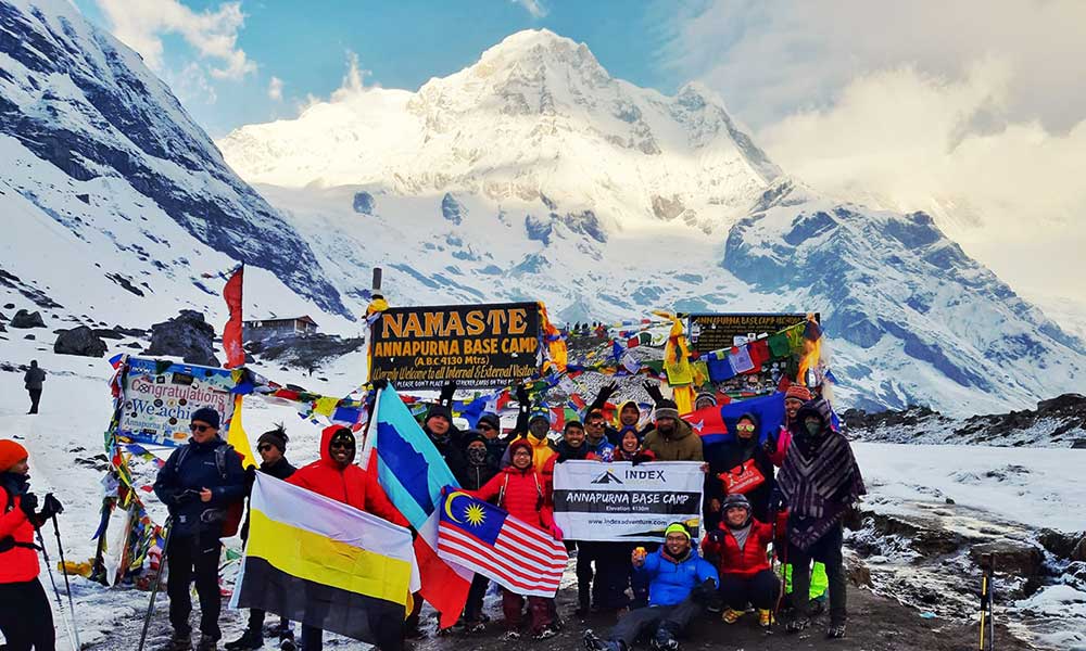
Short Route vs Poon Hill Route: Which ABC Trek Distance Suits You?
Choosing between the shorter, direct ABC route and the classic extended loop via Poon Hill depends on your available time, fitness preparation, and the specific character of experience you want from the trail.
|
Route Variation |
Approximate Distance |
Typical Duration |
Main Benefit |
Best For |
|---|---|---|---|---|
|
Short Route from Jhinu Danda / Matkiu |
approx. 70 km round trip |
7 to 8 days |
Most direct access into the Sanctuary minimizes total walking days |
Trekkers with tight schedules or strong preconditioned fitness |
|
Classic ABC Route (Without Poon Hill) |
approx. 75 to 80 km round trip |
8 to 9 days |
Balanced, streamlined path through Chhomrong and up to ABC |
Hikers wanting the complete base camp experience without side detours |
|
ABC Loop with Ghorepani and Poon Hill |
approx. 90 to 95 km round trip |
10 to 11 days |
Adds Poon Hill sunrise and a highly diverse landscape profile |
Trekkers with ample time who want the ultimate all-inclusive circuit |
|
Route via Ghandruk Village |
approx. 80 to 85 km round trip |
9 to 10 days |
Deep immersion into local Gurung culture alongside mountain vistas |
Travellers blending village cultural history with the trek |
|
Traditional Route from Birethanti / Nayapul |
approx. 90 to 95 km round trip |
10 to 11 days |
Explores the entire lower valley completely on foot |
Purists who prefer walking every section of the historical trail |
Index Adventure Pvt. Ltd. operates all five of these route variations with fully supported departures, including TIMS and ACAP permits, certified bilingual guides, porter logistics, and pre-arranged teahouse accommodation across every stage.
Book Your ABC Trek with Index Adventure Pvt. Ltd.
Index Adventure Pvt. Ltd. is a Pokhara-registered trekking operator with operational experience across the Annapurna Conservation Area spanning years of guided ABC departures. Their team includes certified high-altitude guides who have led this route through every season, across every route variation, and at every fitness level.
What Index Adventure provides on every ABC trek:
- TIMS card and ACAP permit processing
- Certified, bilingual Nepali mountain guides
- Licensed high-altitude porters with regulated load limits
- Stage-by-stage teahouse accommodation, pre-arranged before departure
- Altitude sickness monitoring protocols above 3,500 metres
- Emergency contingency planning and evacuation contact networks
- Flexible itineraries adaptable to pace, fitness, and weather conditions
Whether you are targeting the compact 7-day direct route from Jhinu Danda or the complete 11-day Poon Hill circuit from Nayapul, Index Adventure structures the itinerary around your specific objectives, not around a generic group departure calendar.
Contact Index Adventure Pvt. Ltd. to plan your Annapurna Base Camp trek and receive a customized stage-by-stage itinerary with precise km figures for your chosen route.
Frequently Asked Questions: ABC Trek Distance
What is the total distance of the Annapurna Base Camp trek?
The Annapurna Base Camp trek distance is approximately 70 to 95 kilometers round trip (43 to 59 miles). Your final mileage depends on your chosen trailhead, road access depth, and whether you include the Poon Hill loop.
What is the ABC trek distance from Jhinu Danda?
The ABC trek distance starting from Jhinu Danda is approximately 70 km round trip, covering roughly 35 km one way from Jhinu Danda to ABC. This is the shortest common walking route and uses modern jeep access to skip the lower valley sections.
What is the Annapurna Base Camp trek in km in total?
The total Annapurna Base Camp trek distance is 70 to 95 km round trip, depending on route variation. Adding Poon Hill pushes the abc trek km figure to approximately 90 to 95 km.
How many km is the ABC trek on each day?
On the classic 10-day itinerary, the number of km in the ABC trek per day varies from as little as 3 to 5 km on the final descent day to 13 km on the Poon Hill crossing. The average daily distance is 7 to 10 km.
What is the Annapurna trek distance from Pokhara?
The Annapurna trek distance from Pokhara is split into a 42 to 60 km road transfer and a 70 to 95 km round-trip trek on foot. The Pokhara to Annapurna Base Camp distance cannot be quoted as a single walking figure.
What is the Pokhara to Annapurna Base Camp distance by road?
The Pokhara to Annapurna Base Camp distance by road ranges from 42 km to Nayapul (1.5 to 2.5 hours) to approximately 55 to 60 km to Jhinu Danda or Matkiu (2 to 3 hours). These are driven distances, not trekking distances.
What is the Dovan to Deurali distance?
The Dovan to Deurali distance is approximately 6 to 7 km, with an elevation gain of 630 meters, typically taking 3 to 4.5 hours. This section passes through the Himalaya Hotel settlement and represents the final forested stage before entering open alpine terrain.
What is the MBC to ABC distance?
The MBC to ABC distance is approximately 3 to 4 km, gaining 430 meters of elevation at altitudes above 3,700 meters. At this altitude, the MBC to ABC trek distance typically takes 1.5 to 2 hours despite its short length.
What is the Deurali to ABC distance?
The Deurali to ABC distance, via Machhapuchhre Base Camp, is approximately 8 to 9 km with a total elevation gain of 900 metres. The deurali to mbc distance is 4 to 5 km, followed by the mbc to abc distance of 3 to 4 km.
What is the Deurali to MBC distance?
The Deurali to MBC distance is approximately 4 to 5 km, gaining 470 meters of elevation at high altitude, and typically takes 2 to 2.5 hours.
What is the Himalaya to ABC distance?
The Himalaya Hotel to ABC distance is approximately 11 to 12 km, covering the himalaya to deurali section of 2 to 3 km, then the deurali to mbc section of 4 to 5 km, and finally the mbc to abc section of 3 to 4 km. The Himalaya-to-ABC distance requires most of a full day at altitude.
What is the Himalaya-MBC distance?
The Himalaya Hotel to MBC distance is approximately 7 to 8 km, combining the himalaya to deurali distance of 2 to 3 km and the deurali to mbc distance of 4 to 5 km.
What is the Himalaya-to-Deurali distance?
The Himalaya Hotel to Deurali distance is approximately 2 to 3 km with an elevation gain of approximately 310 meters, typically taking 1.5 hours.
What is the Dovan to MBC distance?
The Dovan to MBC distance is approximately 9 to 10 km, covering the dovan to himalaya section of 3 to 4 km, the himalaya to deurali section of 2 to 3 km, and the deurali to mbc section of 4 to 5 km.
What is the Dovan-Himalaya distance?
The Dovan to Himalaya Hotel distance is approximately 3 to 4 km, gaining 320 meters of elevation through a damp, mossy gorge adorned with waterfalls, typically taking 1.5 to 2 hours.
What is the Chhomrong to Dovan distance?
The Chhomrong to Dovan distance is approximately 10 to 11 km with a net elevation gain of 800 to 900 meters, typically requiring 5 to 6 hours including the significant descent and re-ascent of the Chhomrong Khola valley.
What is the Chhomrong to Bamboo distance?
The Chhomrong to Bamboo distance is approximately 7 to 8 km, passing through Sinuwa and the Khuldighar checkpoint, typically taking 3 to 4 hours.
What is the Chomrong to Sinuwa distance?
The Chhomrong to Sinuwa distance is approximately 2 to 3 km, taking 1 to 1.5 hours. Despite the modest horizontal distance, the Chomrong to Sinuwa section includes a steep descent to Chhomrong Khola and an immediate uphill climb, making it more demanding than the raw km figure suggests.
What is the Bamboo to Jhinu Danda distance?
The Bamboo to Jhinu Danda distance is approximately 9 to 10 km, taking 5 to 6 hours and passing back up through Chhomrong before the final descent to Jhinu. The bamboo to jhinu danda trek distance includes the full Chhomrong Valley re-ascent and re-descent.
What is the ABC to Bamboo distance?
The ABC to Bamboo distance on the descent is approximately 12 to 13 km, dropping 1,780 meters through MBC, Deurali, Himalaya Hotel, and Dovan in a single long descent day taking 6 to 7 hours.
What is the Bamboo to Dovan distance?
The Bamboo to Dovan distance is approximately 2 to 3 km, gaining 290 meters of elevation through a forested trail tracing the Modi River, typically taking 1.5 hours on the ascent.
What is the Bamboo to Deurali distance?
The Bamboo to Deurali distance is approximately 8 to 10 km, covering the Bamboo to Dovan, Dovan to Himalaya, and Himalaya to Deurali segments combined. This section takes 4 to 5 hours and gains approximately 920 meters of elevation.
What is the Jhinu Danda to ABC distance?
The Jhinu Danda to ABC distance is approximately 35 km one way, making the round-trip ABC trek distance from Jhinu Danda approximately 70 km. From Jhinu Danda, the trail ascends through Chhomrong, Bamboo, Dovan, Himalaya Hotel, Deurali, and MBC before reaching ABC.
What is the Jhinu Danda to Chhomrong distance?
The Jhinu Danda to Chhomrong distance is approximately 3 to 4 km, ascending 390 meters uphill from Jhinu Danda (1,780 m) to Chhomrong (2,170 m), typically taking 1.5 to 2 hours.
What is the Nayapul to ABC distance?
The Nayapul to ABC distance is approximately 45 to 48 km one way, making the classic round-trip ABC trek distance from Nayapul approximately 90 to 95 km.
What is the Ghandruk to ABC distance?
The Ghandruk to ABC distance is approximately 40 to 42 km one way, with the Ghandruk to Annapurna Base Camp route passing through Chhomrong, Sinuwa, Bamboo, Dovan, Deurali, and MBC.
What is the Pokhara to Chhomrong distance?
The Pokhara to Chhomrong distance combines a road transfer of approximately 55 km to Jhinu Danda (2 to 3 hours) with a 3 to 4 km uphill walk from Jhinu Danda to Chhomrong (1.5 to 2 hours), making the combined Pokhara to Chhomrong distance approximately 58 to 59 km by all modes of transport.
What is the Annapurna Base Camp elevation?
The Annapurna Base Camp elevation is 4,130 meters (13,550 feet) above sea level. This Annapurna base camp height places the camp well above the altitude at which acute mountain sickness becomes a serious risk for unacclimatized trekkers.
What is the Annapurna Base Camp to summit distance?
The Annapurna Base Camp to summit distance to the top of Annapurna I (8,091 m) is approximately 12 to 15 km in horizontal map distance, though the technical climbing route to the summit follows a completely different, highly technical high-altitude path that is inaccessible to recreational trekkers. ABC provides a base camp proximity point, not a summit approach.
How long is the ABC trek in total?
The ABC trek length is 70 to 95 km round trip depending on the trailhead.
How long is the ABC trek in terms of days?
7 to 11 days.
How long is the Annapurna Base Camp trek in hours per day?
5 to 7 hours of daily walking.
What is the Kathmandu to Annapurna Base Camp distance?
The Kathmandu to Annapurna Base Camp distance encompasses three separate segments: Kathmandu to Pokhara (approx. 204 km by road or 25 minutes by air), Pokhara to trailhead (approx. 35 to 60 km by jeep), and the Annapurna Base Camp trek itself (approx. 70 to 95 km round trip on foot). The Annapurna Base Camp to Kathmandu distance for the return journey follows the same structure in reverse.
Does the ABC trek distance change between spring and autumn?
The physical trail distance remains identical year-round. However, daily pacing and experience across those kilometers vary seasonally. Spring (March to May) delivers rhododendron forests in bloom but afternoon cloud build-up above 3,000 meters. Autumn (September to November) delivers crisp, clear air and uninterrupted mountain visibility all day, making it the most consistently favored season for the Annapurna Base Camp trek.
Is a shorter ABC route less physically demanding?
Not necessarily. Compressing the ABC trek distance into a 7-day direct itinerary from Jhinu Danda eliminates the gradual warm-up days on the lower trails, placing heavy vertical demands on the legs from day one. A shorter ABC trekking distance saves time but raises the daily physical demand per kilometer walked.
Need Help? Call Us+977 9851167996orChat with us on WhatsApp

Latest Travel Blogs
Need Help? Call Us+977 9851167996