Ghorepani is a picturesque, historic village in the Myagdi District of Nepal, situated at an elevation of 2,874 meters (9,429 feet). It is the famous base for hiking to nearby Poon Hill (3,210m)—the ultimate vantage point for panoramic, snow-capped views of the Annapurna and Dhaulagiri mountain ranges.
Ghorepani Village is a small mountain settlement in Myagdi District, in Nepal's Annapurna region. It stands at 2,874 meters (9,429 feet) above sea level, inside the Annapurna Conservation Area. Most travelers know it as the overnight base for the pre-dawn climb to Poon Hill (3,210 m / 10,531 ft), one of Nepal's most famous sunrise viewpoints.
Ghorepani or Ghodepani? The name comes from two Nepali words: "ghode" (or "ghora"), which means "horse," and "pani," which means "water." Historically, this famous village in the Annapurna Conservation Area served as a critical rest stop where ancient traders watered their horses and mule caravans.
The village lies in Annapurna Rural Municipality, in Gandaki Province, about 17 km from Beni, the district headquarters. You reach it on foot, usually in two days of trekking from Pokhara, or in a single long jeep ride on the rough mountain road. From Kathmandu, the trip begins with a drive or short flight to Pokhara first.
This guide covers the village's exact location, its elevation in every unit, the clearest ways to get there from both cities, and what to pack, budget, and expect on the trail.
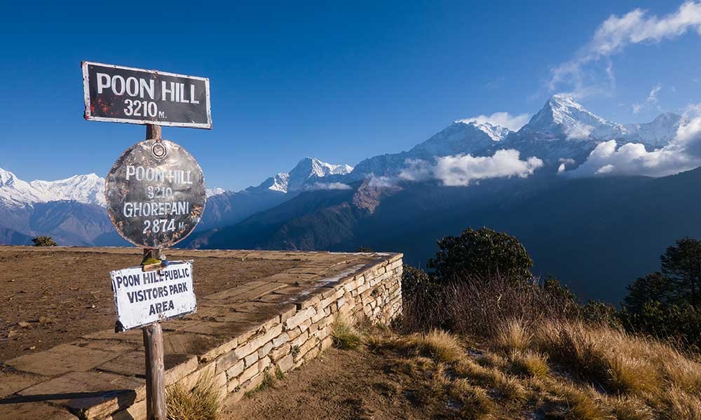
Elevation: 2,874 m (9,429 ft); Poon Hill viewpoint: 3,210 m (10,531 ft)
Difficulty: Easy to moderate
Trek duration: 3 to 5 days (classic loop)
Best time: March to May and September to November
Permits: ACAP card and TIMS card
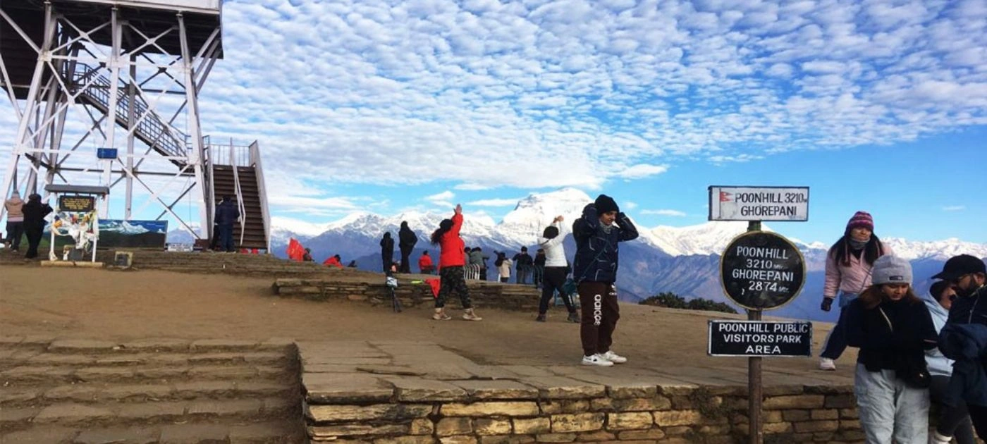
Ghorepani Poonhill View Point
Where Is Ghorepani Village Located?
Ghorepani Village sits in Myagdi District, in the western hills of Nepal, under Annapurna Rural Municipality in Gandaki Province. Before Nepal's 2015 federal restructuring, the district belonged to the Dhaulagiri Zone, a name still printed on many older maps. The village rests on a low pass between two forested ridges.
Its position is what makes the village so useful. It sits on the trail that links Nayapul and Birethanti in the south to Tadapani, Ghandruk, and the wider Annapurna Base Camp route. Poon Hill, the viewpoint above the village, sits on the border between Myagdi and Kaski districts.
Geographic detail
Information
District
Myagdi
Rural municipality
Annapurna Rural Municipality
Province
Gandaki Province (formerly Dhaulagiri Zone)
Coordinates
28°23′50″N, 83°41′50″E
Distance from Beni (district HQ)
About 17 km
Protected area
Annapurna Conservation Area (7,629 km²)
Who Lives in Ghorepani?
The village consists of approximately 50 households, mainly from the Gurung and Magar (specifically the Pun subgroup) communities. For generations, families lived on farming, herding, and the salt and wool trade that passed through these hills. That trade route faded once roads reached the lower valleys. Today, tourism is the main source of income, and the trail is lined with family-run lodges that welcome trekkers from around the world.
The Magar/Pun People: This indigenous hill tribe dominates the major ethnic makeup of the village. They are famous for their rich cultural heritage, unique dances, and prominent military history.
The Gurung People: Known for their distinct culture and bravery, the Gurungs are another prominent community in the region. They make up a large portion of the world-famous Gurkha regiments.
How High Is Ghorepani Village? Height and Altitude
Ghorepani is a prominent village in the Annapurna Conservation Area of Nepal, located at an elevation of approximately 2,874 meters (9,429 feet) above sea level. A few older guides list 2,860 m; readings vary slightly by GPS device, but 2,874 m is the standard.
This height keeps the trek comfortable. At under 3,000 meters, the risk of serious altitude sickness is low. The air is cool and the views are clear, yet the village sits low enough for beginners and families to sleep well. To stay safe, drink 3 to 4 liters of water a day and keep a steady, unhurried pace.
A few handy details about the village and the surrounding altitude:
Overnight Elevation: Ghorepani (2,874 meters) is the highest altitude where most trekkers sleep on this specific route.
Highest Point: The adjacent viewpoint of Poon Hill sits slightly higher at 3,210 meters (10,531 feet).
Altitude Sickness: Because the height gain is moderate and trekkers typically only spend a short time at the higher Poon Hill, the risk of altitude sickness here is very low.
The trail climbs gradually to reach the village. Here is the elevation along the classic route from Pokhara:
Point on the route
Elevation
Nayapul (trailhead)
1,070 m (3,510 ft)
Tikhedhunga
1,540 m (5,052 ft)
Ulleri
1,960 m (6,430 ft)
Ghorepani Village
2,874 m (9,429 ft)
Poon Hill (viewpoint)
3,210 m (10,531 ft)
The most demanding stretch is the climb from Tikhedhunga to Ulleri, a stone staircase of more than 3,000 steps.
Ghorepani Poon Hill Trek
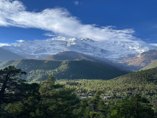
The Ghorepani Poon Hill Trek is a renowned, beginner-friendly route in the Annapurna region of Nepal. Accessible year-round, it typically takes 3 to 4 days to complete. Trekkers journey from Pokhara to the spectacular 3,210-meter viewpoint for panoramic sunrise views over the Annapurna and Dhaulagiri mountain ranges.
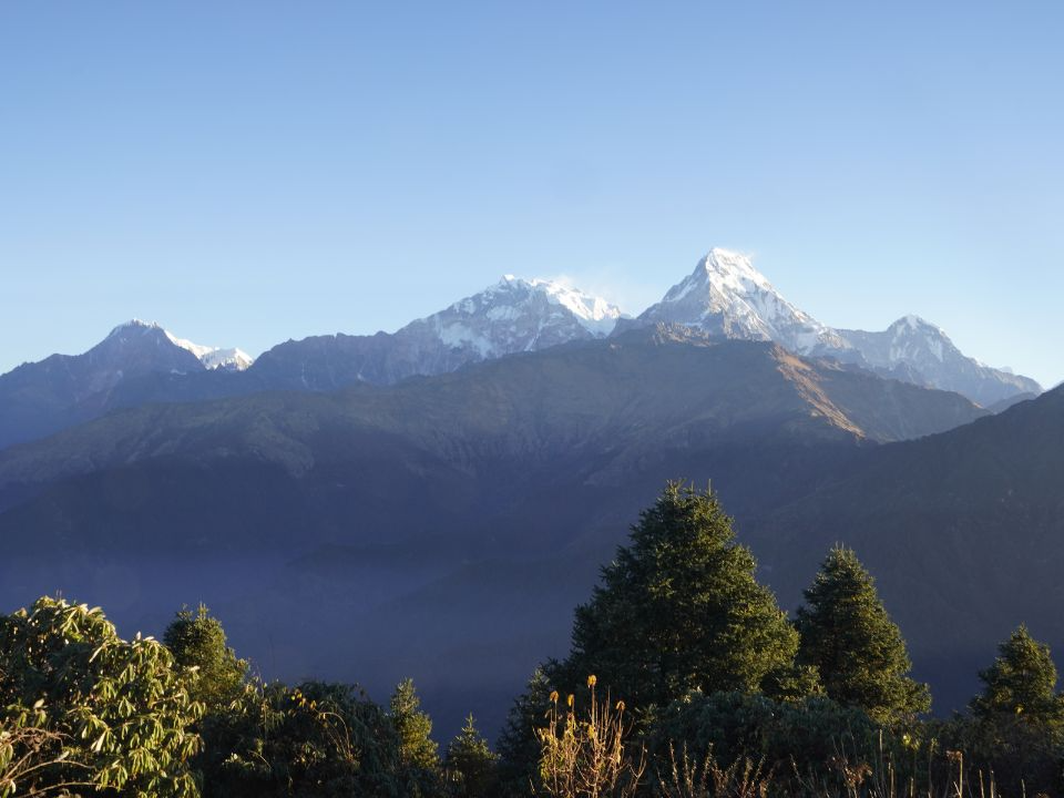
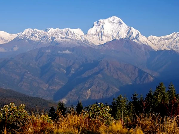
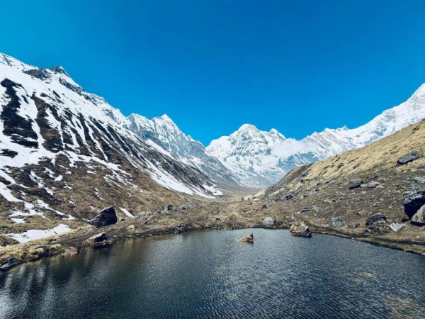
From Ghorepani Poon Hill, you can see a breathtaking 180-degree panoramic view spanning across both the Annapurna and Dhaulagiri mountain ranges
Major Mountains and Peaks Visible
Dhaulagiri Range:
Dhaulagiri I: 8,167 meters (the 7th highest mountain in the world).
Annapurna I: 8,091 meters (the 10th highest mountain in the world).
Annapurna South: 7,219 meters. Annapurna II, III, and IV.
Annapurna Fang (Varanasikatar): 7,647 meters.
Other Prominent Peaks:
Machhapuchhre (Fishtail): 6,993 meters (famous for its distinctive twin-tail silhouette).
Nilgiri: 7,061 meters (A rugged, massive northern profile).
Hiunchuli: 6,441 meters.
Tukuche Peak: 6,920 meters.
Lamjung Himal: 6,983 meters.
Mountains View from Poonhill Viewpoint
What Are the Top Attractions in Ghorepani?
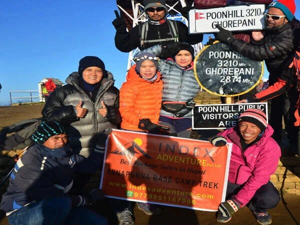
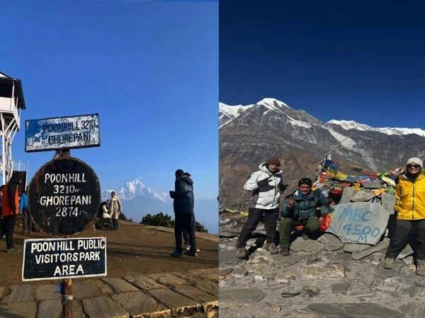
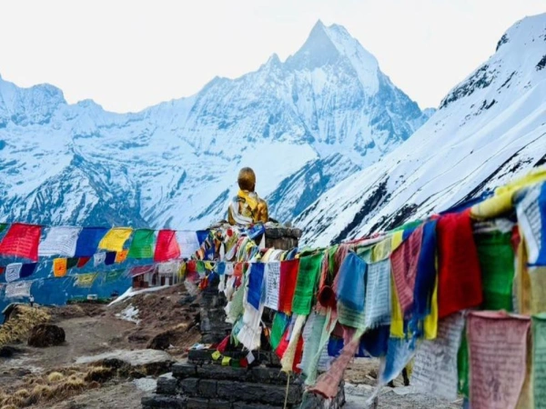
Poon Hill Viewpoint (3,210 m / 10,531 ft)
Poon Hill is the reason most people stay in Ghorepani. The viewpoint stands at 3,210 meters (10,531 feet), about 336 meters above the village. The walk up covers roughly 1.5 km and takes 45 minutes to one hour. Trekkers leave around 4:30 to 5:00 AM to reach the top before first light. From there, a 360-degree panorama opens across more than 20 peaks, including Dhaulagiri, Annapurna I, Annapurna South, Machhapuchhre (Fishtail), Hiunchuli, and Nilgiri.
Rhododendron Forests
The trails above the village burst into red, pink, and white blooms each spring, in March and April. The rhododendron is Nepal's national flower. Some of the oak and rhododendron trees here are old growth, exceeding 200 years in age and reaching 25 meters tall.
Mountain Village Life
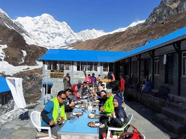
Evenings are quiet and warm in the teahouses, the local mountain lodges that line the trail. Steaming plates of dal bhat (the classic Nepali rice-and-lentil meal), social common rooms, and clear morning views of Annapurna and Dhaulagiri give the village its character.
How Do I Get to Ghorepani Village?
No road reaches the village center, though jeep tracks now stop at nearby points. Every visitor combines transport with some walking, and the journey almost always passes through Pokhara first.
From Kathmandu
Kathmandu sits about 200 km from Pokhara. You have two choices for this leg:
By flight: Airlines such as Buddha Air and Yeti Airlines run several flights a day between Kathmandu and Pokhara. The flight takes 25 to 30 minutes and costs around USD 80 to 120 one way.
By road: A tourist bus or private car covers the Prithvi Highway in 6 to 9 hours, depending on traffic and roadwork. Tourist buses usually depart from the Sorhakhutte area near Thamel around 7:00 AM. Standard buses cost about USD 10 to 15; Deluxe and VIP buses add air conditioning, charging ports, and lunch for about USD 19 to 25.
From Kathmandu, plan on 6 to 7 days for the full loop, since you spend extra time traveling to and from Pokhara.
From Pokhara
Pokhara is the real gateway to the village. From here you have three main options:
Option
How it works
Time
Cost (approx.)
Classic trek
Drive to Nayapul or Birethanti (1.5-2 hrs), then trek via Tikhedhunga and Ulleri
2 days to Ghorepani
USD 10-15 drive
Jeep + trek (hybrid)
Private jeep to Ulleri or Banthanti, then trek 1.5-4 hrs
Half day
~USD 300 per jeep (seats up to 7)
Direct jeep
Long 4WD drive close to the village via the Beni-Tatopani road
~8 hrs
Shared or private jeep
Private Jeep or Classic Trek: Which Is Better?
The right choice depends on your time, fitness, and budget.
Classic 2-Day Trek
Private Jeep
Speed
Slower, about 2 days
Faster, about half a day
Effort
High; over 3,000 stone steps
Low; skips the steps
Cost
Cheaper, around USD 10-15 to drive
Higher, around USD 300 per jeep
Scenery
The full lower trail and villages
Misses much of the lower trail
Best for
Fit trekkers who want the full experience
Limited time, families, or limited mobility
What Permits Do I Need for Ghorepani?
Two permits are required to enter the Annapurna Conservation Area:
ACAP (Annapurna Conservation Area Project) entry permit: NPR 3,000 (about USD 22 to 25) for foreign nationals, and NPR 1,000 for SAARC nationals. Nepali citizens are exempt.
TIMS (Trekkers' Information Management System) card: Around NPR 2,000 for individual foreign trekkers, with lower rates for SAARC nationals.
SAARC stands for the South Asian Association for Regional Cooperation. Its members besides Nepal are India, Pakistan, Bangladesh, Sri Lanka, Bhutan, Maldives, and Afghanistan, and their citizens pay the reduced fees above.
You can arrange both permits at Nepal Tourism Board offices in Kathmandu or Pokhara. Bring your passport and a few passport photos. For official details, see the Annapurna Conservation Area regulations from the National Trust for Nature Conservation and the latest trekking permit fees from the Nepal Tourism Board.
How many days does the Ghorepani Trek take?
The classic Ghorepani Poon Hill loop runs 35 to 45 km, with 4 to 6 hours of walking each day. Three itineraries suit most travelers:
3-day trek: A fast pace. Drive to Nayapul, trek to Ghorepani, climb Poon Hill for sunrise on day two, then descend to Nayapul or Ulleri to depart.
4-day trek (recommended): The most balanced route, following Nayapul, Tikhedhunga, Ghorepani, Poon Hill, Tadapani, Ghandruk, and back to Nayapul.
5-day trek: A relaxed pace with extra time in the villages and a rest day.
The descent often passes through Ghandruk, a large Gurung village known for its slate-roofed stone houses and a small Gurung museum that records local life and customs.
Sunrise View from Poonhill
Which trek can you join to/from Ghorepani Poon Hill Trekking?
If you are looking to extend your Ghorepani Poon Hill Trek, you are in luck. Ghorepani and the nearby village of Tadapani act as major trail junctions within the Annapurna Conservation Area, making it incredibly easy to combine Poon Hill with several other world-class routes.
Depending on your timeframe, fitness level, and interests, here are the major multi-day trek extensions you can join directly from the Poon Hill route:
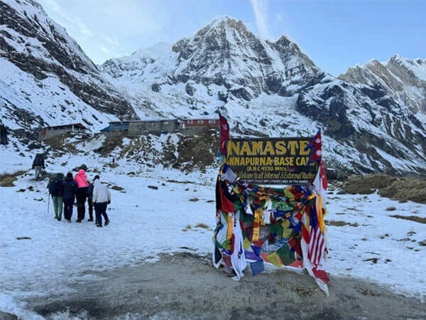
Annapurna Base Camp (ABC) Trek
This is the most popular extension. Instead of looping back down to Pokhara after Poon Hill, you head deeper into the Annapurna Sanctuary to stand at the foot of massive 8,000-meter peaks.
How it connects: From Ghorepani, you trek to Tadapani. From Tadapani, instead of heading down to Ghandruk, you divert toward Chhomrong and follow the Modi Khola valley up to the base camp.
Added Duration: Adds 5 to 7 days to your itinerary.
Maximum Altitude: 4,130 meters (13,549 feet).
What to expect: A mix of lush bamboo forests, steep stone staircases, alpine terrain, and a dramatic 360-degree mountain amphitheater at the base camp.
If you want to escape the crowds and prefer a more rugged, off-the-beaten-path experience, this is an exceptional alternative to the standard ABC trek.
How it connects: You split from the main Ghorepani trail near Tadapani or Swanta, ascending through secondary trails toward Bayeli Kharka and Dobato to reach the high ridge of Khopra.
Added Duration: Adds 4 to 6 days (making the total trek roughly 6 to 11 days).
Maximum Altitude: 3,660 meters at Khopra Ridge; up to 4,660 meters if you do the day hike to the sacred Khayer Lake.
What to expect: Stunning "balcony" views facing the massive Dhaulagiri range, community-run lodges, fewer tourists, and a challenging alpine hike to a high-altitude sacred lake.
Mardi Himal is a relatively new, highly scenic ridge trek that offers intimate, close-up views of Mount Machhapuchhre (Fishtail).
How it connects: From Tadapani or Ghandruk, you cross over toward the village of Landruk. From Landruk, you enter the Mardi Himal trail system at Forest Camp and ascend through Low Camp to High Camp.
Added Duration: Adds 4 to 5 days.
Maximum Altitude: 4,500 meters (Mardi Himal Base Camp).
What to expect: Walking along a high, narrow forest ridge with stunning vistas on both sides, pristine rhododendron forests, and minimal village settlements as you get higher.
For a complete change of scenery, culture, and climate, you can head north into the rain shadow of the Himalayas.
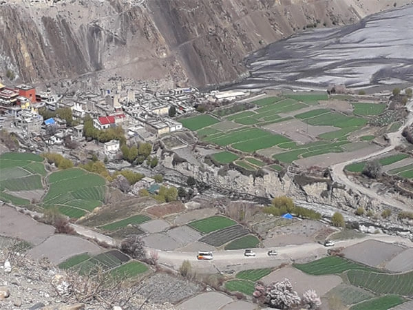
How it connects: From Ghorepani, instead of looping east, you descend north down a long flight of stairs to Tatopani (famous for its natural hot springs). From Tatopani, you follow or jeep up the Kali Gandaki River valley through Jomsom and Kagbeni to the sacred temple town of Muktinath.
Added Duration: Adds 3 to 5 days (highly customizable due to local jeep roads).
Maximum Altitude: 3,760 meters (Muktinath).
What to expect: Arid, desert-like landscapes reminiscent of the Tibetan Plateau, strong afternoon winds, ancient Tibetan Buddhist culture, and a transition from lush forests to dramatic rocky gorges.
If you have a couple of weeks to spare, the Poon Hill trek can serve as the grand finale (or starting point) of the classic Annapurna Circuit.
How it connects: Similar to the Muktinath route, you connect via Tatopani in the lower Kali Gandaki valley. Most hikers do the circuit counter-clockwise, crossing the high Thorong La Pass (5,416m), descending into Muktinath, and then walking down through Ghorepani to finish at Poon Hill.
Added Duration: Adds 8 to 12 days depending on where you start and your transportation choices.
Lodging and meals are affordable, but small extras add up:
Item
Typical cost
Teahouse room (twin)
USD 5-15 per night
Meal (dal bhat, noodles, momos)
USD 5-10
Hot shower
USD 1-3
Phone charging or Wi-Fi
USD 1-3, often charged separately
Bottled or boiled water
USD 1-3
Note: Carry enough cash in Nepali rupees. The village has no ATM, and card payment is rare.
When Is the Best Time to Visit Ghorepani Village?
Season
Months
What to expect
Spring
March-May
Rhododendron blooms, mild days, clear mornings
Autumn
Sept-Nov
The clearest mountain views, stable weather
Winter
Dec-Feb
Cold and quiet, possible snow, few crowds
Monsoon
Jun-Aug
Rain, leeches, slippery steps, landslide risk
Spring and autumn are the most popular seasons, and for good reason. The monsoon months bring heavy rain, poor visibility, slippery steps, and a real risk of landslides.
Where Does Ghorepani Fit in a Bigger Trek?
For many trekkers, Ghorepani is a first taste of the Himalayas. It is short, low, and beginner-friendly, which makes it a natural starting point before a longer adventure.
From the same region, you can extend toward the Annapurna Base Camp Trek, the Mardi Himal Trek, or the full Annapurna Circuit. Each one adds more days and higher ground. If the sunrise here leaves you wanting a bigger goal, the Everest Base Camp Trek is the classic next step, trading these gentle hills for the high Khumbu and a close view of the world's tallest peak.
At Index Adventure, we guide both routes, along with other top alternatives like Annapurna Base Camp and Mardi Himal. Our packages cover permits, licensed local guides, and teahouse stays, so you can spend your energy on the trail instead of the logistics.
From Pokhara, drive to the trailhead at Nayapul or Birethanti in about 1.5 to 2 hours by jeep or local bus. The classic route then treks for two days, passing Tikhedhunga and climbing the stone steps to Ulleri before reaching Ghorepani. If you want to save your legs, a private jeep can carry you higher, to Ulleri or Banthanti, leaving only a 1.5 to 4 hour walk. A long direct jeep ride along the Beni-Tatopani road can also bring you close to the village in about eight hours.
How long is the Ghorepani trek?
The classic Ghorepani Poon Hill loop takes 4 to 5 days and covers roughly 35 to 45 km, with 4 to 6 hours of walking each day. Reaching the village alone takes about two days of trekking from Pokhara. A compact version can be finished in 3 days, while families often add a day or two for rest. Starting from Kathmandu adds travel time, so the full trip usually runs 6 to 7 days.
In which district is Ghorepani located?
Ghorepani lies in Myagdi District, in Gandaki Province, in west-central Nepal. The village sits inside the Annapurna Conservation Area, Nepal's largest protected region. Before the 2015 federal restructuring, the district belonged to the Dhaulagiri Zone, a name still seen on older maps. Poon Hill, the viewpoint just above the village, sits on the border between Myagdi and Kaski districts.
How far is Ghorepani from Ghandruk?
The route from Ghorepani to Ghandruk runs through Tadapani and covers roughly 18 to 20 km. Most trekkers walk it on the descent, over about 8 to 10 hours of total trekking. The standard itinerary splits this across a day and a half, with an overnight stop in Tadapani. The trail drops through rhododendron and oak forest before reaching the large Gurung village of Ghandruk.
Why is it called Ghorepani?
The name joins two Nepali words: "ghoda" or "ghode" (horse) and "pani" (water), so Ghorepani means "horse water." The village was once a watering stop on an old trade route between the lowlands and the high Himalayan passes. Traders rested their horses and mules here and let them drink before moving on. New roads later replaced the trade trail, and tourism became the village's main income.
How high is Ghorepani Village?
Ghorepani Village sits at 2,874 meters (9,429 feet) above sea level, the figure used by Wikipedia and most operators. Poon Hill, the sunrise viewpoint above it, reaches 3,210 meters (10,531 feet). Because the village stays under 3,000 meters, the risk of serious altitude sickness is low. This makes Ghorepani a comfortable, beginner-friendly stop in the Annapurna region.